
Em and I had 11 days between blocks of work and were overdue for an adventure together. She was super generous about wanting to help me achieve my peak bagging goals and told me to choose a place. I gave her a few options and she settled on the longer trip – South West Cape walking in and out the Port Davey track with a few extra peaks. That would also get some extra kilometres under our belts before the adventure race we had coming up in February.

We had a lazy start, leaving Hobart a touch before 9 and setting off from Scott’s Peak shortly after 11. The new pack was pretty light, despite three 8L dry bags of food and we zoomed along (so much so Strava told me I got the course record for the start of the Western Arthurs – ha!). We ran into a Pandani group complete with friendly faces at Junction creek, 2 hrs after starting out.


It was hot and humid, but I felt pretty good on my wet, muddy feet. The mountains were out on the fine summer day and we were properly off into the bush. If I could hold a tune I may have sung. Instead Em and I chatted away intermittently, musing over the things we wanted to focus on this year, while we tried not to step in the really deep bogs and drunk lots of water (but still not quite enough). We came across a dried out echidna skin, but otherwise didn’t see a lot in the way of wildlife. Even the birds were pretty quiet.


While the track was boggier than we both expected and we slowed a bit as the day wore on, we were at Crossing River 5 hours after leaving the car park. We sat and ate a snack while Em decided if she wanted to go on (she’d had a later than expected night the evening before). She made the call and we set off again, knowing it was at least another 10km to Watershed and that we’d already done 20km, but figuring we could stop wherever we wanted.

In the end that’s exactly what we did. We happened across a river, Em couldn’t stop yawning, so we found a flat spot on the next rise and I collected water while she began pitching the tent. It was a new Hyperlite tent so I watched and learnt when I returned as she made some final tweaks. Then it was time to unpack, clean ourselves up a bit, cook some food and in my case, repair a hole in my mat. I was grateful that for some reason I’d thrown in my mat repair kit at the last moment, even though I haven’t carried it for some time now! I suspect it had something to do with the length of the trip…even better, I hadn’t forgotten my toothbrush! The result was the same nonetheless, we’d be sharing one for this trip 🤣!!

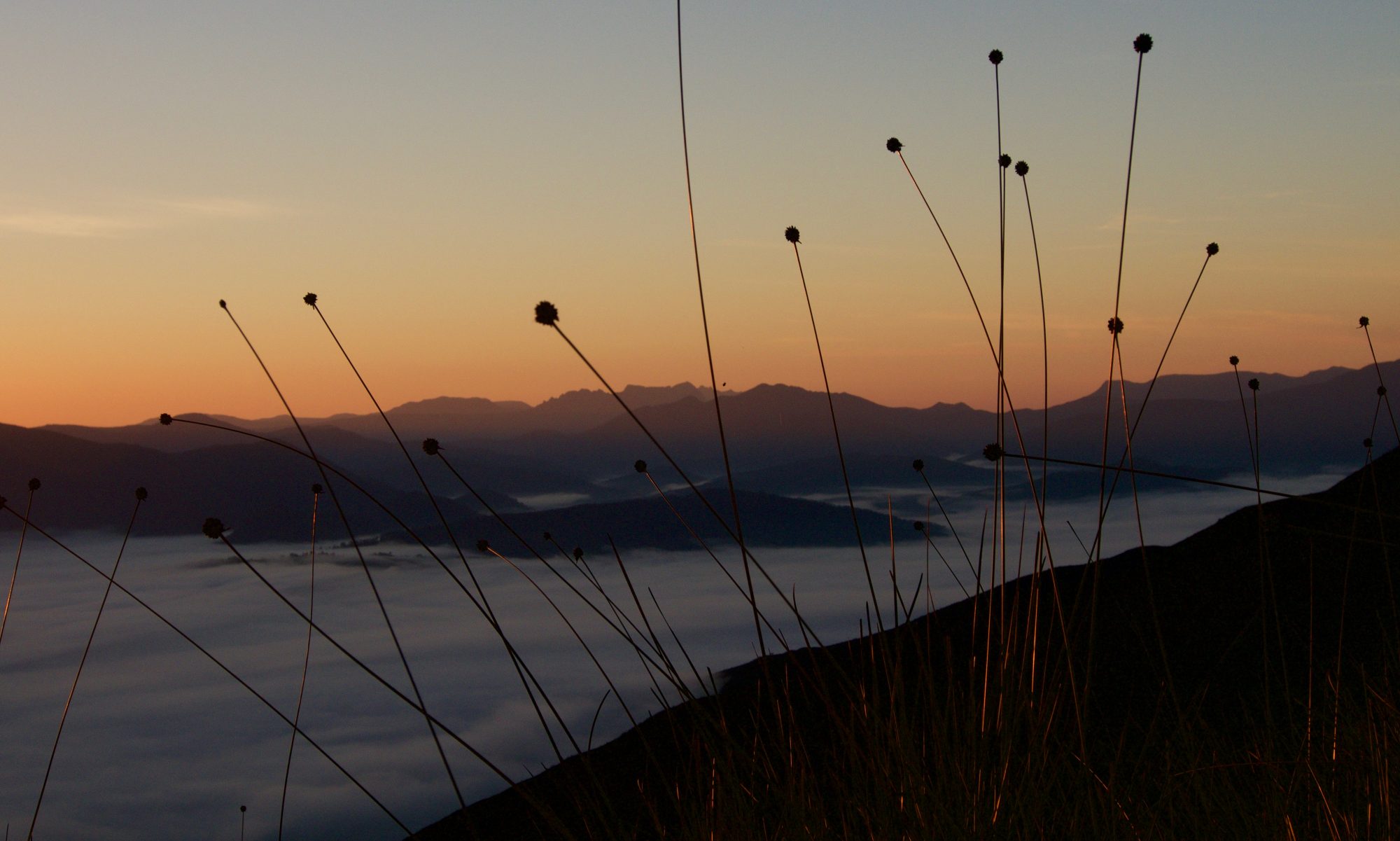
We chatted some more and then settled down for a good sleep. A pee break in the middle of the night turned my mood from one of mild annoyance at having to get up to wonder at the beauty of the stars in a dark, unpolluted landscape. I’ve seen them plenty of times before, of course, but they always make me pause and smile, like hitting a reset switch, and somehow I’d forgotten this.
We had a bit of a lie-in the next morning, waiting for the tent to dry a bit from the still night and all our condensation. It was after 8:30 when we were ready to set off and the sun was already beating down. I stole sideways glances at Mt Braddon as we worked our way west and south, wondering if I’d get to climb it at the end of summer as planned. Time would tell, but hope is a wonderful thing. It looked scrubby.

The track was more overgrown and slower than both of us remembered now, and while we made good progress it felt slow, especially given the distance we wanted to travel. We saw a few baby tiger snakes, and some fish, but again the land appeared a relatively uninhabited. We told stories to keep us going but eventually fell into a tired quiet rhythm. The track didn’t hold the same magic it had the first time we’d walked it and I mused on this, eventually settling on the conclusion that it was now just a means to get to the ‘new’ or ‘real’ part of the walk and therefore wasn’t given the same value. All of this, of course, lay in my head, but it still wasn’t easy to reframe.

By the time we arrived at the northern end of Spring river, about 500m from where I’d have a crack at Mount Berry (again!), Em had made up her mind that she really didn’t want to walk back out along the Port Davey track. We spent the next few hours revising our itinerary, running through all the possible options (there were lots), and settled on one that would hopefully see us fly out of Melaleuca in 8 days time. It had better, we were asking Tim to book us flights…


With that sorted (or so we thought) we settled into cleaning gear and ourselves, eating dinner and some of our now spare snacks, and trying to avoid the swarms of ants (the only downside of this cute little site). I headed to bed happy to not have the Port Davey track to repeat too, but aware I’d have a few big days climbing mountains while Em rested in the tent, and not much leeway if things didn’t go to plan. That always makes me a bit nervous.
My alarm sounded at 5, and it seemed too early to get moving. I stayed there for 15 minutes till I could procrastinate no longer, then got changed, donned my pack and set out, rather nervously! I felt a tad envious of Em’s morning of rest and relaxation, but knew I’d made my choices long ago. 500m down the track I turned off to the west and took to the same ridges I’d come down on my last attempt at Berry.

The sun was just rising and the day was already warm. I was glad I’d started early and wondered if the 4L of water I had would be quite enough. The climb up was steep near the start, but once I made the main ridge it was easier going. I was shocked to see that a significant sized fire had hit the ridges sometime in the last 8 months and the effect was devastating. But for the new shoots of button grass the land looked dead where the fire had hit. There were no animals save for the cicadas, some small butterflies and one whip snake. The yabbie holes looked long vacant and there wasn’t even any birdsong. I was glad I’d seen and walked the ridge before the fire had gone through.


The going was straight forward enough, I knew it would be. There were a few ups and downs, and I only made one change to account for a spot where the burnt scrub actually made for easier going. Sweat was pouring down my face when I arrived at the base of the summit block, about 3 hrs and 8km after setting out. I’d decided to have a crack around the right hand or northern side of the summit. It didn’t last long. The scrub was hideously thick with big drops between the boulders and I just didn’t have the strength in me for that. I remembered the almost bottomless cave-like system under the even bigger rocks and the rainforest that grew between them on the southern or left hand side from my last attempt, and decided this might be a better option, so I backtracked quickly and tried again.
I again hit annoying thick scrub to start with and began to fear I’d make it to the summit at all. As much as I’d have liked it, I didn’t have all day. But eventually with a bit of perseverance and some loss of height I found a way into the underworld. There I wove my way left, more left and upwards, when I dared. I took any route under the big boulders that didn’t require me to get my head torch out, because I figured if enough light was coming through from the far end I shouldn’t hit a dead end too often. I had to take my pack off for one tight pinch, but largely it was the quickest way to cover distance. In between the cave-like system I tried to stay in the very luscious rainforest, even if every second branch that I wanted to stand on gave way, and all those I wanted to break seemed to be sturdy! It was quite literally a jungle gym. Progress was slow but steady and not quite as tiring as an uphill bash.


In time I found I was making my way up the contours to the final line without too much resistance and felt like it might be time to see if I could pop out on top safely. My suspicions were correct and I found myself standing on solid ground, without scary drops around me. The summit was 50 metres or so away and very easy going now. I was immensely relieved not to be coming back a third time. I let out a whoop, took a few photos, and saved the real celebrations and a pat on the back for when I was back down safely through the rocks, jungle and caves.


Following my exact route back was impossible, I kept finding myself several metres above where I’d come up, and in getting down I managed to rip a hole in the seat of my pants and put a palpable dent in my sunnies (glad it was them and not my head) but I didn’t have any uncontrolled falls between big rocks this time!
It had taken me over an hour to go all of 200m and back, but I’d made it. I was pretty stoked. I began the long walk back, trying to make up time, but not really succeeding. There’s only so fast you can go on that kind of terrain. I slurped thirsty on water, more interested in it than food in general. In this fashion I eventually made it back to the track, then Em and the tent a bit under 7 hours after having left. She wasn’t expecting me till later, but was happy to see me. She had a coffee and stroopwafel for me in celebration, which I thought was super sweet. She also offered to carry all the shared gear for the rest of the walk and wouldn’t have it any other way. I was grateful. My legs were just a bit tired after 17km, and I knew they would be ready to stop well before we got to the narrows.

When we checked the inReach there was news from Tim that the Par Avian website wasn’t up to date and the plane tickets he had tried to get us weren’t available anymore. We guessed we’d be walking out after all, and should probably stop eating extra snacks because we’d need them all now! This was feeling a bit like a trip of multiple small failures (punctured mat, forgotten toothbrush, failed flights…).
Em packed up the tent while I packed my bag and we set off. We quickly remembered just how much slower this final section of the Port Davey track was, and how many more undulations it had. The 15km took us 5 hours and really zapped our energy, especially because we carried a full 4L of water for the last few, unsure of where the last bit of decent water would be. We made the obligatory 3 boat trips with almost as much laughter as last time and we didn’t even go in too many circles by the third trip.


When the tent was up and we’d done enough talking to the local birds (they were very sweet and full of song), we began cleaning ourselves and our gear. We both found our shoes weren’t holding up to the constant wet mud and scrub and we were a little worried they wouldn’t make the distance. Em began to arrange to fly a spare pair of boots in to us to pick up on our way through should we need them. Trail runners are good, but probably not ideal for longer trips in Tassie scrub and mud.
That sorted, we sat on the grass at the end of Joan Point and ate dinner, revised our schedule taking the weather into account and Em did some yoga. We’d been relatively late into camp, so we retired after dinner to some more audiobook before sleep. I didn’t sleep well, my body decided to punish me for what I’d made it do, so I spent a bit of time laying there listening to the night life while I waited for some paracetamol to take the edge of the whole body aches.


We woke to my alarm at 6, keen to get some walking in before the forecast rain was due to hit us mid-late arvo. It was just after 7 by the time we got moving, early enough that Em was still a bit sleepy on the first hill. We spent a fair bit of time deciding if we were going to walk across the plain or wade/swim the rivers that enter into Horseshoe Inlet and eventually settled on the latter, not finding any sign of the end of a decent looking pad intersecting the Port Davey track.


In hindsight, it was a poor decision and I told Em to never let me talk her into going off route. It was more of a wade than open walk and that zapped both energy and time, though the scrubby river crossings weren’t actually too bad. It probably took longer than if we’d swum the rivers, and as it turned out we were soaking wet at the end of the day so the result was otherwise similar!
It was glorious to pop onto the track, which is described in Chapman’s notes as poorly defined. If you ask me, it was quite well defined, although later on it would be harder to follow in one or two places where it temporarily became indistinct, unless you knew where it was headed. We slogged our way up and over Pasco ridge, sweat dripping off us again although there was at least decent cloud cover between us and the sun and even the odd threatening drop of rain. We celebrated on top with a snack before following the track down to Hannant creek and then back up the other side to the top of the northern end of the South West Cape range. Here the track was like a white quartzite scar in the ankle-high scrub.


At the top of the range I started following the gps route I had been given ages ago from a fellow walker, but something Em had asked me the day before made me check it against Chapman’s map and I realised it was substantially different. We decided to have a peak over the edge and decide which way we wanted to go. Fortunately we spied what we thought was a pad on one of the ridges to our left, where Chapman described the route and not where our GPS route went. After a brief discussion we chose to cut across to it. Sure enough it was the track and we were over the moon at having a pad to follow to camp instead of off track walking through button grass plains. It was a good pad too and we wove through the plain and arrived at the back of some massive white sand dunes, climbing over them and onto Noyhener beach.


It was a stunning beach with lots of really cool islands just off the coast. We’d discussed the possibility of camping here, or continuing on, and when I looked to Em she told me she’d already decided that if we arrived before 3pm, we’d continue on. It was only 2, so onwards we went. It took a little bit to readjust my mindset to another few hours of walking but this was helped by the fact we had to go over a massive rocky shelf at the far end of the beach. Our timing was great and the tide was out (the alternative at high tide was to fight through thick scrub – yuck). There were so many rock pools, with heaps of crabs and anemones and massive kelp. They were teaming with life and we could have spent all afternoon there if we didn’t have more walking to do! Equally we could have visited Spain Bay, which is reportedly a beautiful place to visit, but that would have to wait till another time.


We found the cairn signalling the exit from the beach and took to the scrub. Some time in the thick of it, it started drizzling and pretty soon the scrub was drenched. We got more wet pushing through the overgrown track than we did from the drizzle itself. It was so wet it was like someone turning the shower on for a burst each time we pushed past a bush. Nothing stayed dry. We rose and descended, eventually breaking out onto more open ridges that gave us some misty views of the coast. It was more mysterious and grand with the mist curtain swirling around us, and we got spectacular glimpses of big headlands and rolling ridges.
As we eventually descended towards Window Pane Bay we spotted two boats sheltering in a nearby bay and hollered at them. Who knows if they heard us, but we waved in case! Down we slid, into the forest and eventually out onto the beach where someone had most decoratively outlined the entrance path and campsites with white rocks. It made it most homely. There was already a couple in a tent and we said hello, but got no response. We pitched the tent, stripped off wet gear, towelled off and got into warm and dry clothes. Putting the wet gear back on again some time in the future didn’t bear thinking about right then.


As we made dinner we talked again about our ever changing plans. Em’s knees were inflamed from the ups and downs (a subacute problem) and she didn’t want to exacerbate that any more than necessary before our adventure race. We talked again about flying her out but she was adamant she didn’t want to leave me. Then lo and behold Tim messaged to say he’d got us two flights in 4 days time. It was perfect timing – I’d climb all the mountains I wanted and we’d get to come home earlier without retracing our steps on the Port Davey track. We celebrated with extra snacks and told Tim how much we loved him (he’s probably getting sick of running so many errands for us when we’re out walking but he does it without blinking an eye). Then we had to brush our teeth again…but it was worth it!
We woke again to the alarm and packed tentatively, reluctantly considering donning wet clothes. Em did better than I. I opted for shorts and overpants instead of my sodden pants. Fortunately it wasn’t too cold, even at the early hour, and it wasn’t raining yet either. That meant after a short walk in the forest I was quickly replacing my attire with my wet pants and not even shuddering at the cold. Just in time, we left the green behind and began a long but mostly gentle climb up and up and up the ridges to the South West Cape range. It started to drizzle as we rose into the bottom of the low lying cloud and the scrub quickly became wet too. Fortunately it stayed low and a brisk wind meant we dried half as fast as we got wet.


Sadly the cloud stayed low the whole climb onto the high point of the range, which meant we saw very little of the views. Our summit was a little grey-white bubble with some wind and rain and we didn’t dally in it at all. It was nice when we dropped back down out of the clag and began to get glimpses of the stunning coastline and dramatic cliffs. We popped on and off the formed pad, it wasn’t always all that clear, and slowly wove our way down and back up to the summit of Karamu. We discovered it clearly wasn’t the typical way to go by accidentally following the track off the ridge that takes the short cut down to Wilson’s Bight. Chapman’s notes describe this as the less popular route and not a defined pad, but it clearly has the greater foot traffic these days.


We backtracked a few hundred metres and followed open ridges to Karamu, which was a lovely summit with good views towards the South West Cape. We then took our time descending, taking it easy on Em’s knees. Both of us were glad we’d done the circuit the way we did, feeling we had the better day between Window Pane Bay and Wilson’s Bight, even if the weather hadn’t quite done as we wanted.


But our day wasn’t quite done. It was only mid afternoon and we had decided on camp at Ketcham Bay so we strolled along the beach in that direction. At the first rocky point we walked towards the bouy marker that indicated where to cross and heard a strange noise. Em thought I had wind or something, but no, it was a seal blocking the path. He or she barked and huffed a bit but eventually joined the rest of the family, including several little pups in the water and on the rocks below. This allowed us passage past them. We couldn’t believe our luck at meeting them, though talking to other walkers it sounds like they may have made that rocky spot their home for a bit.


The walk between Wilson’s Bight and Ketcham Bay was short and easy. The track was nicely graded and only overgrown in a few spots. It didn’t take us long. When we arrived we finally met the three owners of the footprints we’d been following for the last two days and we spent the entire evening chatting to them while removing ticks and leeches off ourselves as we found them. They were interesting and lovely people, and night fell too fast. It turned out we’d be sharing the next two camp sites with them and neither of us thought that was a bad thing! That night we snuggled down to the sound of the sea, in a very comfortable camp site.


We were in no rush to get going the next morning, there was only a half day walk to New Harbour campsite, and then I planned to duck up to the peak by the same name in the afternoon. I still woke early though, needing to pee, and crept out of the tent. Em told me to come back and we’d chat about when we got up but she was back asleep when I returned, so I grabbed my breakfast and nibbled it on the beach in the early morning sun. I sat there for quite some time, enjoying the warmth, not too hot yet. It would be. It was a nice moment to think about life and my people and to just be grateful. One of our new friends came and went for an early morning dip, I was almost tempted to join her. It was that kind of morning.


Instead Em and I went and checked out a nearby cave made by the waves, chatted about gear and generally took our time starting the day. There was no rush. It only took us 2.5 hours to chat away the 10km between Ketcham and New Harbour bays and the change of pace was a nice reprieve. The walk was easy, nicely graded with some lovely views. Hidden bay, which sat between the two bays, was simply stunning and the place I’d try and camp at next time I’m in the area.


When we arrived at camp, just in time to see some kayakers head off for Little Deadman’s bay, Em generously set up the tent and all my gear while I got ready to climb New Harbour range. She sent me off with one of her favourite bars and a good idea of my planned route. I walked along the somewhat braided track for a few kilometres till I arrived at a burnt out but recovering spur. It was steep and it was longer than the most direct route from camp, but it was open and I didn’t feel like contending with unknown quantities of scrub this time. I’d save that for tomorrow if need be.


It was a long hot steep climb, but the best part about that was it went quickly and each time I paused to look at the views I had clearly climbed higher. Soon enough the climb levelled out and I had a much easier time of working my way south across the ridge line, which meant I could walk and look at the views at the same time. Mostly, anyway. There were some corrugations in the scrub that made for uneven going but overall it was pretty good.


The views all around were as good as I hoped and on a bluebird day it was difficult to know where to look. As I approached the summit I found a well worn pad and though it interesting, but gave it no further thought until I arrived on the summit and looked east to find the white scar of a quartzite track running up the ridges. Presumably a more official route than the one I’d taken! Oops.


I spent a bit of time looking over to Mount Counsel, as I planned to climb it the next day on the way to Melaleuca but I was a little concerned it might be scrubbier than first appearances suggested. I was still too far away to tell. I would have to wait. For now I enjoyed the summit, took the views in and eventually pulled myself away and back down the way I’d come, thinking now of how wonderful a swim would be!
Down was as steep as up had been, although the going a little less controlled but certainly faster. I took a few photos, admired the blue sun orchids, and motored back to Em and the tent. I think she was surprised to see me only 3 hrs after I’d set out, but my timing was perfect. She’d just had a swim in the brackish river, so I had one too, then we walked the kilometre back along the beach to the other campsite where the people we’d met at Ketcham Bay were thinking of camping. We chatted a while before leaving them to their evening and heading back for dinner, hot chocolate and some bedtime audiobook listening. I was a big fan of this routine.

I slept well and was surprised to find it darker than expected when my alarm sounded at 5. I guessed it was the expected drizzle clouds so put on my walking clothes and crept out of the tent. Em had generously insisted on taking my mat and sleeping bag, which meant they wouldn’t be left out in the rain with my other gear that I didn’t want to take to the top of Mount Counsel and back. I was pretty sure the dry bags they were in weren’t that good!
I set off under the light of my head torch which got me to the plains before the day was light enough to not need it. I toileted and ate breakfast as I walked along the final section of the South West Cape track before its junction with the South Coast track. The clouds were grey but not too low and so far not looking like they were about to rain.


I was at the junction and found a clump of trees to hide my extra gear in at 6:30, and ready to climb the mountain 15 minutes later. I plunged into the scrubby plain, waded through the first bit of thicker green, found some helpful wombat pads, and shortly arrived at the river I planned to get water from. Getting across it was the hardest part of the whole walk. It was guarded by a scrubby mix of bauera, melaleuca and cutting grass. I was pushing hard enough to get through the tangle that I nearly fell in to it. It sat more than half a metre below the ground and came up to my knee. It had a bauera top storey which made it difficult to get across. I stood in it, precariously balancing my pack as I filled my bladder, then did the whole walking backwards bash to fight through the scrub on the other side.
I followed more wombat pads through the relatively low scrub across the plain to the foot of the ridge and began the long slow climb upwards. I made pretty quick progress, mostly because it was steep and up was the only way to go. Gradually the gradient lessened and the ridge became more undulating. I slowly lost my views as I climbed into the cloud, which was a pity. It also meant I had to navigate more heavily by gps, as my vision reduced to less than 25 metres. It made for less enjoyable and slightly more tricky walking, but sometimes you just have to take what you can get.


The drizzle started up and then the wind picked up. And I felt like singing, so I did. It’s not a talent of mine, but there wasn’t anyone else to be offended by it. Navigation became increasingly hard when I couldn’t see far enough ahead to decide which way I should go round a rocky outcrop, or if I should just go over. I lent towards the latter, as the scrub was a bit higher up here and I prefer unnecessary climbing on rock to wading uphill through scrub.

A few kilometres from the summit it really started to rain and the wind howled and drove it sideways. It stung my cheeks till they were numb. I walked drunkenly through it, feeling rather alone and isolated, but refusing to give in to that. The walk would be a stunning, happy one on a clear day with a good group of friends. And the summit cairn, well it was something else entirely. I had hoped to have my first sit down lunch for the trip there (a bit early I might add, it was only 9:40), but I couldn’t stop now, it was just too cold. I touched the top, admired the cairn once more, looked around to make sure I wasn’t missing any view, and skedaddled.


In the wind I found it easier to run down the more open bits – it strangely gave me more control than walking. I slipped and slid down the scrubby, goopy bits and spied our new found friends at the junction as I was heading down the final 300m of elevation. I whistled but the wind was still roaring through and carried any sound in the wrong direction. I retraced my steps all the way to my gear stash, picked it up and began the final and very easy 6km to Melaleuca.


It had stopped raining now, the wind doing a brilliant job in moving the clouds on to new places, and in true form the mountain was now a lot clearer. If I’d known it would be that easy I’d have totally waited till later in the day. But I can easily see myself returning at some point to reclimb it. I found the tent that Em had set up and went off to find her. We eventually stopped going round in circles looking for each other and after she fed me soup followed by hot chocolate and coffee mixed together (she always seems to know better than I what I need) we went for a swim off the jetty. It was divine! Even if Em thought there were eels in the water.


We checked messages on the free wifi, arranged logistics for the following day, and spent the evening chatting with our friends and sharing food. A grey shrike thrush came to visit us at the window, as if singing for some dinner, while the swallows zipped around catching their own. It felt wonderful to be heading home after 7 long days on the feet, instead of walking another three days back to the car!

It was a warm night to sleep and all my mozzie, fly, tick and leech bites kept me awake with their itching. Probably the anticipation of flying home didn’t help either. Em and I were both awake at dawn and ready to go. We ate breakfast then had a girls swim in the river. Well, all the other girls did and I just dipped my itchy feet in. Yesterday had been enough and the morning was still a little too chilly for me! We watched the orange bellied parrots until it was time to wait at the airport. There were seven at one time and one was even unbanded! The two planes were late arriving thanks to a wicked north-westerly and needing to go round the coast due to cloud cover. But we were grateful they’d arrived, even if the trip out was a little lumpy.


There was no better way than to celebrate the end of another great walk and the meeting of three really cool people than to go have a quick shower, change of clothes and then lunch/brunch at Ginger Brown. So that’s what we did. Boy did it go down well. Em and I then said our farewells and skedaddled to go collect my car (via a mandatory ice cream stop at the Westerway berry farm). We ran into our friend and park ranger Ian just as we were starting back. He was on a poo mission…
It seems the state of a lot of the popular walking tracks, especially those without toilets, is diabolical, and PWS have introduced the Poo Pot, which they’re selling at Mt Field NP. Probably they should just be mandatory everywhere. We figured we’d help spread the word, because all the camp sites we’d stayed at (and the South West Cape track isn’t all that popular in comparison) had evidence of people’s toileting that we really didn’t need to be looking at while eating our dinner.

The poo pot is a perfect sized light-weight canister, designed to be used with corn starch bags that you poop into. These are stored in the poo pot until you can empty it one of the Sputnik or long-drop loos that PWS provide. There are other options, of course, the main thing is to use one so we keep our wild places clean and we don’t get sick when drinking from nearby water sources! But if you use corn starch bags, then you can empty it into the loos out there, rather than having to carry it ALL the way back home.
All up:
Day 1: 24.7km, 6.5hrs, 643m ascent.
Day 2: 24.3km, 7:21hrs, 670m ascent.
Day 3: 33.2km, 13:15hrs, 1899m ascent. (Mt Berry ascent)
Day 4: 25km, 10:15hrs, 1318m ascent.
Day 5: 23.9km, 9:45hrs, 1503m ascent. (SW Cape range, Mt Karamu ascent)
Day 6: 20.2km, 6:22hrs, 1082m ascent. (New Harbour range ascent)
Day 7: 24.7km, 8.5hrs, 1455m ascent. (Mt Counsel ascent)
