It’s always fun when you have crazy peak bagger friends keen to climb the less frequently visited scrubby mountains. This one had been an idea for a while, and though work tried to intervene by cancelling my leave and not being able to reallocate it, we were not deterred. We simply had to fit all our ambitions into my 12 days off. Challenge accepted! The plan was a massive trip that encompassed climbing Piners, Propsting, Gafney and Hean, all on the west side of the Davey River, and then as many of King, Legge, Braddon, Berry and Robinson as we had time for. I’d done the last two but Shelly and Kevin hadn’t. As I said, ambitious.
If you want to save yourself a whole lot of time, the short of it is I took eight days to climb Mount Braddon, which could be done in 3. And another two (and a tiny bit) to climb Bob’s Knobs, which wasn’t even on the drawing board at the start of the walk! But back to the long-winded version…
I was suitably unimpressed to come down with a cold two days prior to the start of our walk, but Shelly and Kevin were fine with me still coming, even though it increased their chances of getting sick as well and had potential to slow the whole group down. Super generous of them, I thought. I was also unimpressed by the four days of rain that bucketed down in the southwest before we started, with at least another four more to come when we were out there. It made me nervous.
Ambitious plans made for early starts, and dawn was just breaking on the Saturday when Kevin and I picked Shelly up from her home. We were at the start of the Port Davey track a few hours later, chuckling over the note that a ranger friend had left for any walkers crazy enough to be embarking on a trip with the forecasted weather. Cold, very cold, rain and more rain, and crazy winds it warned…”make good choices” it concluded. I understood its necessity a few hours later when we passed some walkers, one of whom was trailing a length of blue plastic rain poncho behind as she walked by. On a more serious note I was rather worried at the rain that had fallen in the past week and the amount still to fall, but Shelly and Kevin were so upbeat about our chances that I put my worries aside. Maybe I was wrong and overly concerned about river crossings, it wouldn’t be the first time.
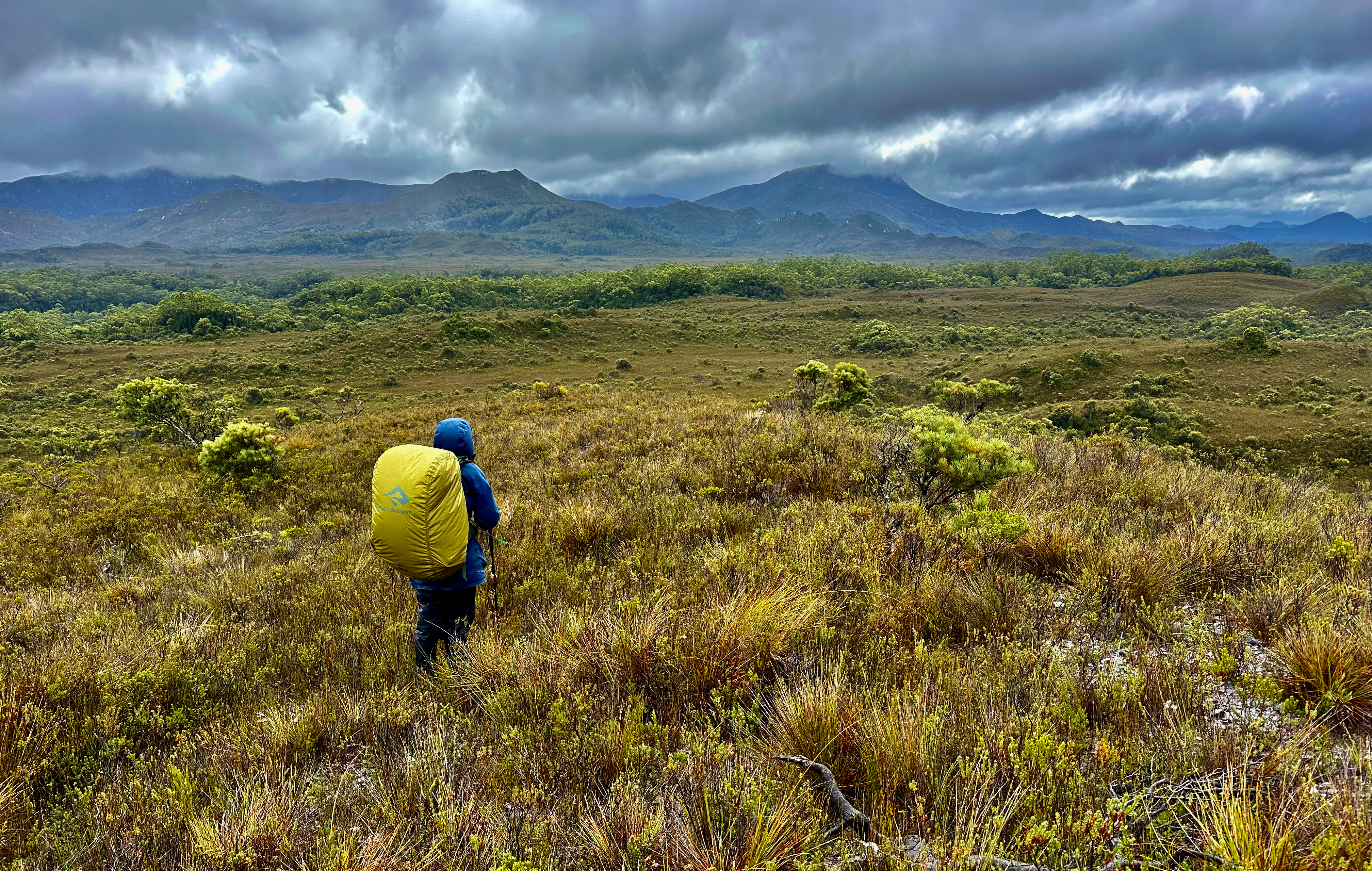
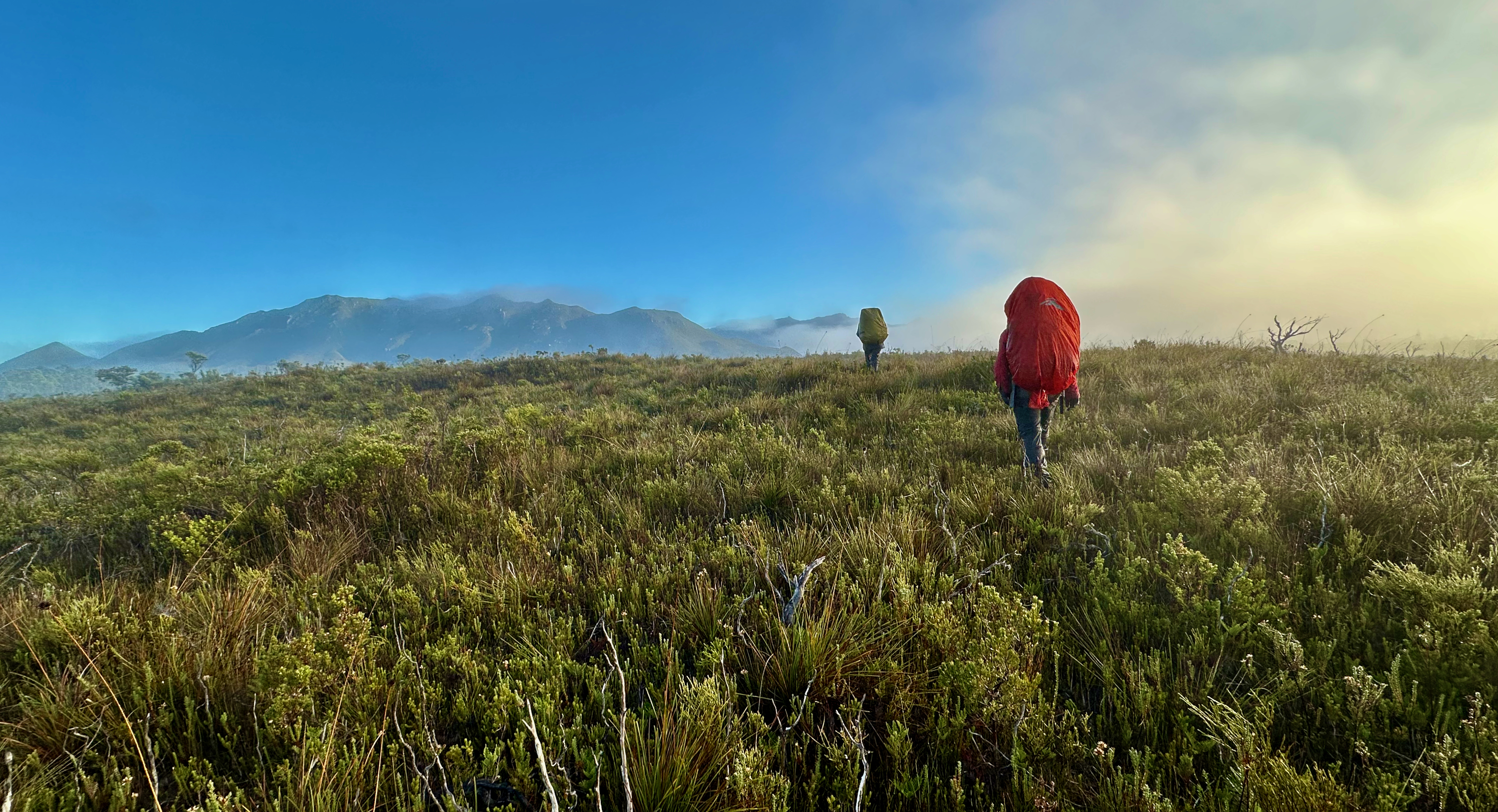
It wasn’t exactly the start to the walk we wanted but we had no choice, there was no wriggle room with dates. Cancelling wasn’t even mentioned. You don’t get opportunities like these too often. Off we set, packs rather heavy on our backs at a pinch over 20kgs for 12 days. I hung at the back, knowing I was going to struggle a bit. Shelly set a considerate pace and checked in to see how I was going from time to time and I felt very well looked out for.
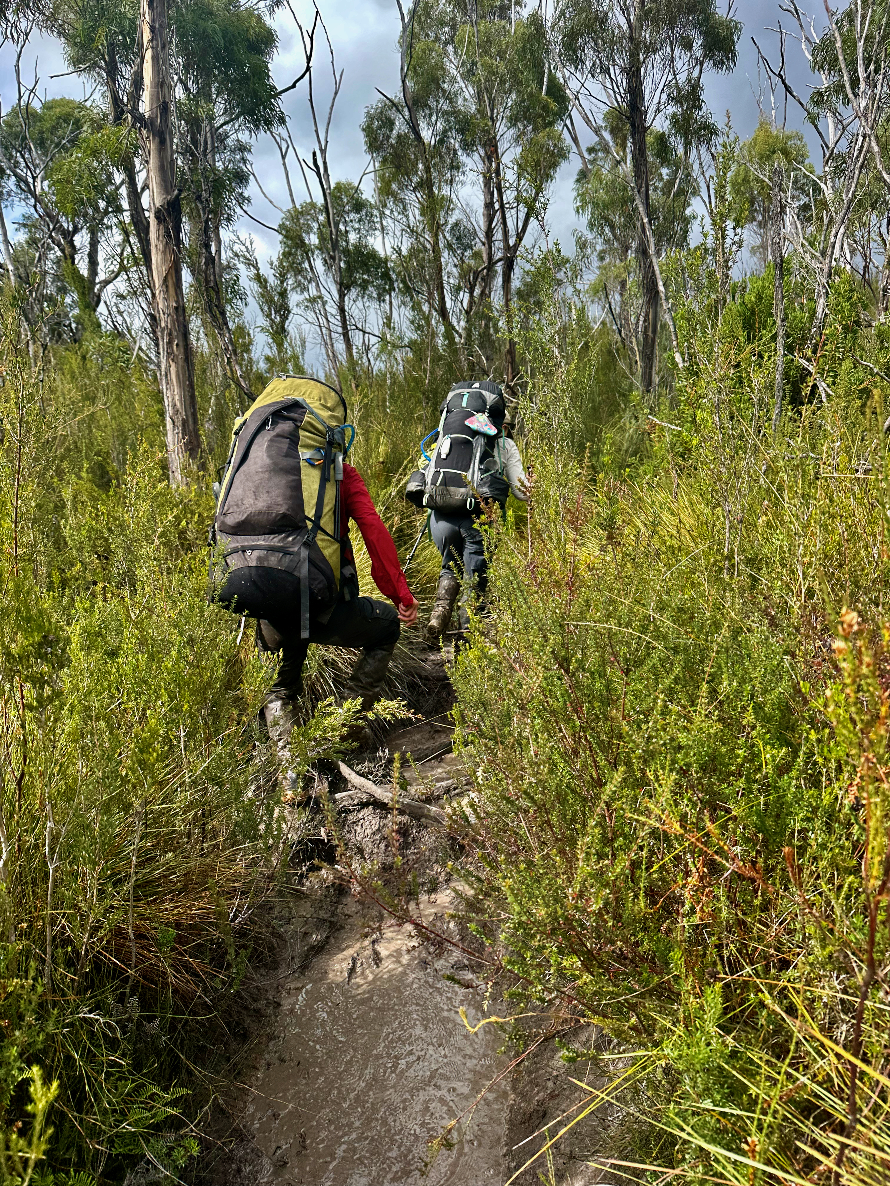
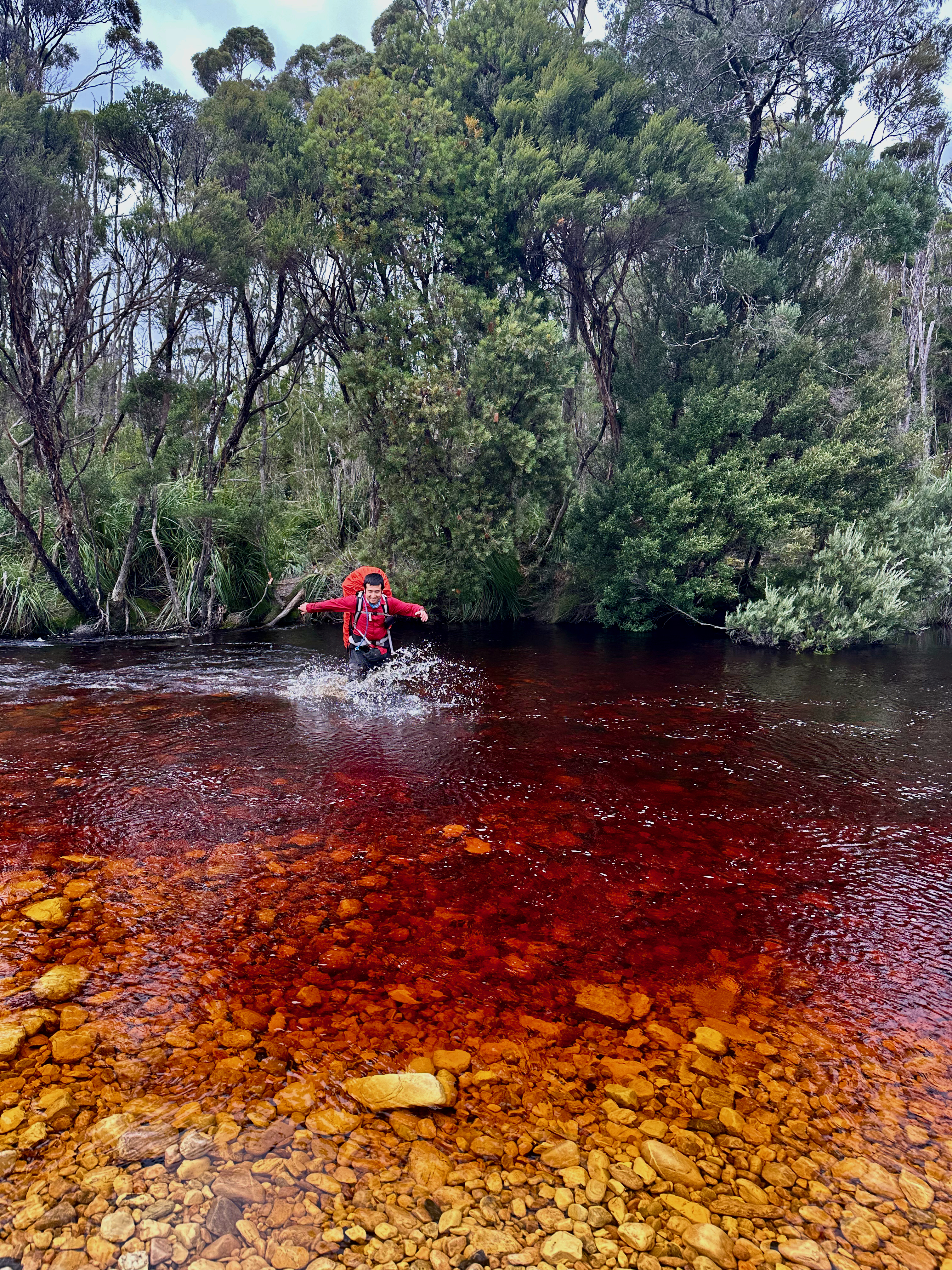
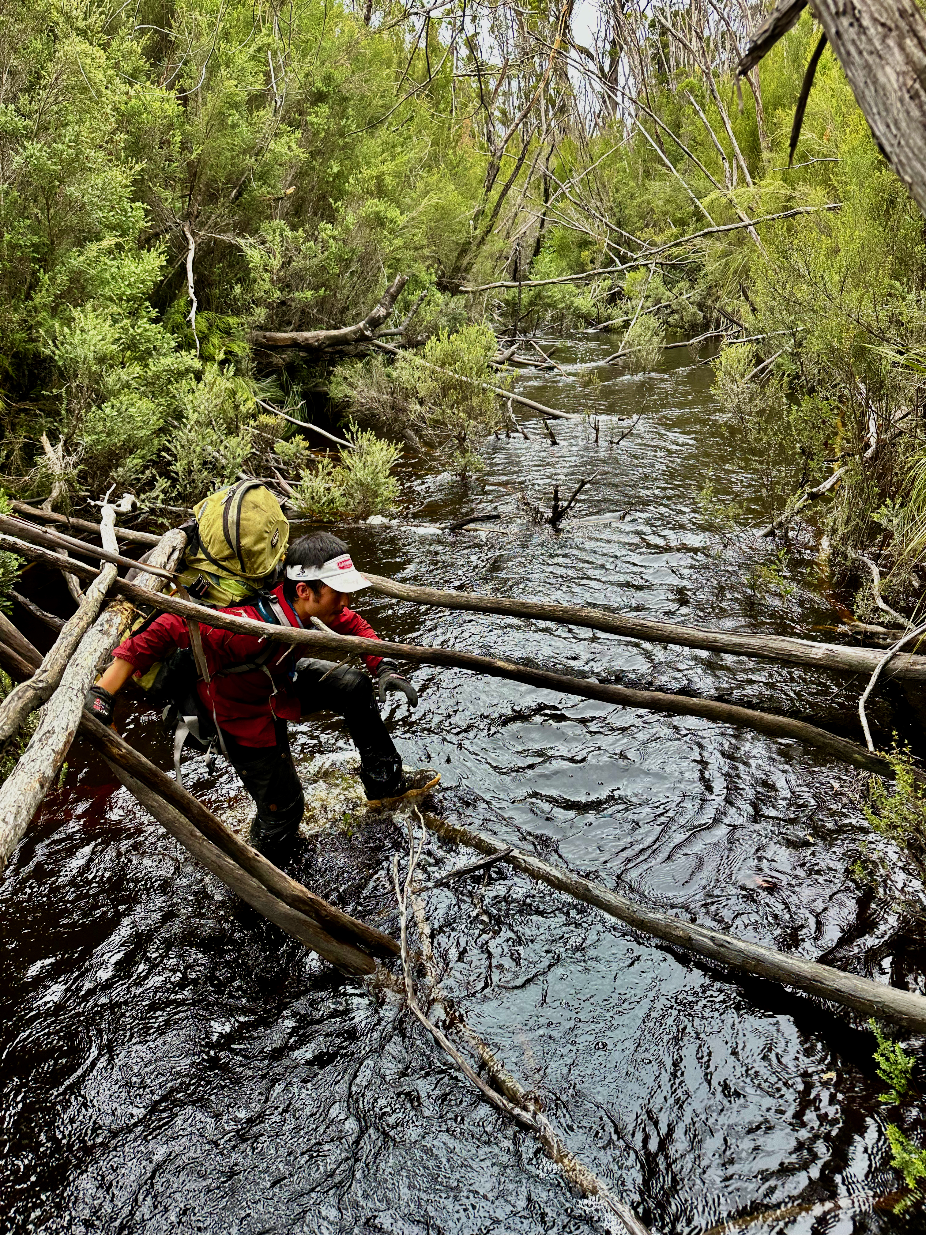
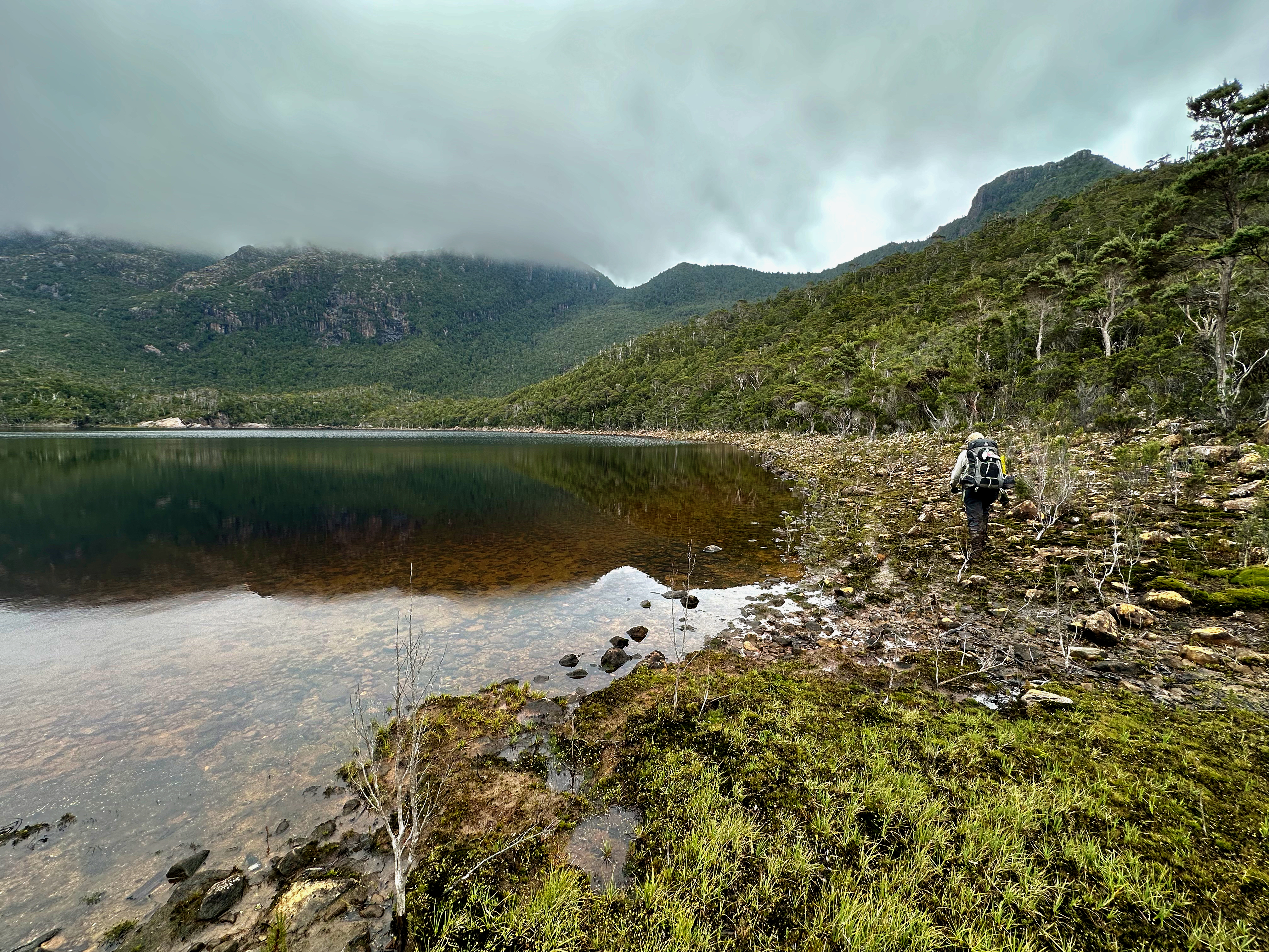
The first 10km to Junction Creek flew by. The track was wet from all the recent rain but the mud relatively solid underneath. The next 10 were a tad slower, but still felt ok. Unfortunately the Crossing river was as high as I’ve seen it, and while the other two had wet feet mine were dry. But knowing the rain was coming meant I didn’t bother to make them wait while I took boots and socks off, and in I plunged, embracing the cold water as it came mid way up my thighs. My worries about actually being able to cross the Davey returned as strongly as the current tried to push me down the river – it was flowing with purpose.
The weather for this day turned out to be much better than expected. The scrub dried out as the day wore on, and we only got very intermittent light showers. The light with incoming showers was even pretty. By the time we approached 30km and our destination for the day, Watershed camp, the kilometres were dragging as much as our feet were stumbling and I think we were all ready to stop. It had been a huge but successful first day, I only hoped my body didn’t pay me out too badly for what I’d made it do.
Who was I kidding?! I was cold, then really hot and resorted to taking Panadol to stop the fevers and try and get some sleep. I managed some intermittent dozing, but mouth breathing dried me out and I kept waking in need of water. The rain fell continuously and I forced my bladder to wait till 6:30 when I couldn’t ignore it anymore. It was time to start moving.
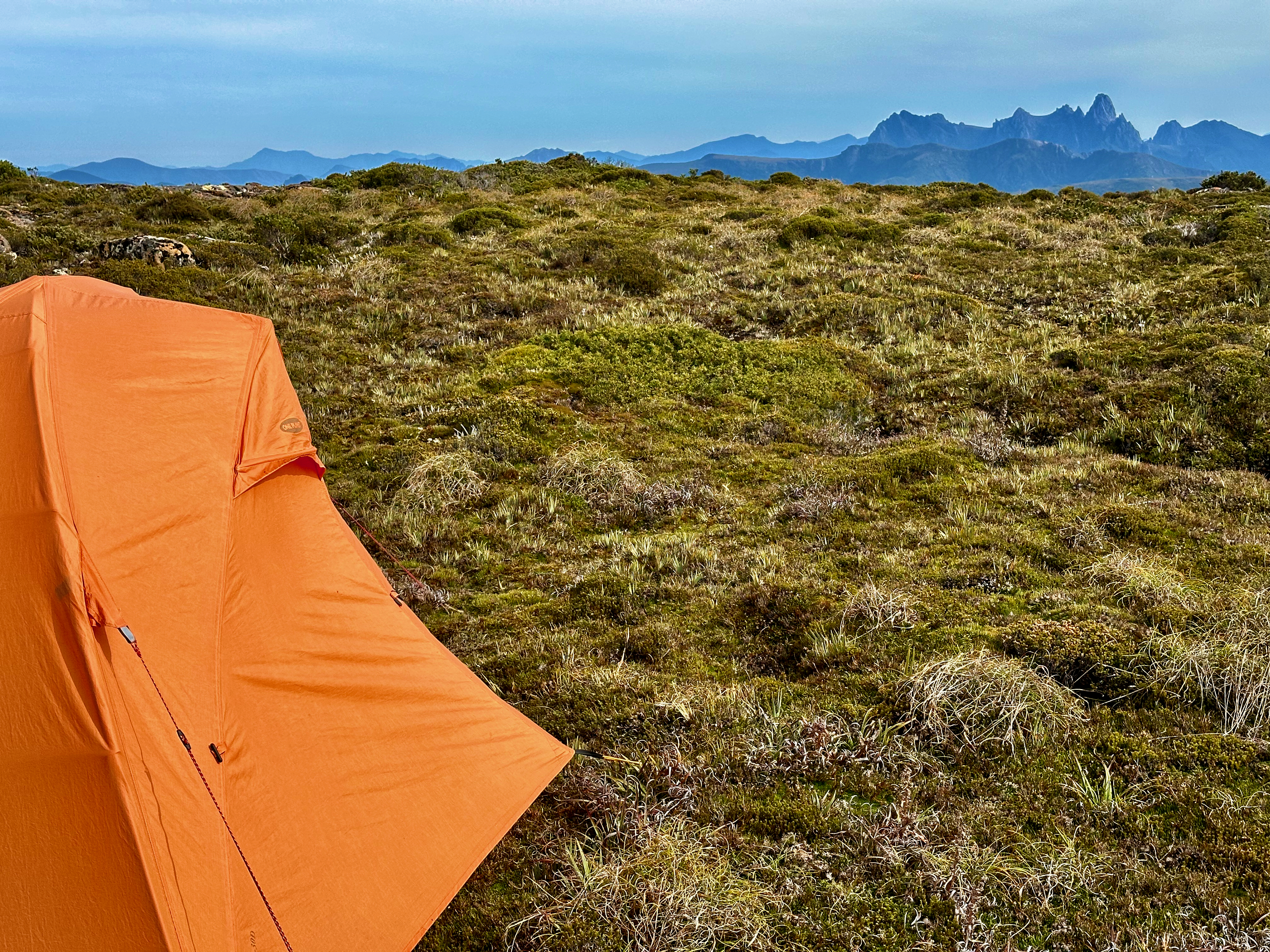
My tent was rather wet, part from splash back and partly because it’s old and not really watertight (almost all of the seam sealing tape is peeling off, I discovered. My mat was smeared with blood and I quickly found and evicted the culprit leech. We had decided on a civilised start of 8:00 so there was plenty of time to easy into wet gear. I went with overpants straight over the top of undies – I didn’t see the sense in getting anything else wet and whatever I wore was guaranteed to get soaked through. It would just so happen that I carried my hiking pants and gaiters around for the entire trip without actually wearing them!
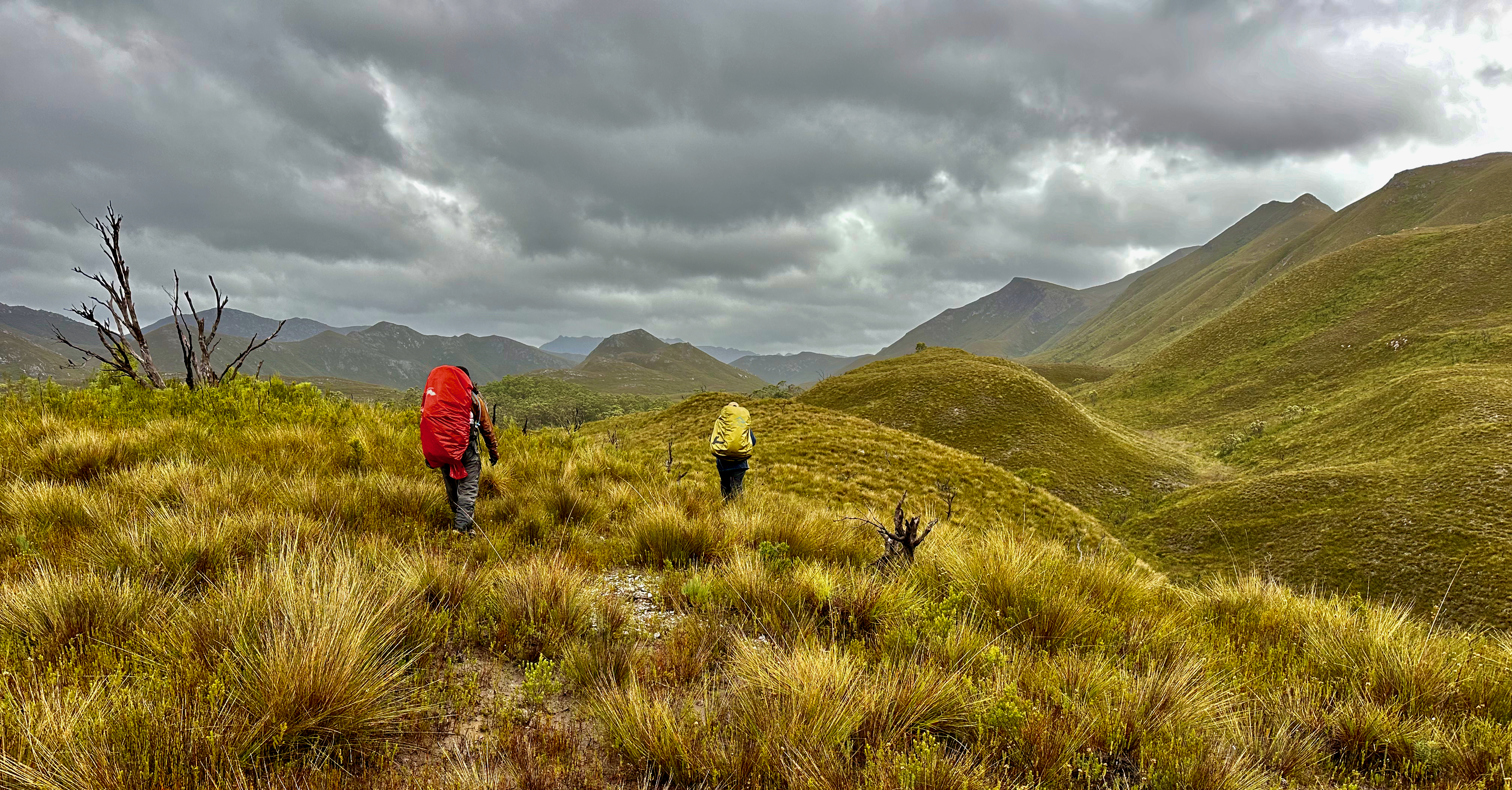
We set off in all our wet weather gear, resigned to what the day promised. It was kind enough not to rain till after we’d started, but the wet scrub was probably more drenching than the rain would be. We could at least see a number of the mountains around us, and the fact that the rain came and went in showers had us hold a little bit of hope. We could at least time quick pauses for food and pee breaks!
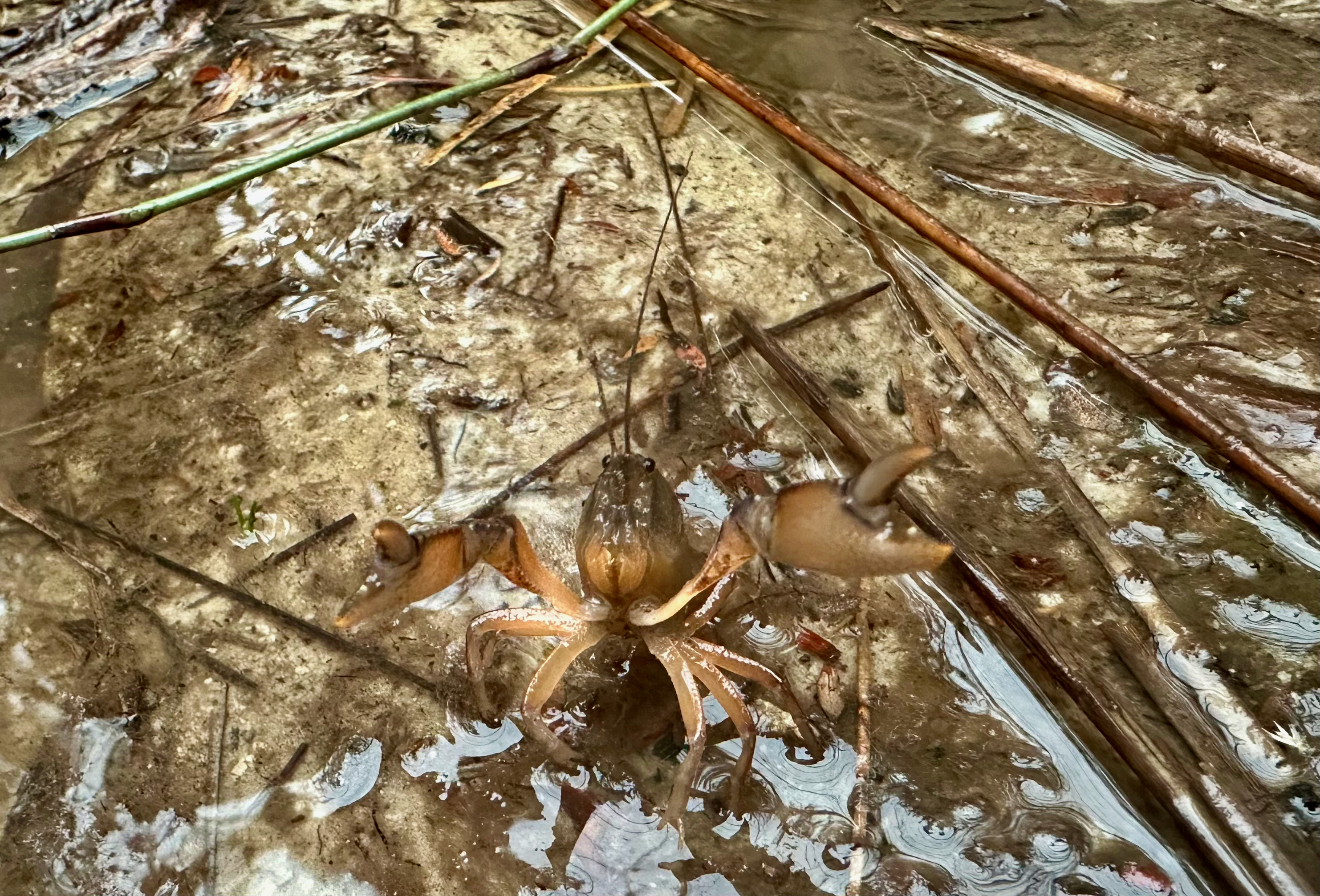
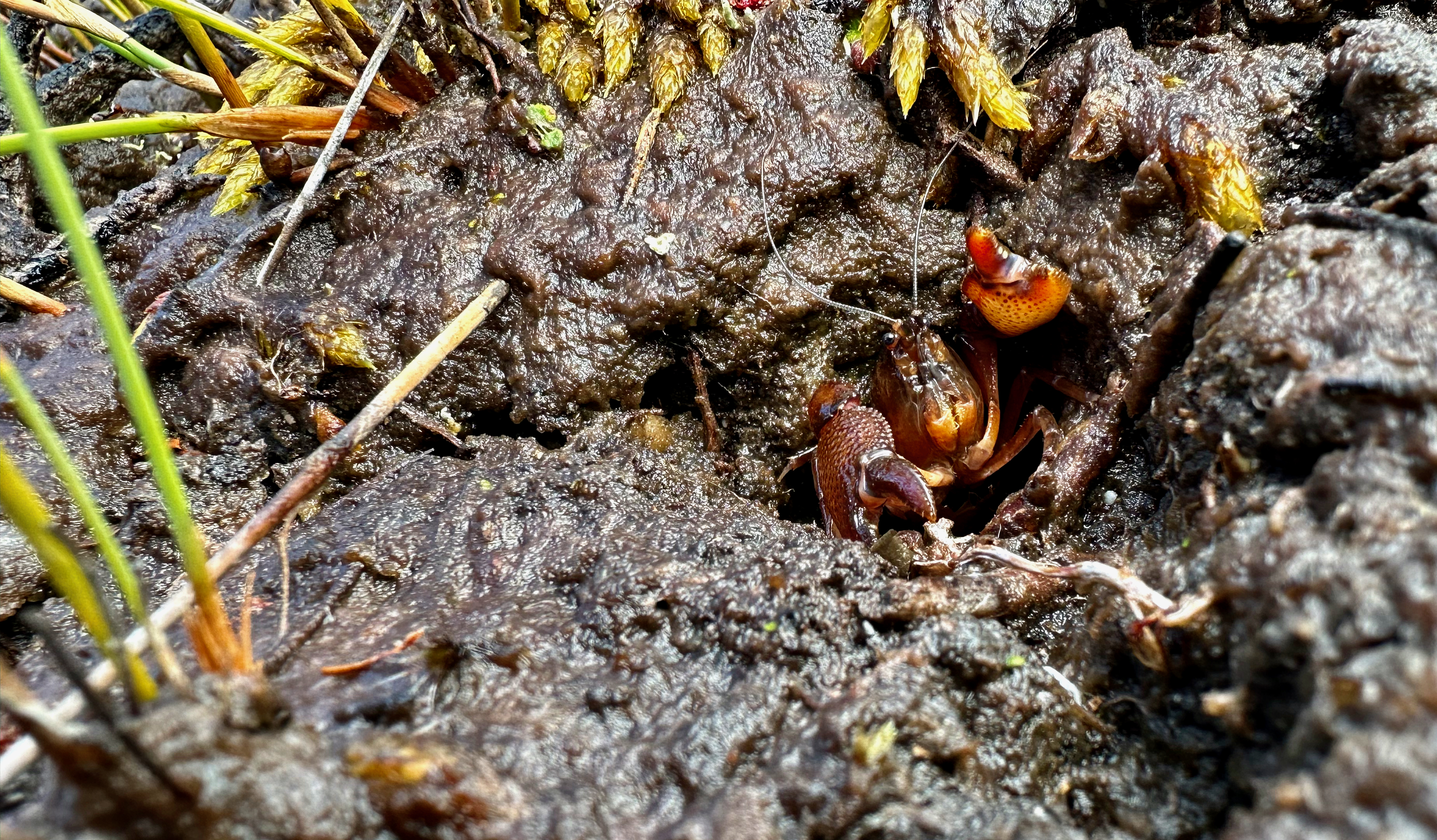
On the up side, the yabbies were out having a field day. We saw 10 in the first 4km alone, some swimming their way down the track which had become a temporary river, others scuttling away into holes, a few played dead and the odd one or two reared up, challenging us with their pincers. They made us laugh, and their burnt ochre bodies were really quite pretty.
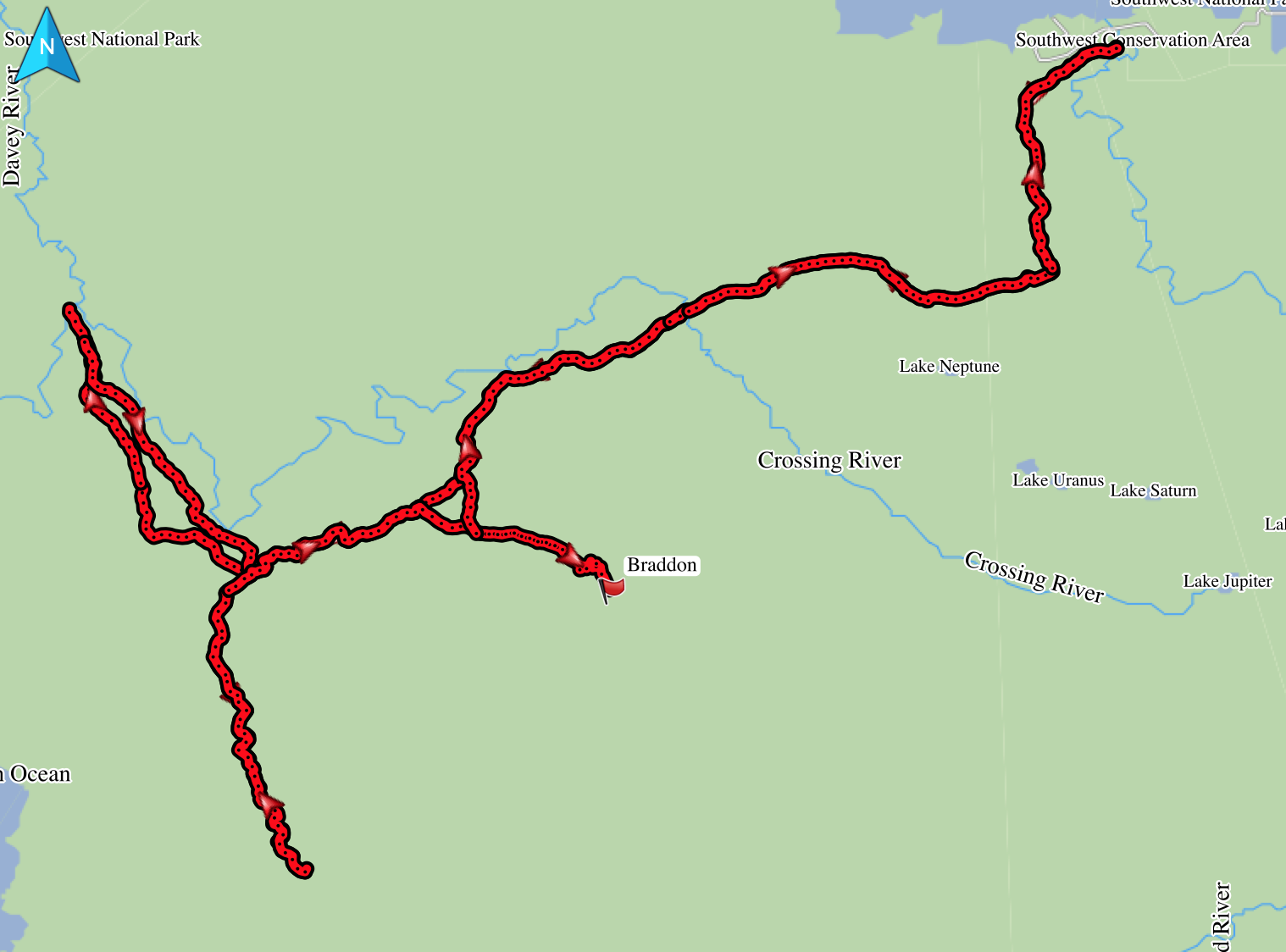
We arrived at the point we’d chosen to leave the track about two hours after setting out and quickly selected a burnt banksia to hang our spare food from. That made for much lighter, somewhat comfortable packs. We discussed route options and agreed to head to the confluence of the Crossing and Davey rivers over Davey Sugarloaf. It meant steep but open going that didn’t require much decision making.
We spent the morning plodding up to the peak, grateful for the considerate wombats who had kept a decent pad well maintained up and back down the mountain. It got cooler as we climbed and the wind was strong enough that our leeward side remained almost dry. If it didn’t keep raining it would have been an excellent clothes drying day. The ridge down off Davey Sugarloaf was lovely looking and I longed to take a photo but the rain wouldn’t cooperate. It was steep in parts towards its tail end, which made it ridiculously slippery and we found down wasn’t much faster than plodding up had been.
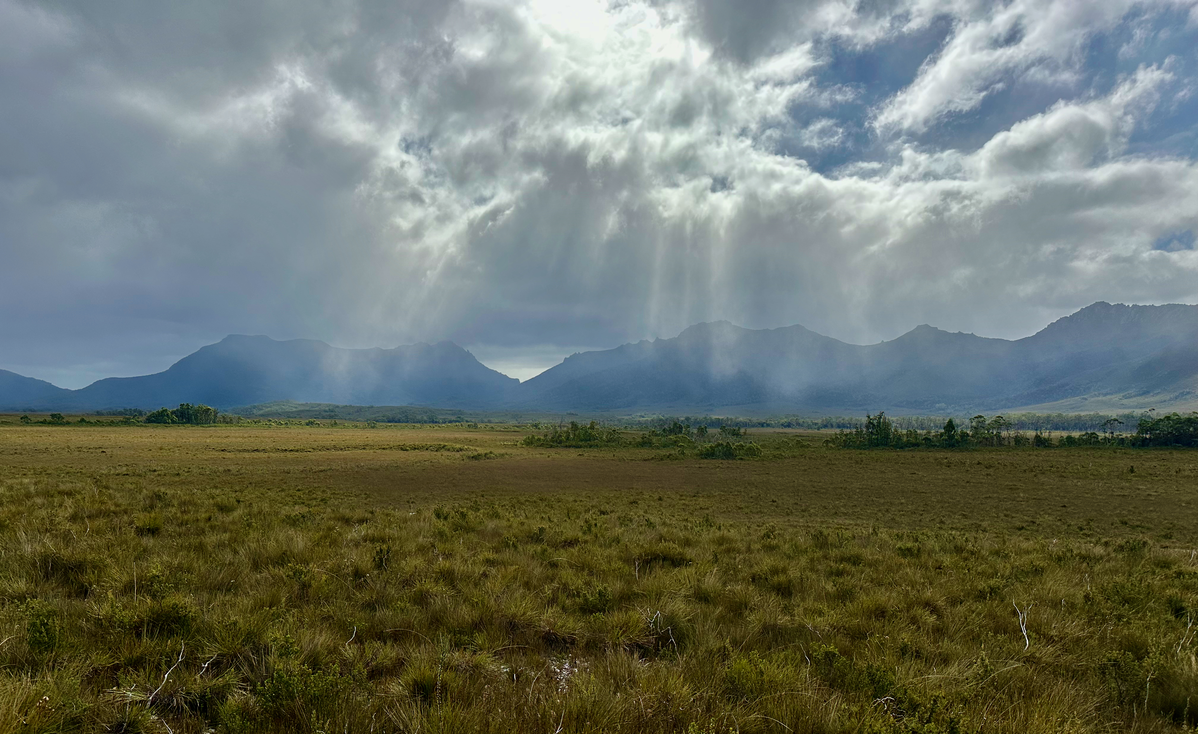
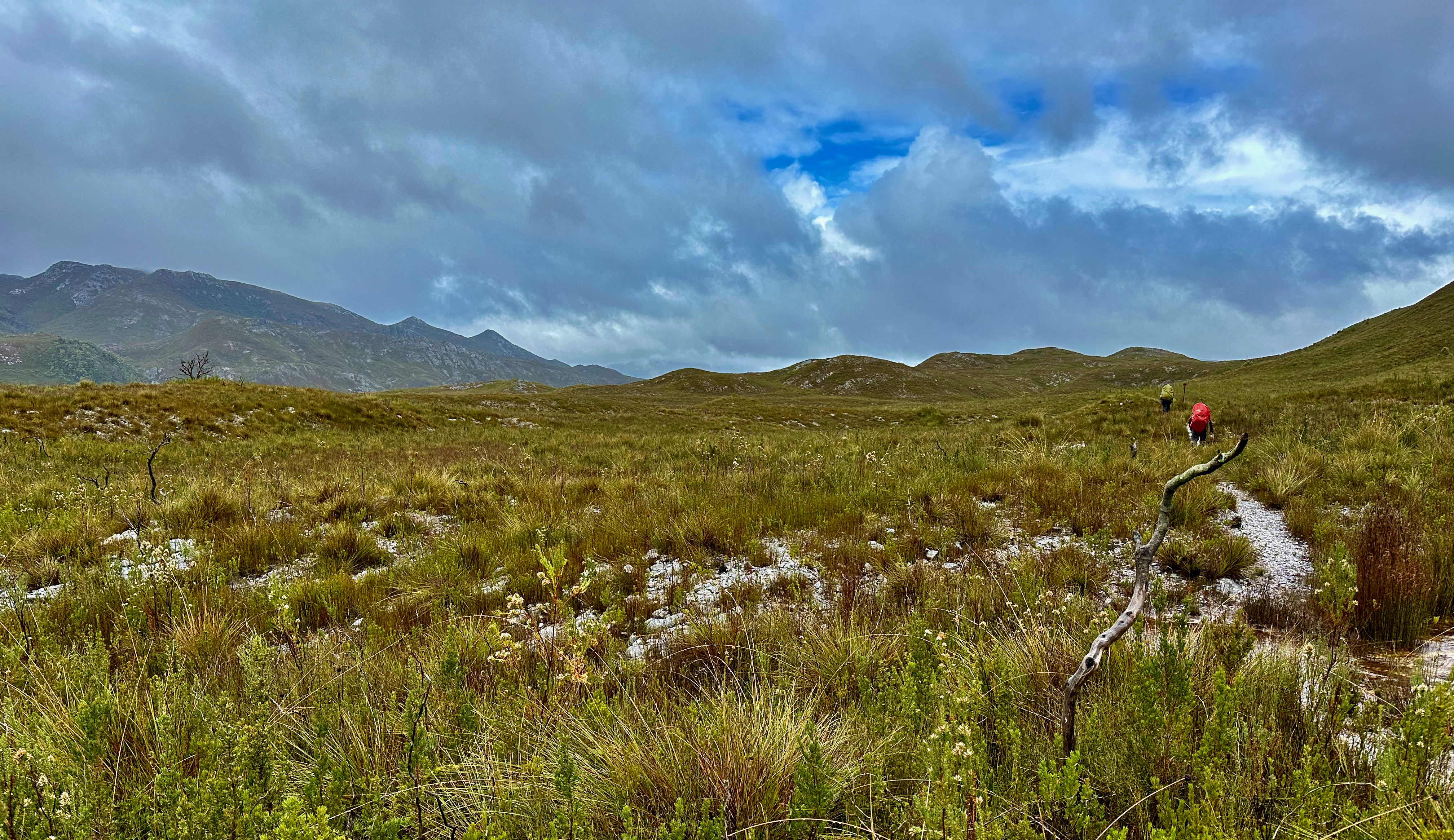
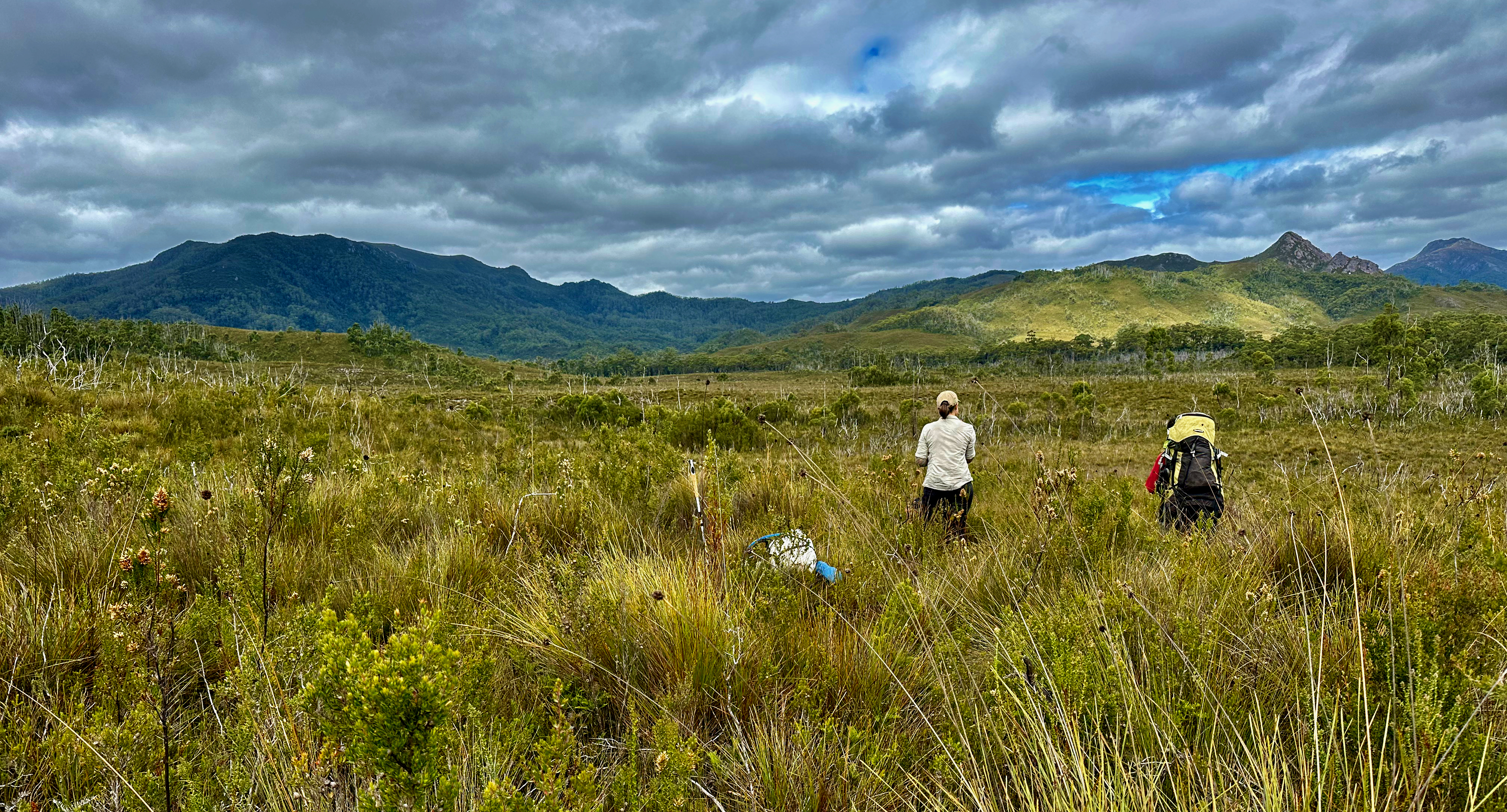
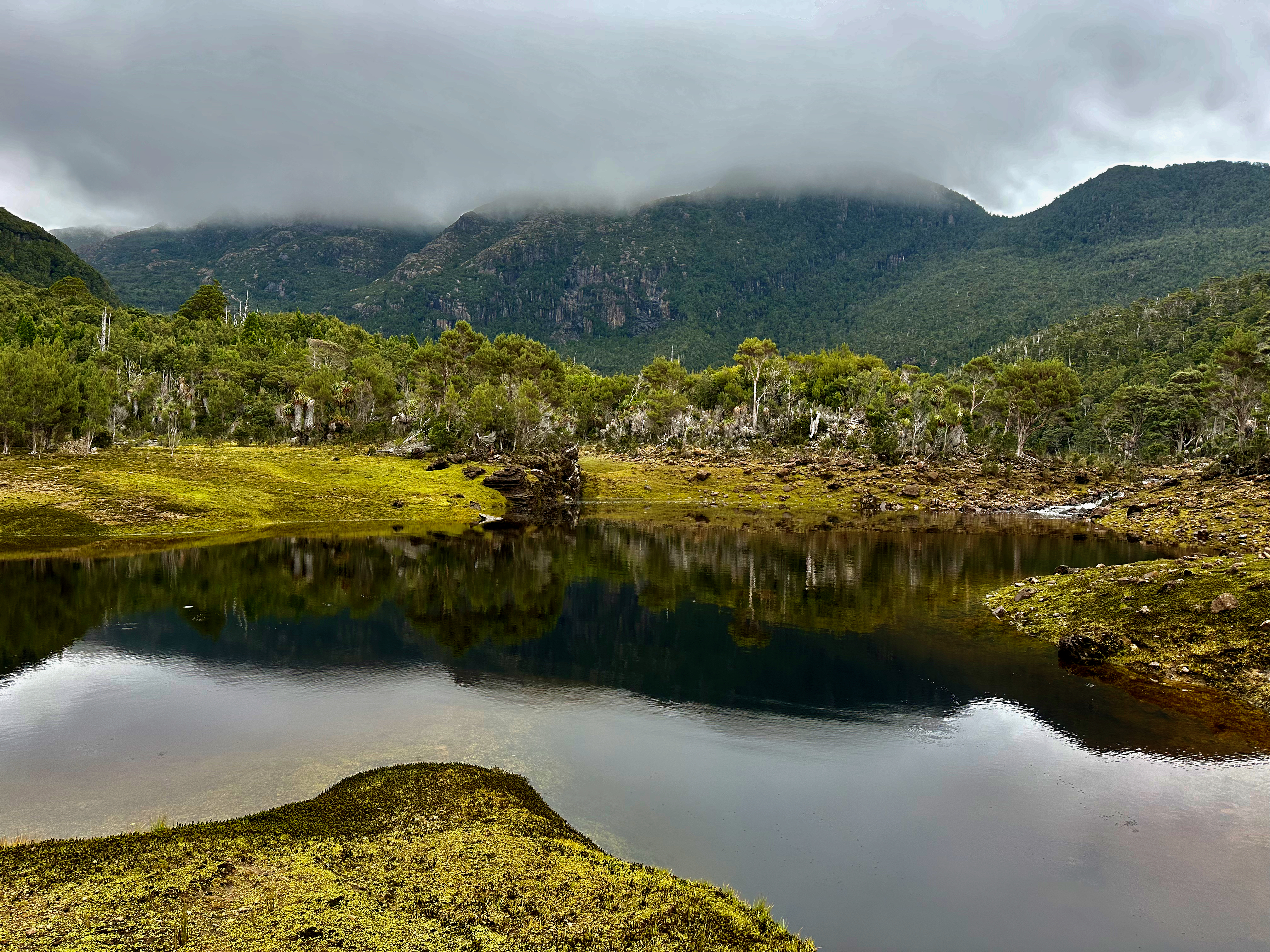
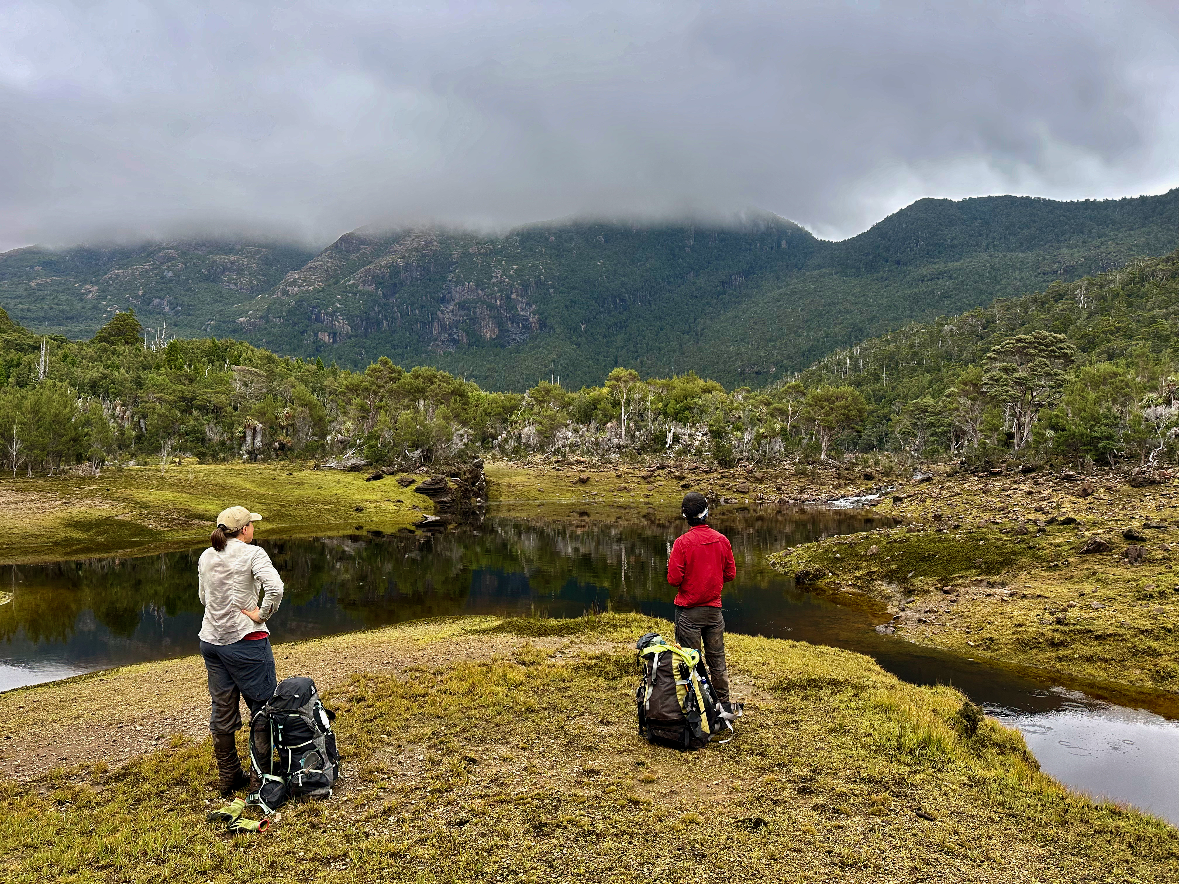
The plains at the bottom were both more sheltered and surprisingly open. The sun came out for a few seconds and a small patch of blue sky opened up. We were feeling good and it didn’t take us long to get to the Davey River. Our spirits were quickly dashed. We were shocked at how wide it was and how fast it was flowing. None of us felt it was safe to cross. There was absolutely no sign of any of the rapids or sandbars we’d seen on the satellite imagery. We made the call, surprisingly quickly and without any dissent. Make good decisions – check!
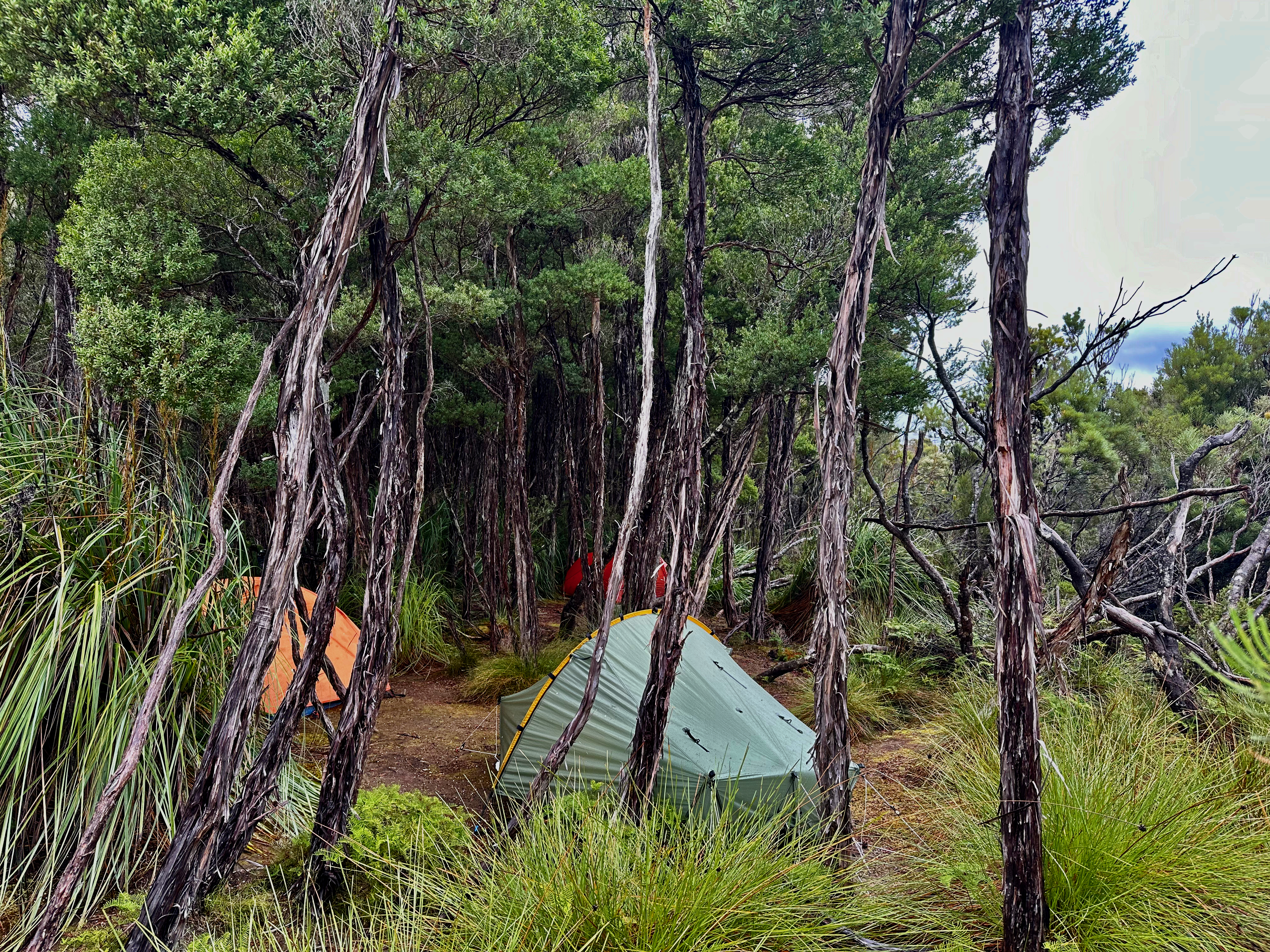
We retreated a short way up the valley and found the flattest and driest spot for our tents, nestled between two ridges. It was a little difficult seeing it had rained so much that anything slightly flat was covered in a layer of water, but we did well. At least we were relatively sheltered from the 50-60kmh winds that were expected. I didn’t mind pulling up early enough to sort out some dinner, warm and dry clothes, notes and teeth well before it got dark and I needed to sleep.
We had already settled on a Plan B, which involved ditching Hean, Piners and Propsting and just going for Berry, Legge, King, Braddon and Robinson. But given we now had three free days Shelly proposed we drive south to see if we could also have a crack at Bobs Knobs (and Bobs and the Boomerang)! When in the presence of peak baggers, one peakbags! It seemed important to both Shelly and I to have this new plan in order to manage the disappointment of being unable to cross the river and follow Plan A. Of course, we also discussed options for a return trip, with pack rafts, to navigate the Davey River!
I slept solidly for three hours and then the wind kicked in. We found out later from Tim that Scott’s Peak Dam had recorded gusts of 120km/h. Our tents were fine, they were buffeted a bit, but nothing crazy. The noise did make it difficult to sleep though, and I dozed intermittently till 6am.
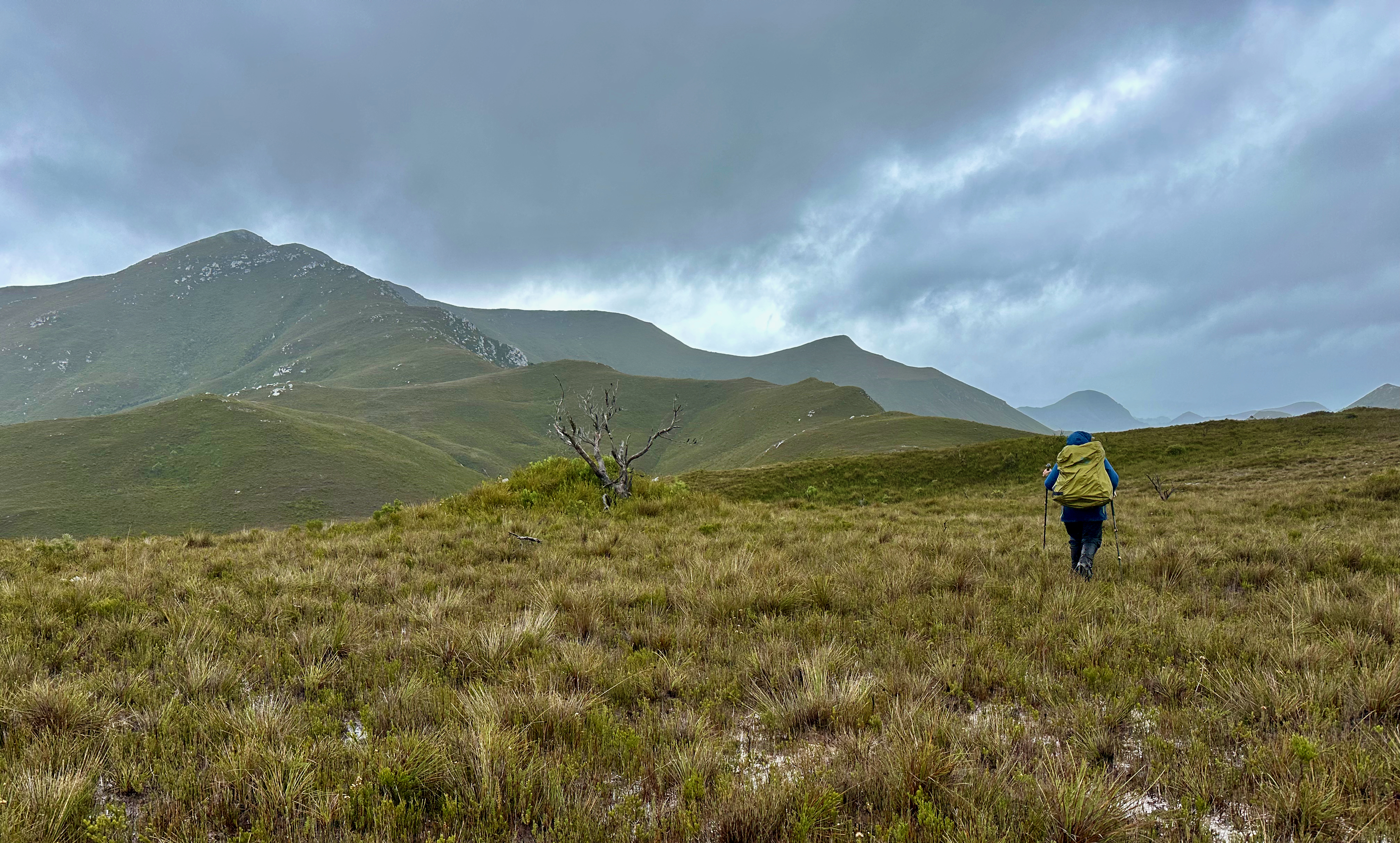
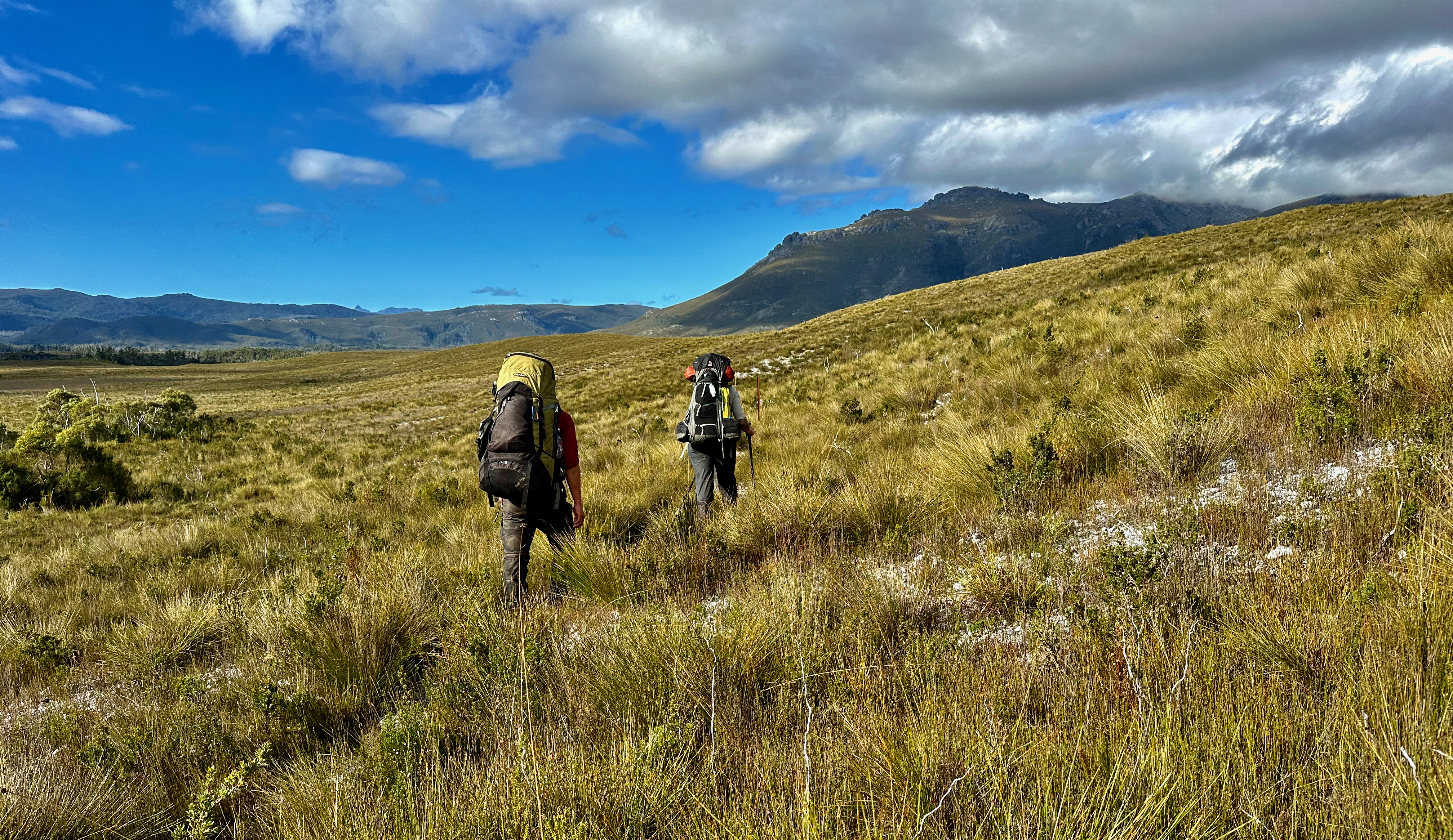
We’d opted for an early start, a slightly different route back that would see us contour around Davey Sugarloaf on the plains, and then a long walk south to Spring River, where we’d spend three nights. I was especially excited. The food bags we’d pass by had BBQ Shapes in them and I would get a rest day when Shelly and Kevin climbed Berry. I was much in need of one – walking long days with a cold isn’t recommended. I was puffed on the hills, fatigued in general and wasn’t sleeping or recovering well either. It would be the first time I’d relished a rest day while others went walking.
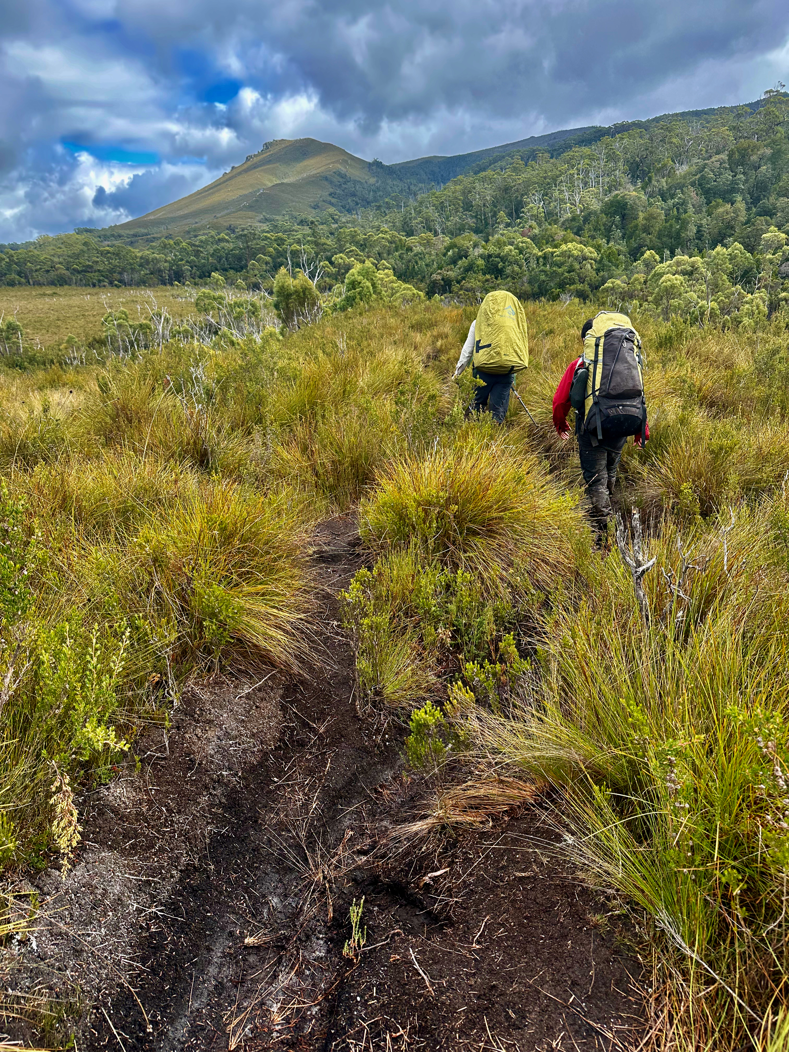
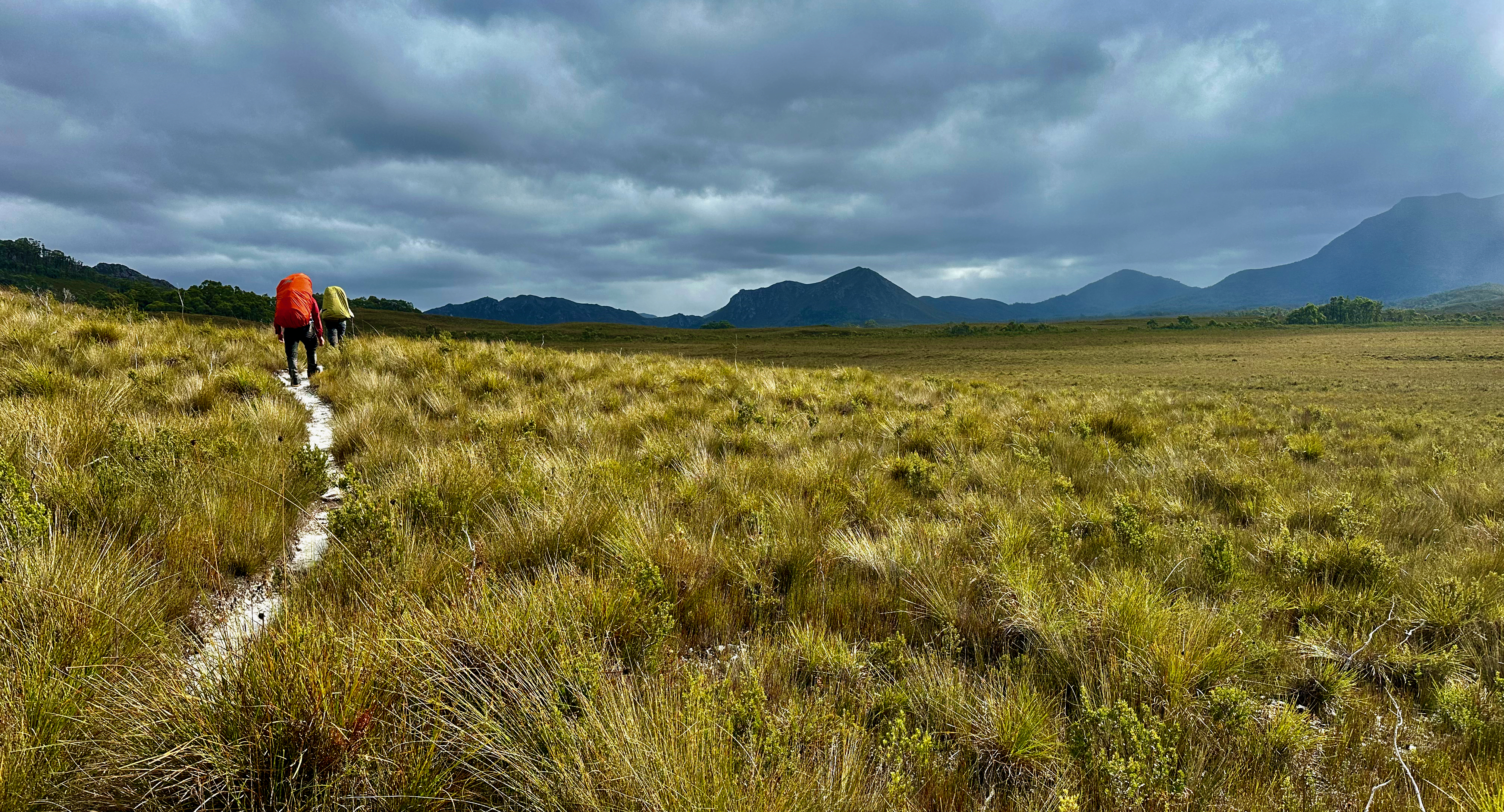
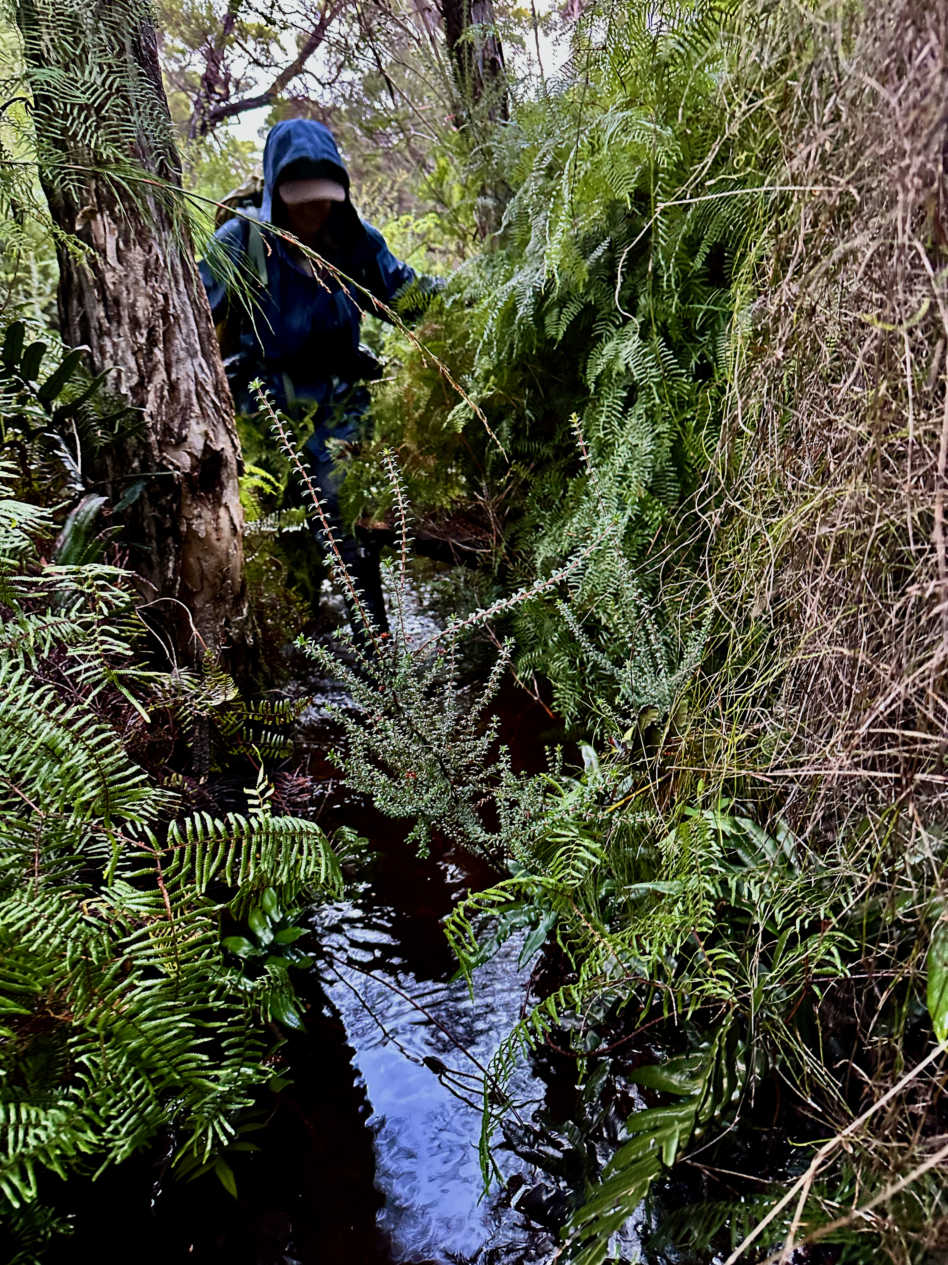
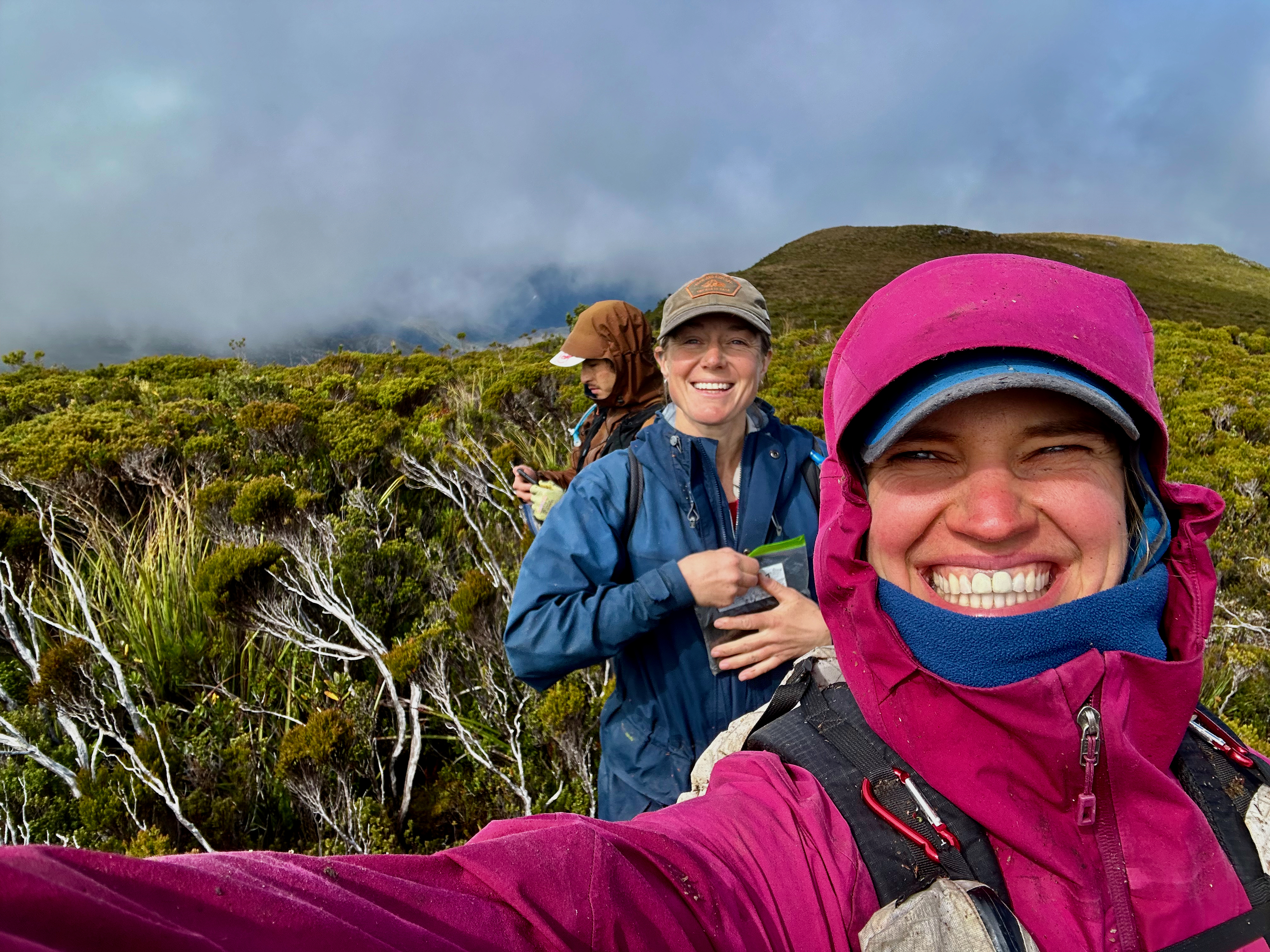
The rain paused to let us pack up our tents after pulling on all our wet gear. At least with a minimum of 13 and a maximum of 14 we weren’t too cold except when the rain and wind acted in unison. In fact, we were almost too warm as we worked our way up and over the very end of the ridge off Davey Sugarloaf. The rain soon came to solve that problem and seemed less intense but a bit more persistent than it had the day before, which had come harder in fits and bursts. We could still see a decent way, which was both nice and helpful. It made for easier route selection as we wound a route up and over little bumps in the landscape, and down to only mildly scrubby creeks in between them.
This low route was a more intensive on decision making but far less taxing on the legs and it was good to have a sense of both routes. We could see our tree full of food bags from quite a distance away and made a beeline for it. We were just in time for lunch and BBQ Shapes! Once again the rain held off, but we couldn’t stop longer than a few minutes without getting cold, now that we were back to being freshly soaked through. I don’t think I’ve ever walked through so much persistent rain and in order to keep warm enough we stuck to short infrequent breaks to eat, pee or make clothing adjustments. Our group was great at it, as well as being ready to go within a few moments of one another, so no one was left standing around shivering.
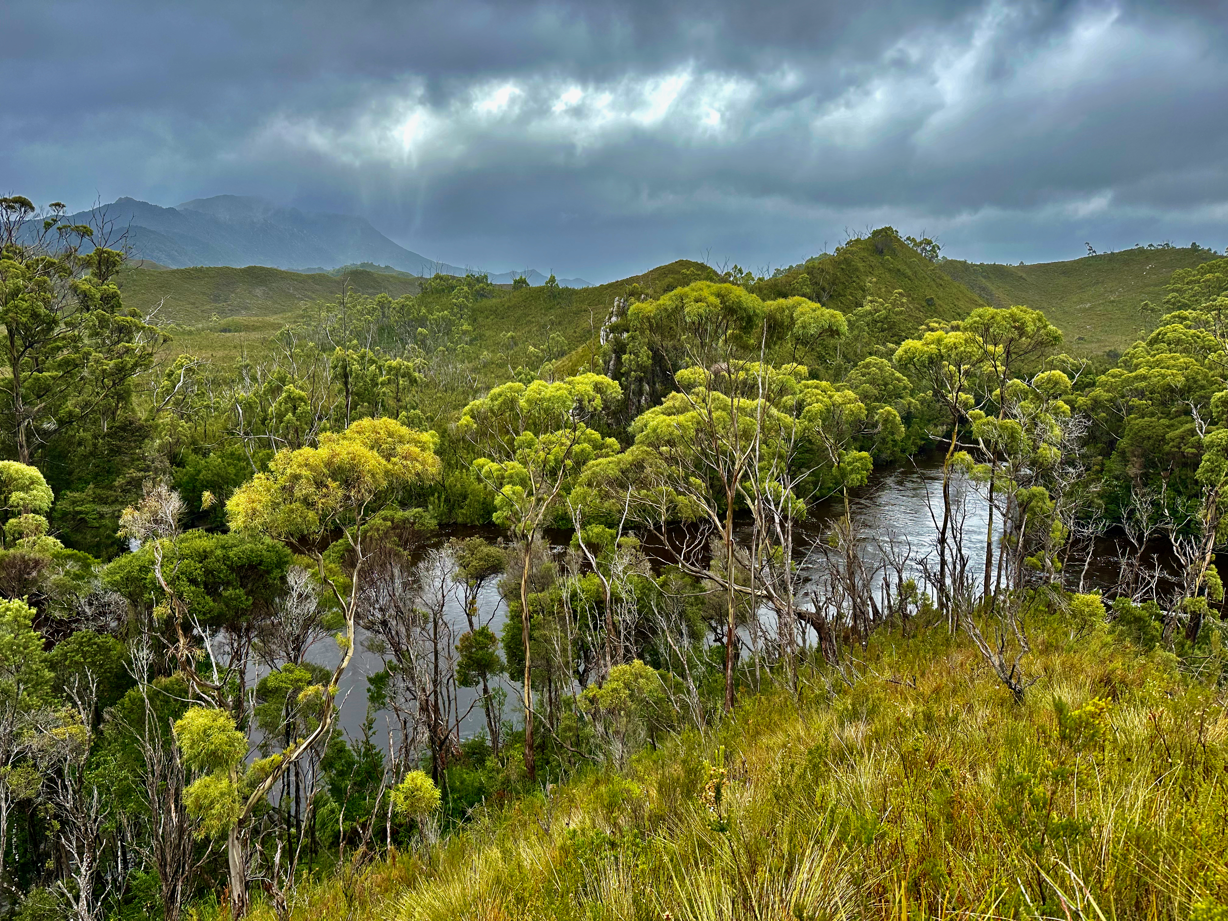
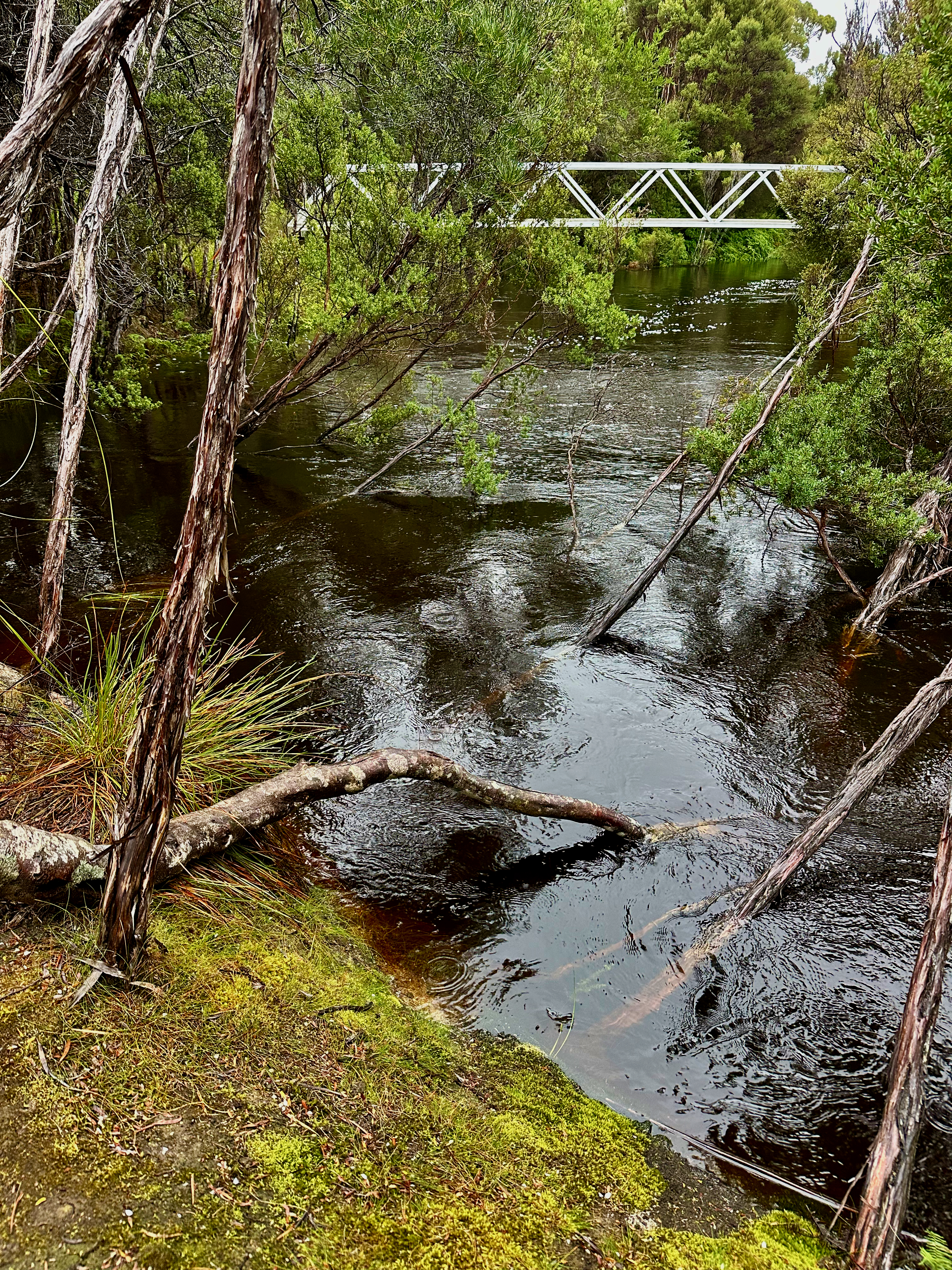
We set off south down the Port Davey Track, through the Lost World. On and on. I wasn’t the only one who felt like the kilometres were dragging and progress was slow. It wasn’t, we were moving much faster than we had been, it just felt very slow. The rain came and went, the scrub kept us wet in between showers. All the creeks and rivers we crossed were pumping full of water. When we finally arrived at the Spring River campsite I was amazed at how high the river was. Less than half a metre higher and the campsite would be flooded. Just as well there was a bridge over it!
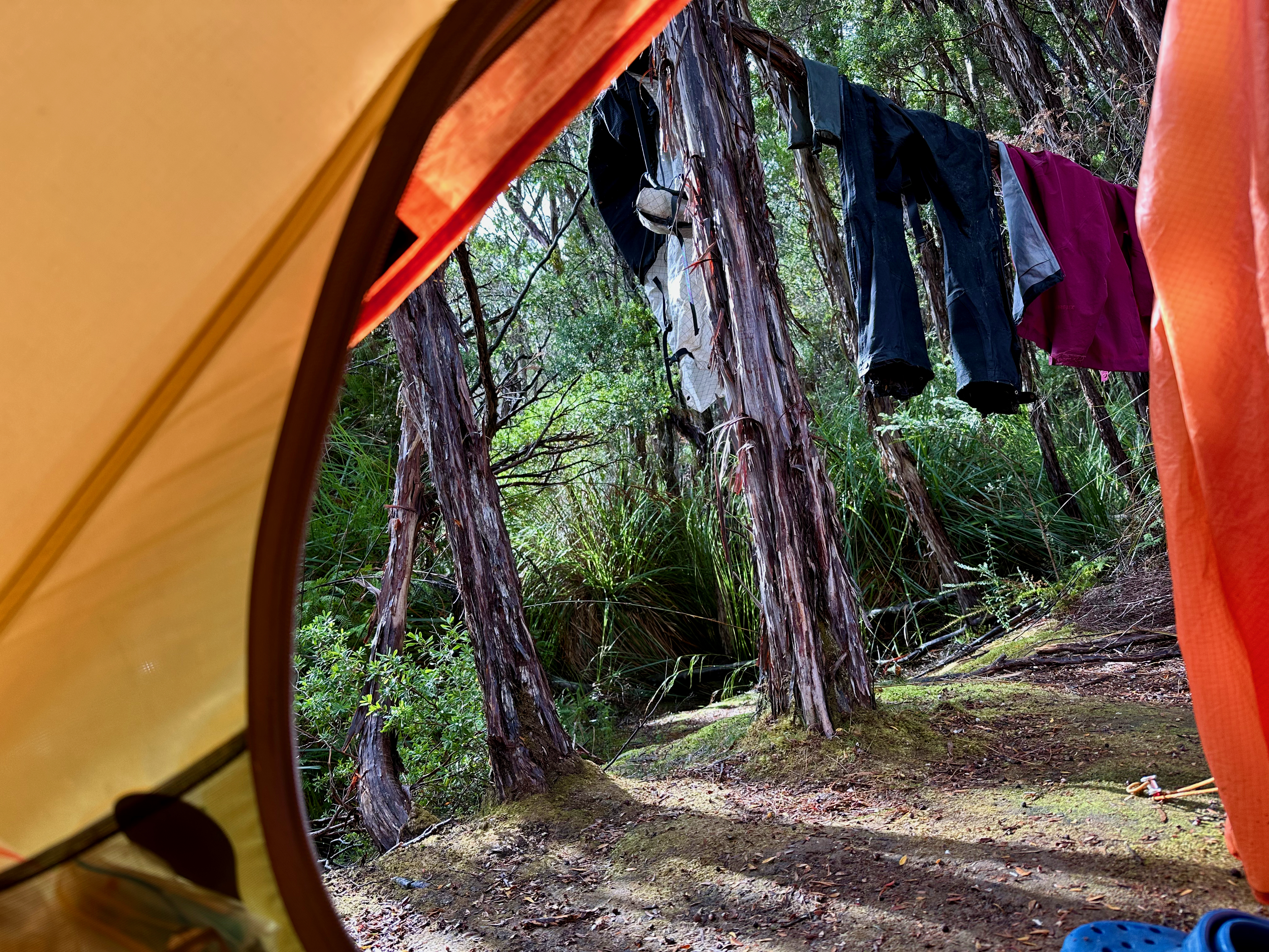
We pitched tents, trying to get them up before the next lot of rain came through. Then came the tricky act of trying to strip off wet clothes and get inside the tent without bringing a massive dirty puddle in too. The benefit of having a rest day was that I could go and wash socks and undies and put on clean dry ones. I felt half civilised as I munched on the rest of my rather smashed up BBQ Shapes and waited for dinner to be ready.
I was very happy when I didn’t have to get up and put on wet clothes and set off into the rain with the others the following day. I bid them farewell and relaxed into the morning. I savoured my breakfast, hung out my clothes, brought them back in, hung them back out and nibbled on snacks. This was the slow tune of my day. I snoozed, often when I was trying to listen to my audiobook and sometimes when I should be bringing the washing in to avoid another shower.
The hours passed surprisingly fast and then I was on the lookout for the others expected return. They were a tad later than anticipated, but they’d had challenging weather so there was nothing unusual in that. They traipsed into camp in good spirits, despite being soaked through once again. After a brief chat and congratulations, they retreated to their tents to dry off and get warm and fed. I returned to my snoozing. I was feeling much better for it, though the real test would be how I felt on the day trip to King and Legge we had planned for the next day.
Plans are all very well and good, but this trip wasn’t playing ball. We rose in the dark and were ready to go as soon as it was light enough to see without head torches. We crossed the bridge over Spring River to find the other side flooded a very short way in. It’s always been hard enough to stick to the track there, but when everything that wasn’t scrub was flooded, and even the scrub was flooded (we did test it!), it was tricky. When we were on the track we kept coming to sections where we couldn’t feel the bottom and we were already standing waist deep in water. We tried taking to the scrub, but that was the same. Only falling through scrub into deeper than waist high water wasn’t fun. We bailed, again. Frustrated.
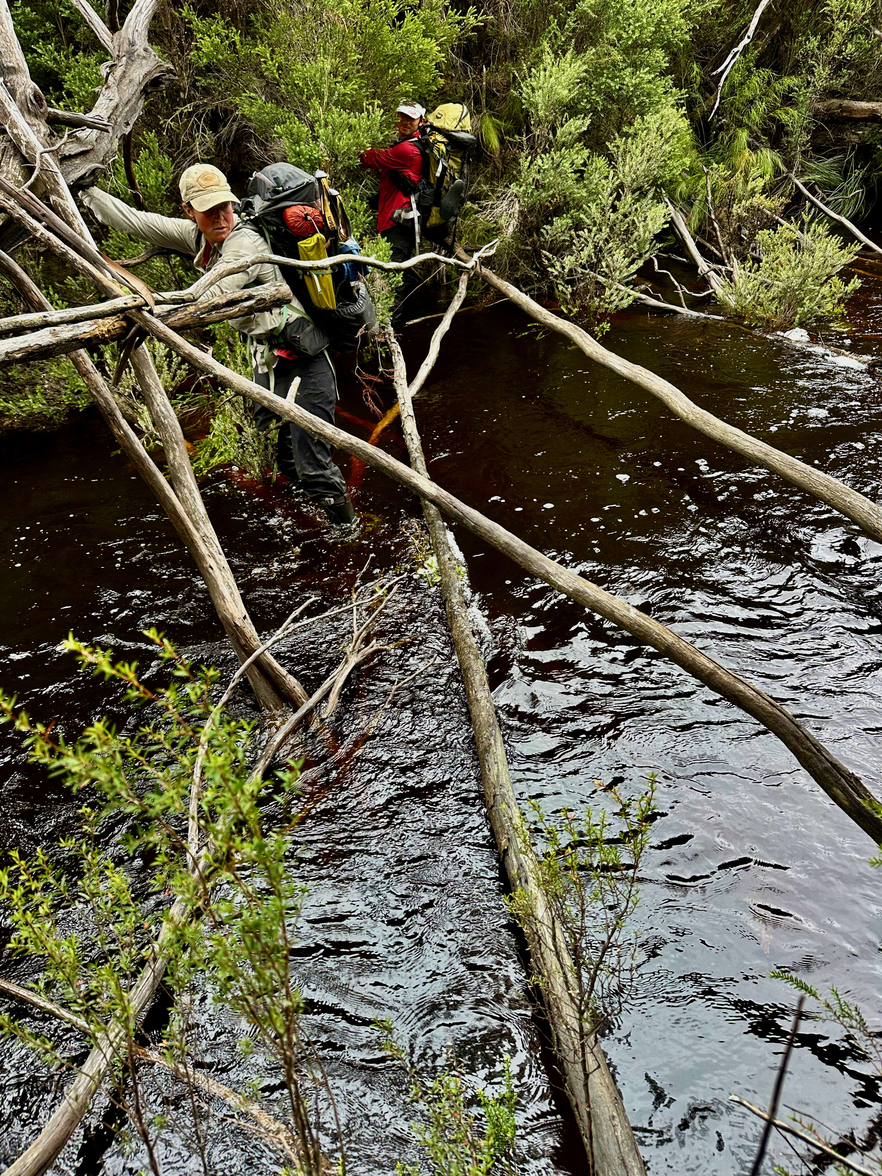
With tails between legs we retreated to pack up our tents and walk back to the foot of Mount Braddon via our dropped food. It was nice to dry out as the day went on, to be able to stop and take photos without phones getting wet, and to stop for food and not risk freezing in the meantime. It went surprisingly fast and it was only early afternoon when we plunged off track for the final few kilometres. There were some thicker patches of scrub, and the start of the Spring River to cross. It was still wide and the first two points we attempted crossing it were too deep. But we weren’t going to be thwarted a third time. We pushed on, determined, finding another spot where we walked in the water, balancing on fallen down, semi-submerged tree trunks. It effectively converted the shoulder high water into a shallow river (so long as you didn’t slip!).
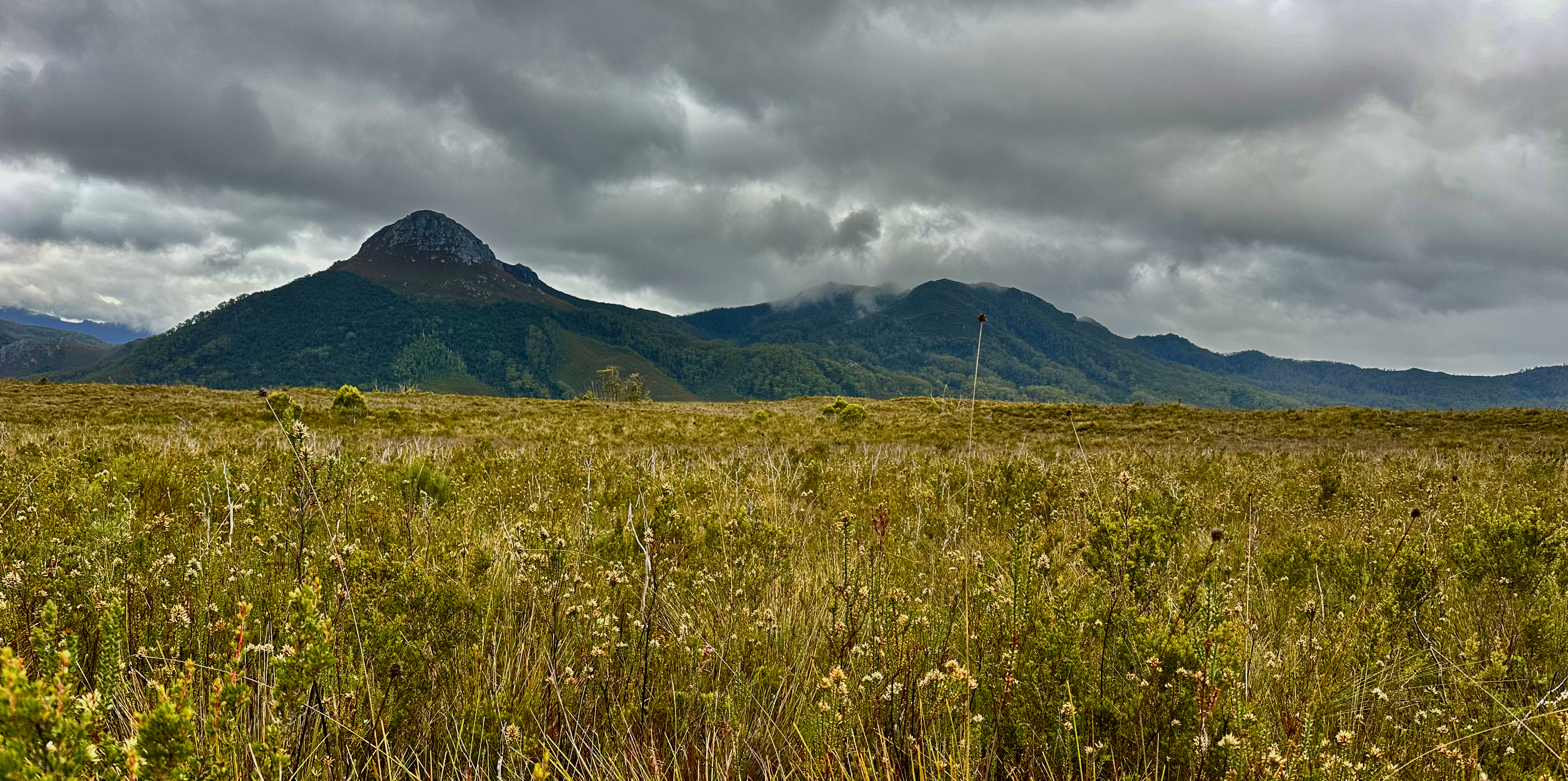
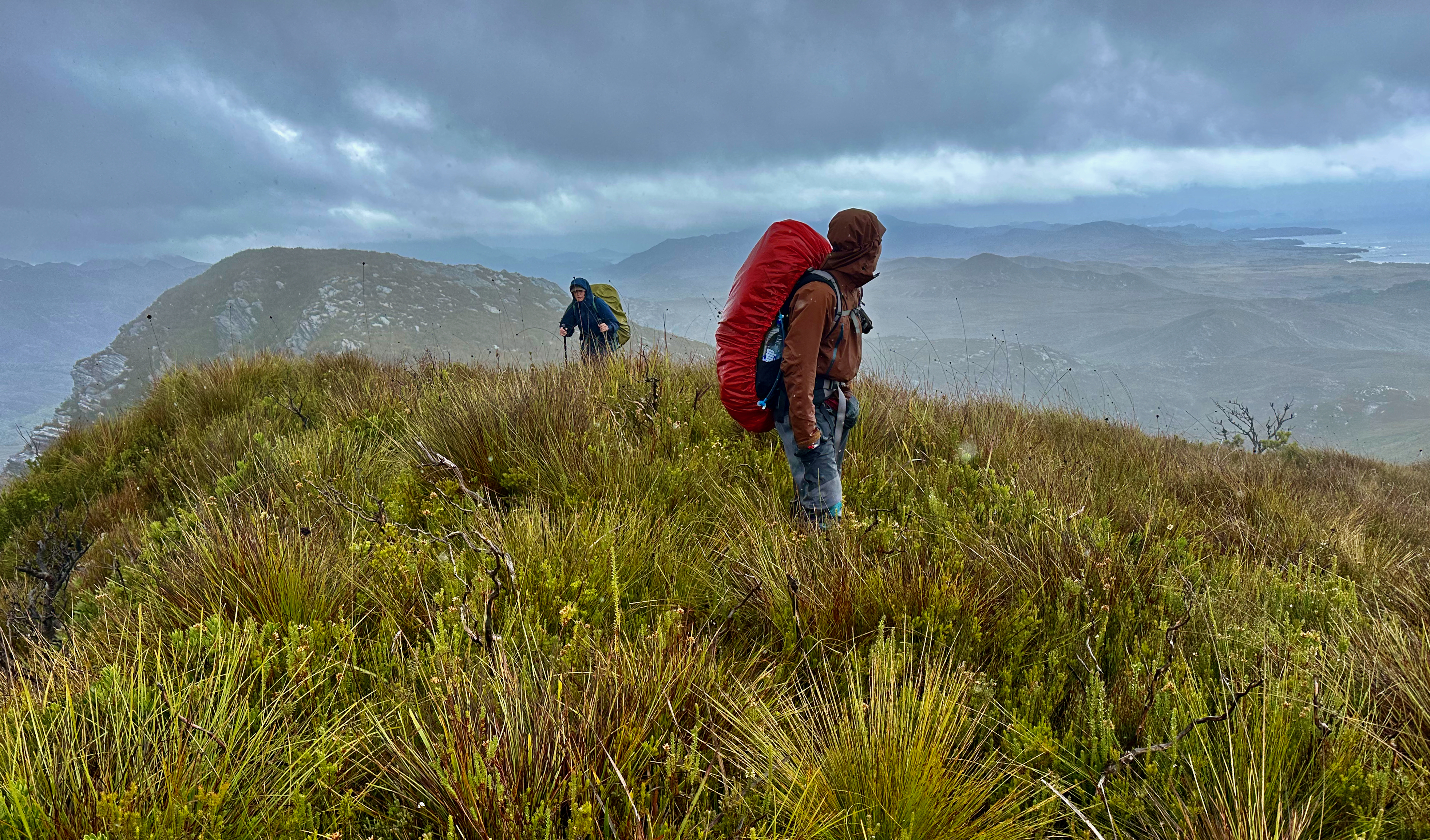
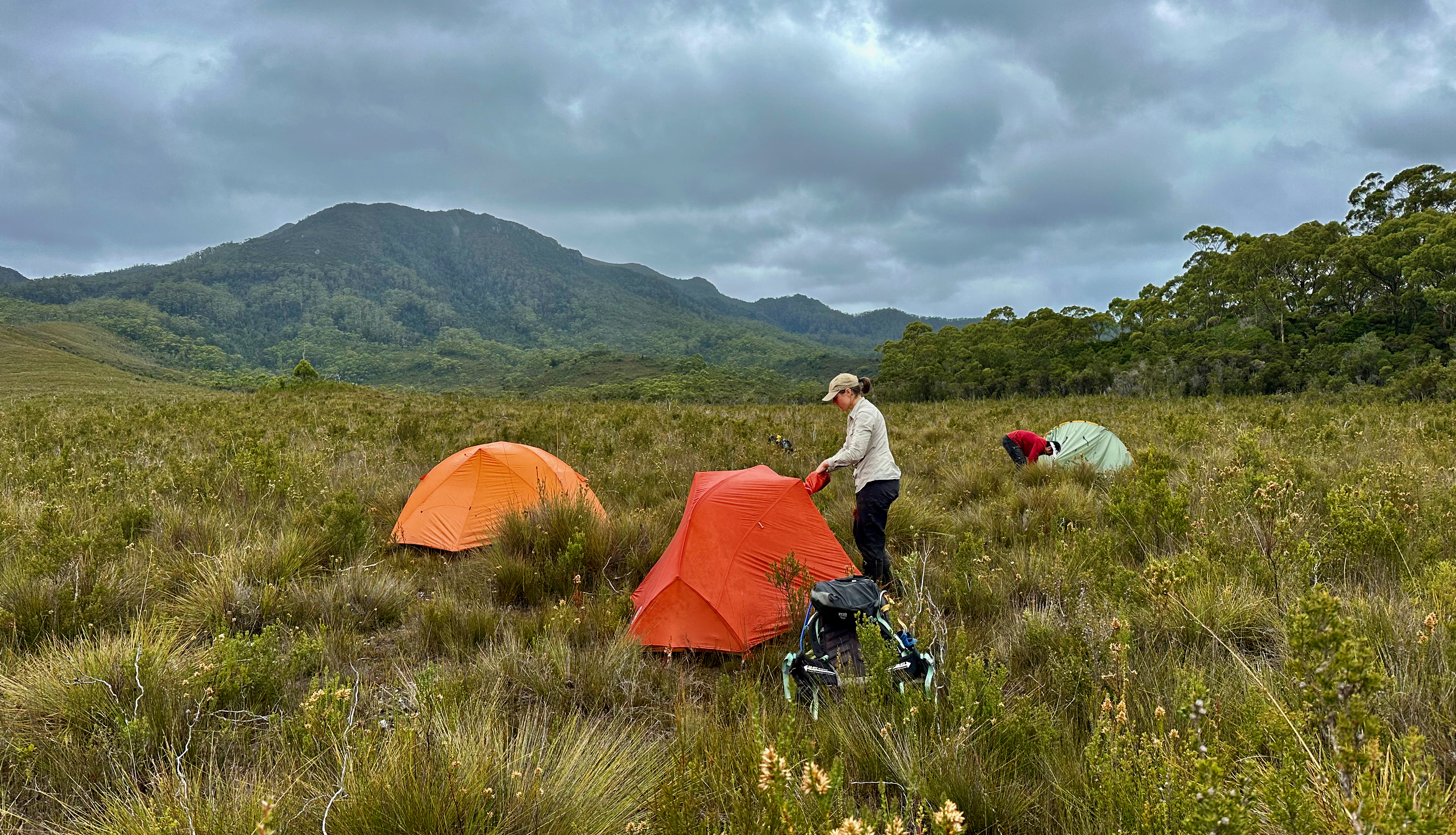
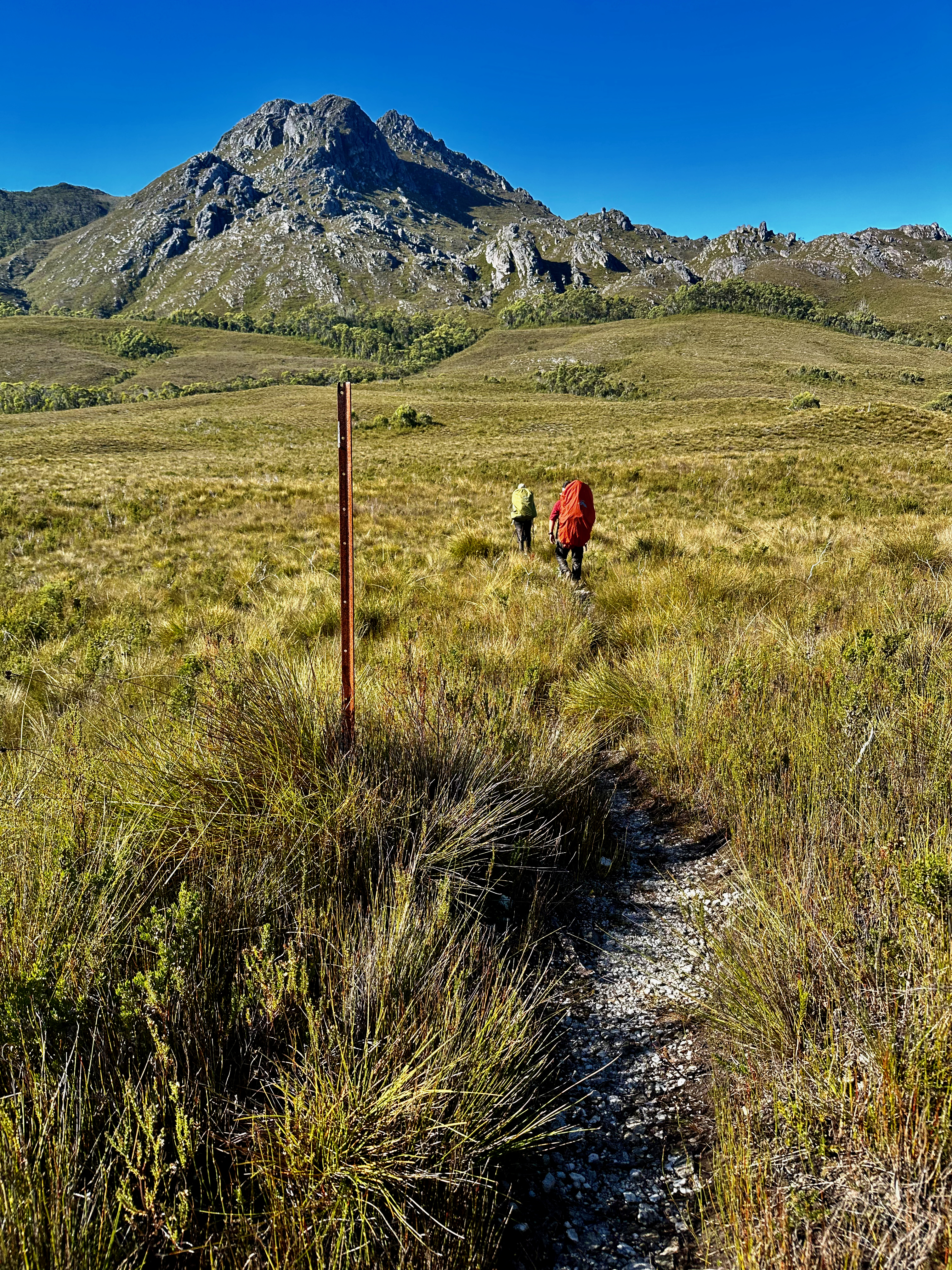
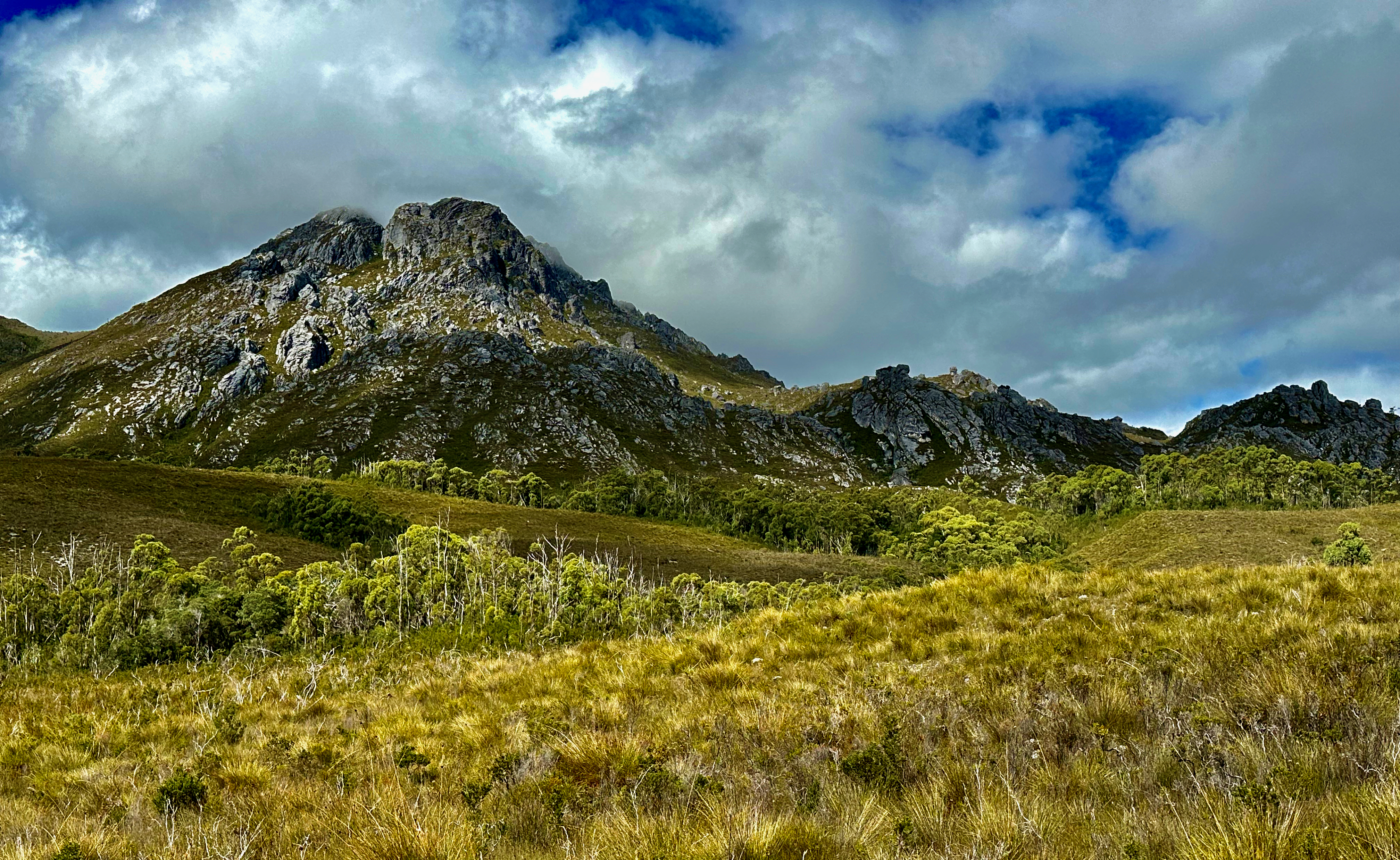
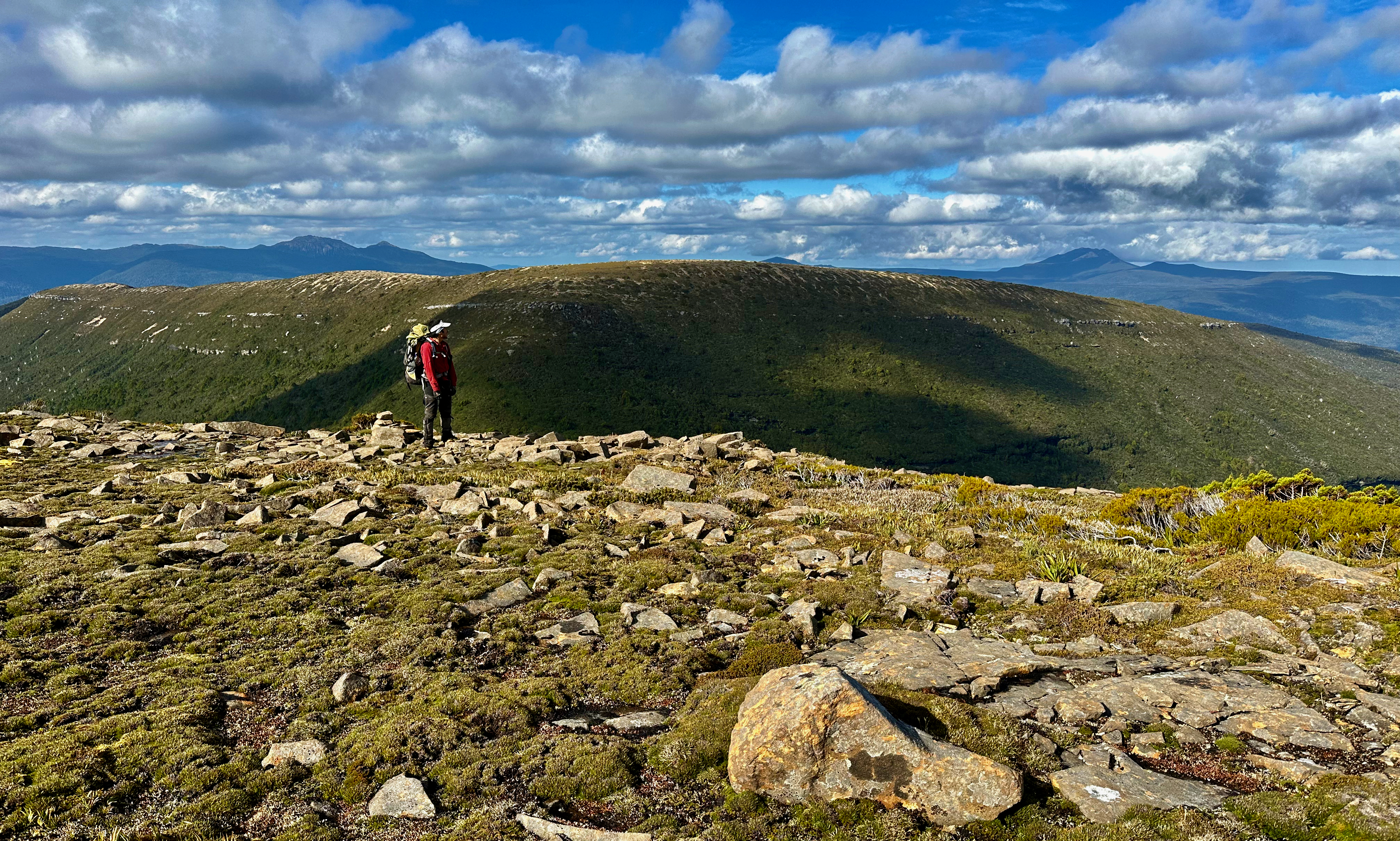
We were excited by our success and popped out onto a lovely flat area to pitch our tents. Even better, the day without rain meant the surface water that had been hanging around two days prior was gone and it wasn’t even too boggy. We had first class views of Mount Braddon, and we ummmmed and ahhhhed over which way we’d go as we prepared for the evening. We’d planned one route, but the other option looked better from below. We settled on it instead. Hopefully, it would be my first peak for the trip! I don’t think anyone else will take as many days to climb Braddon, if we even got there!!
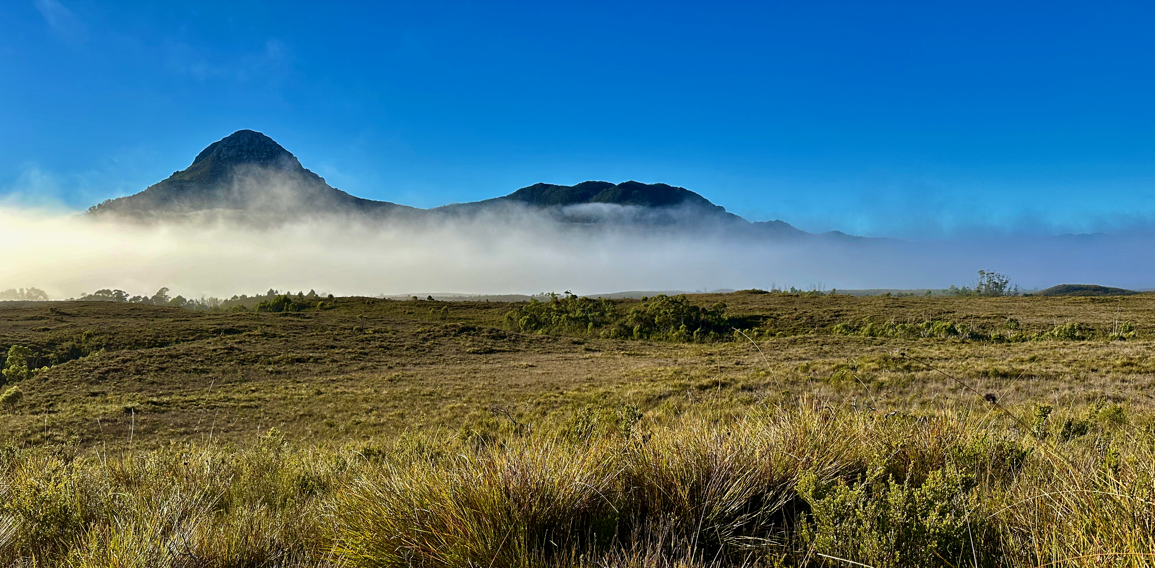
I slept well, waking intermittently to the sound of a boobook owl. Light drizzle greeted us at 6 when our alarms sounded and getting to the loo was an exercise in avoiding too bad a drenching from the water laden scrub. We set out at dawn again and we enjoyed the early morning misty profile of Mount Braddon. It finally felt like we were going to climb a mountain and just maybe we’d get there too.
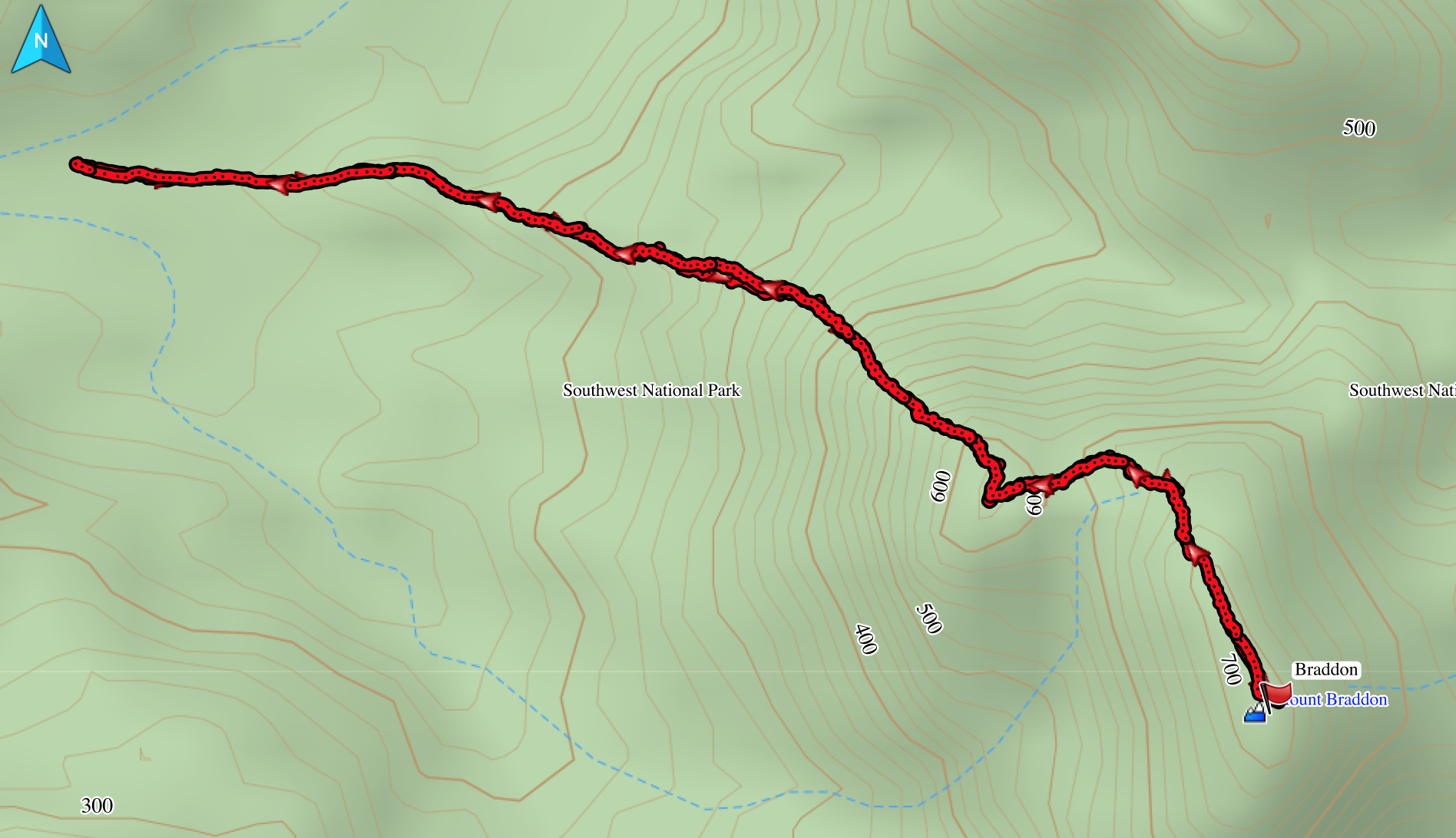
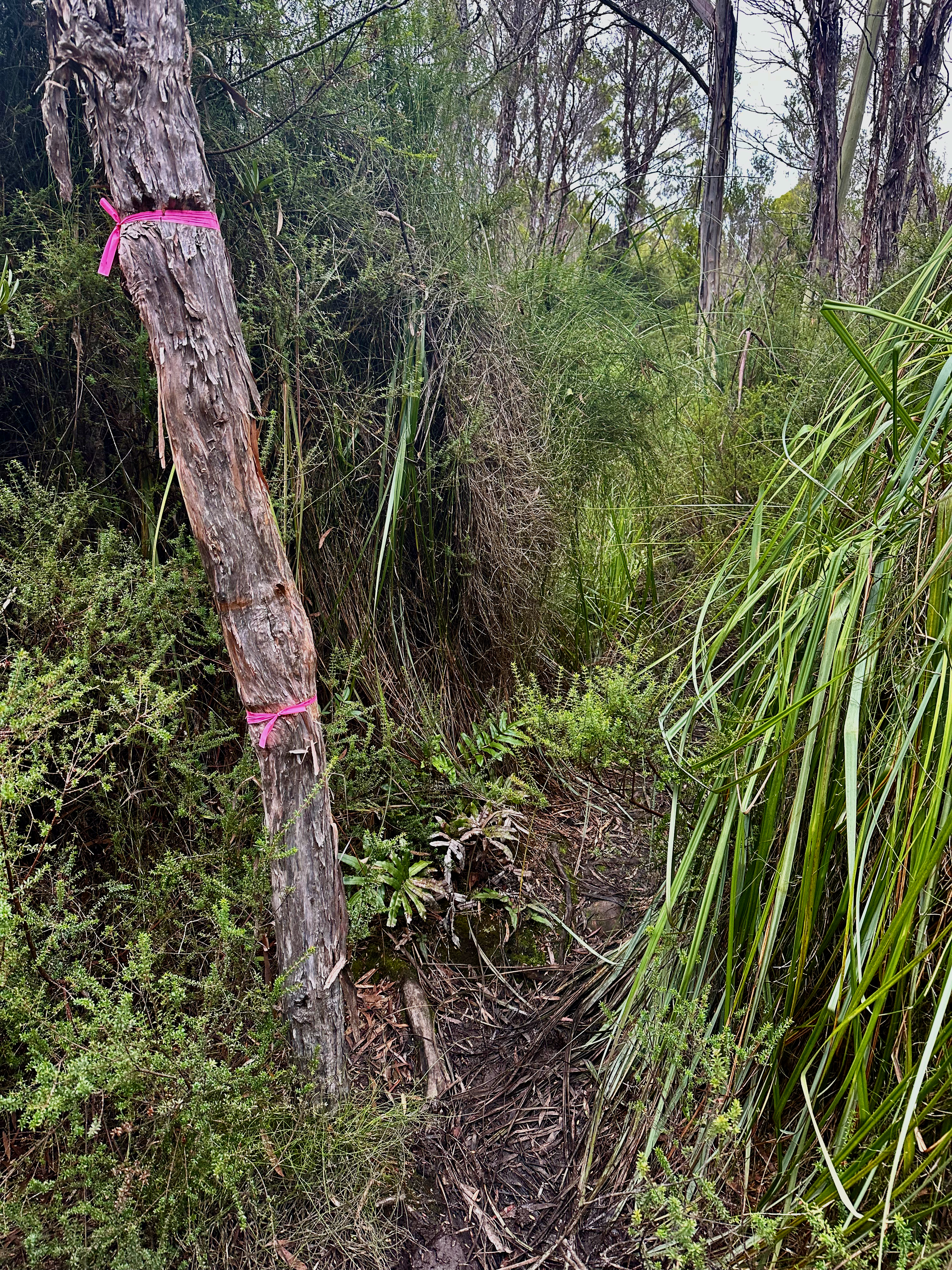
The first kilometre was speedy, over open, but increasingly thicker grassy terrain. This stopped abruptly and transitioned to lovely open forest. We were super happy with our route choice. We quickly happened across pink tape and I suspected I knew who it belonged to. We enjoyed the luxury of walking in someone else’s footsteps for a bit, even if it was the most sensible way to go, tape or not.
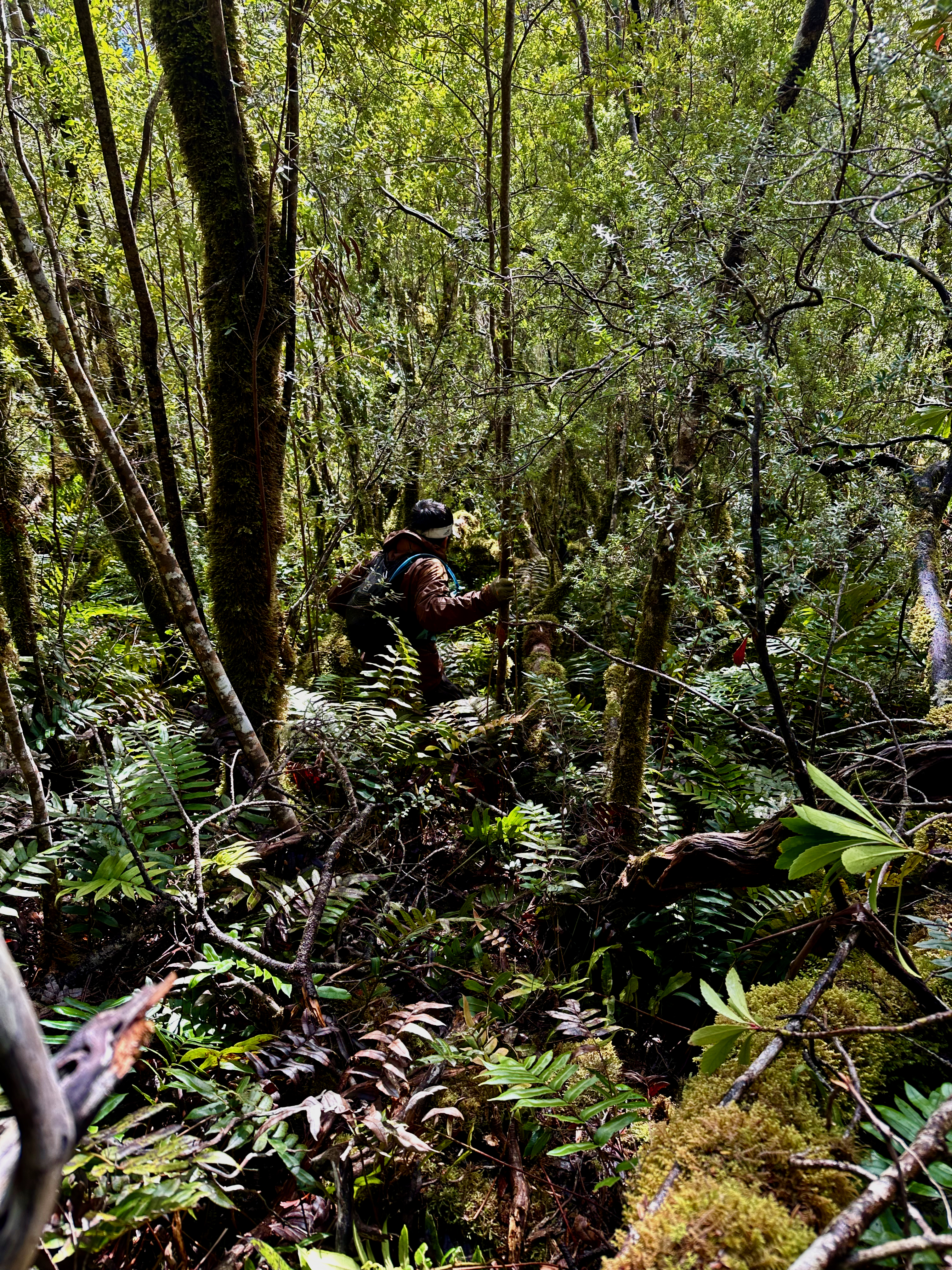
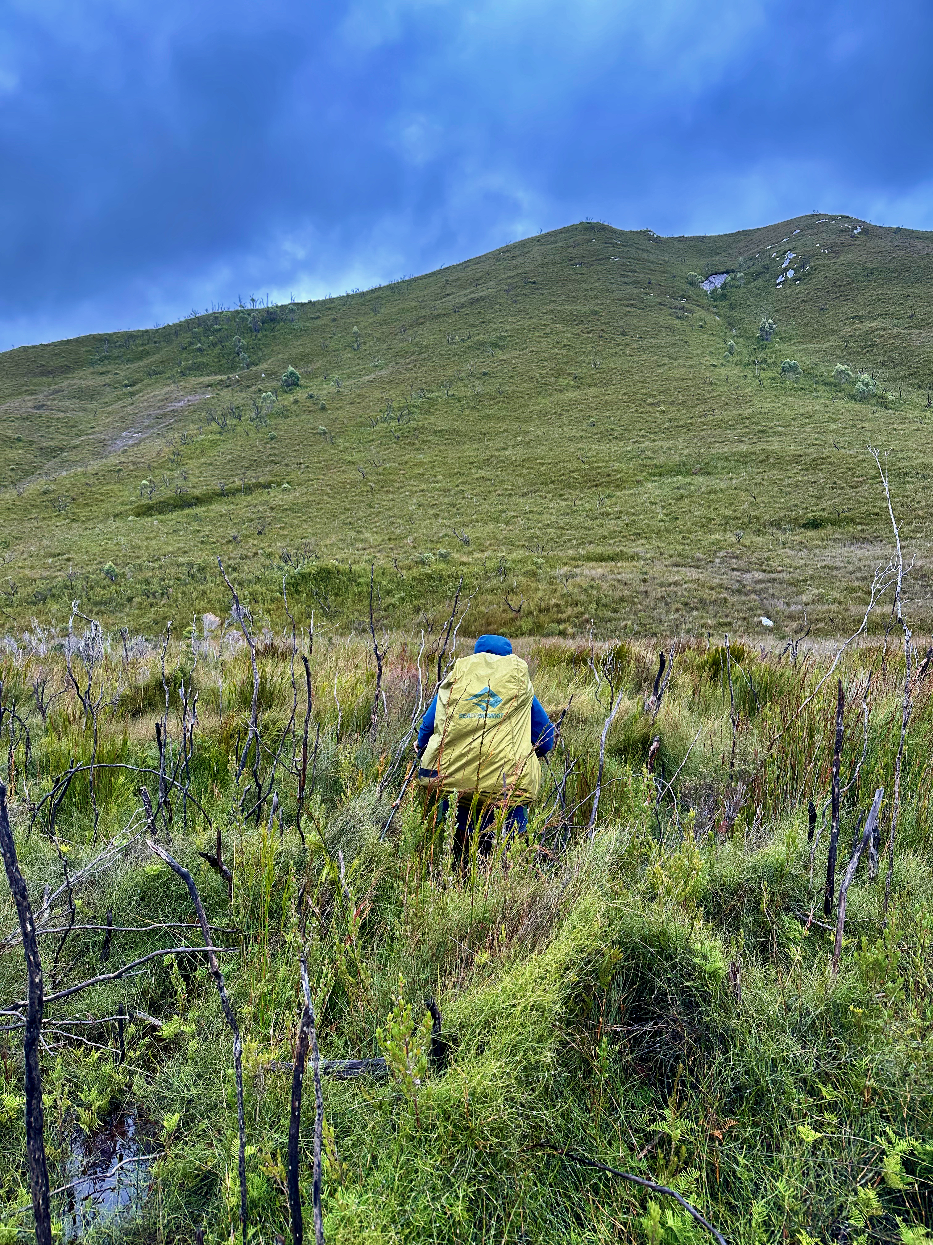
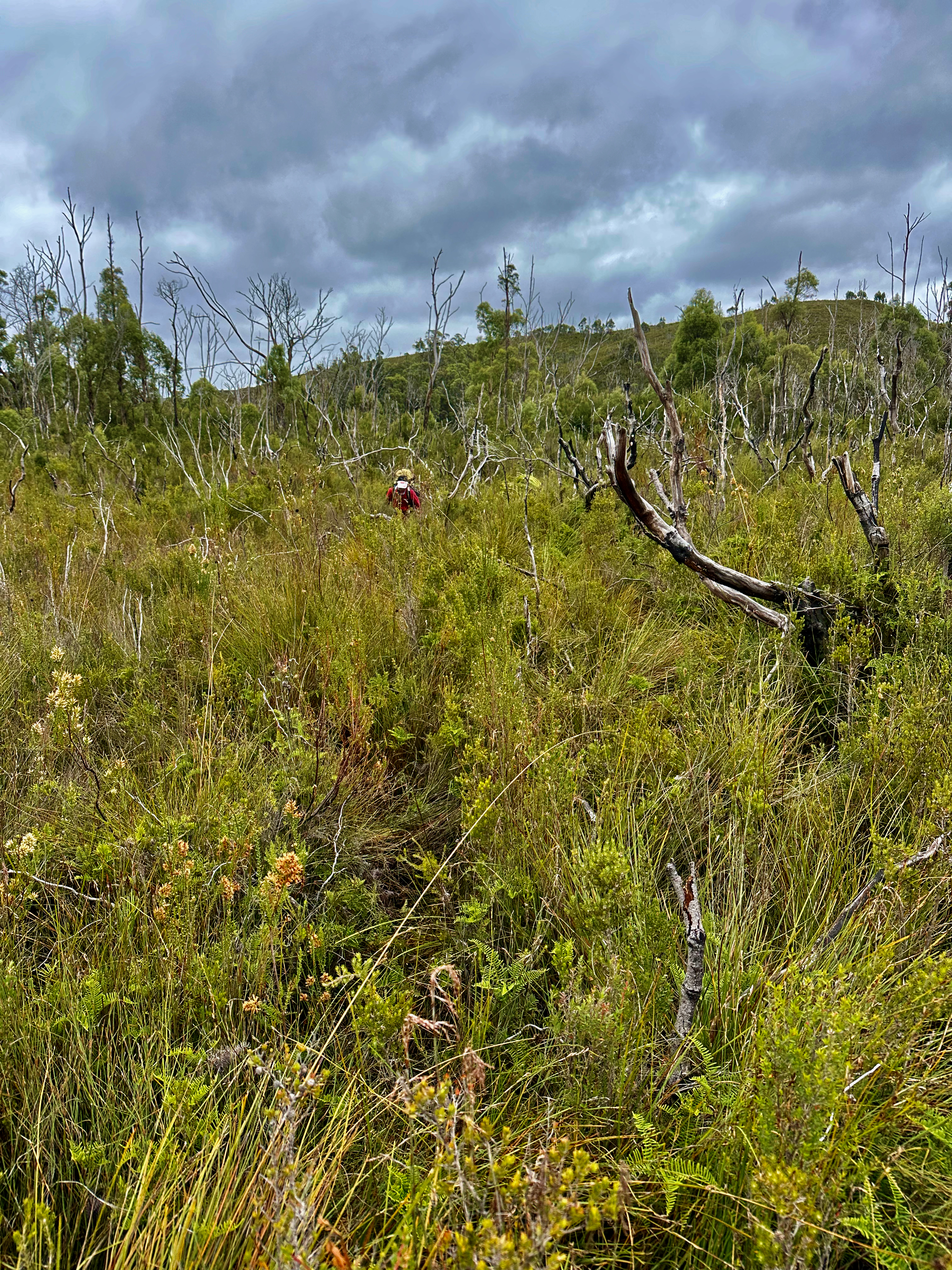
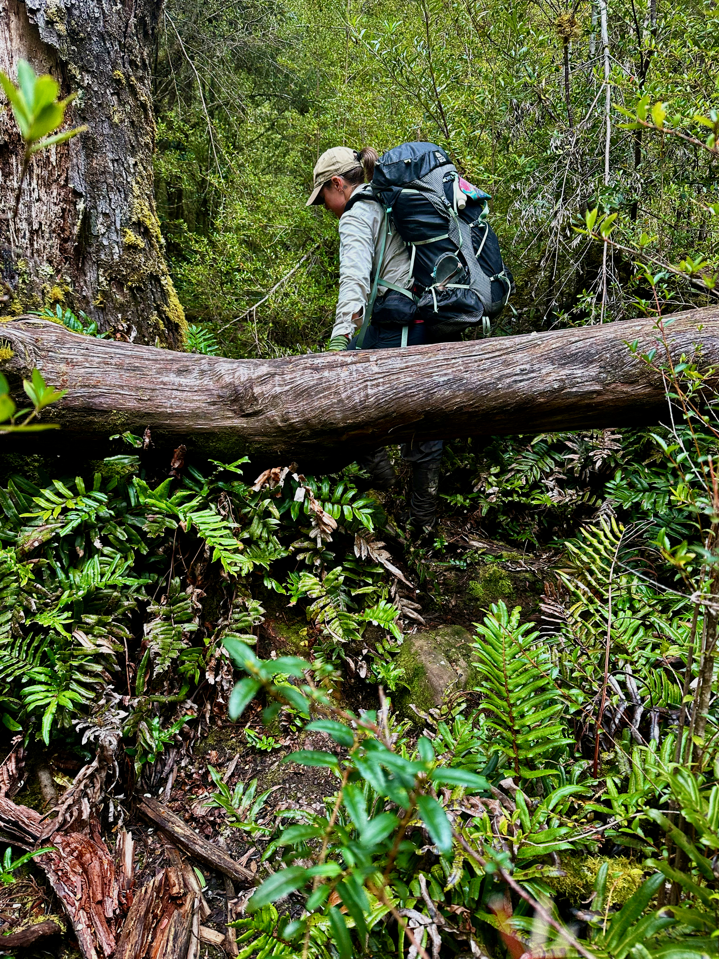
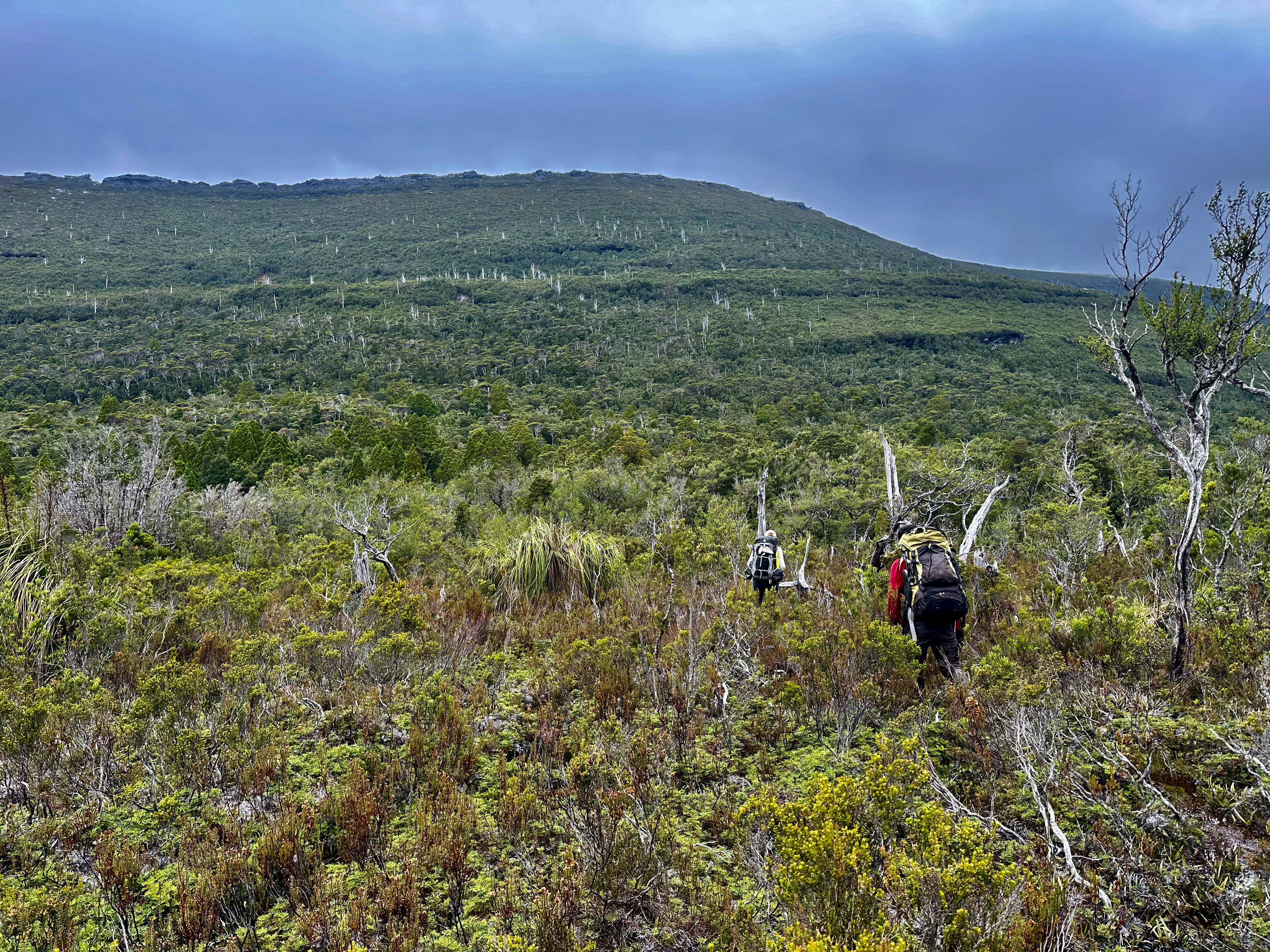
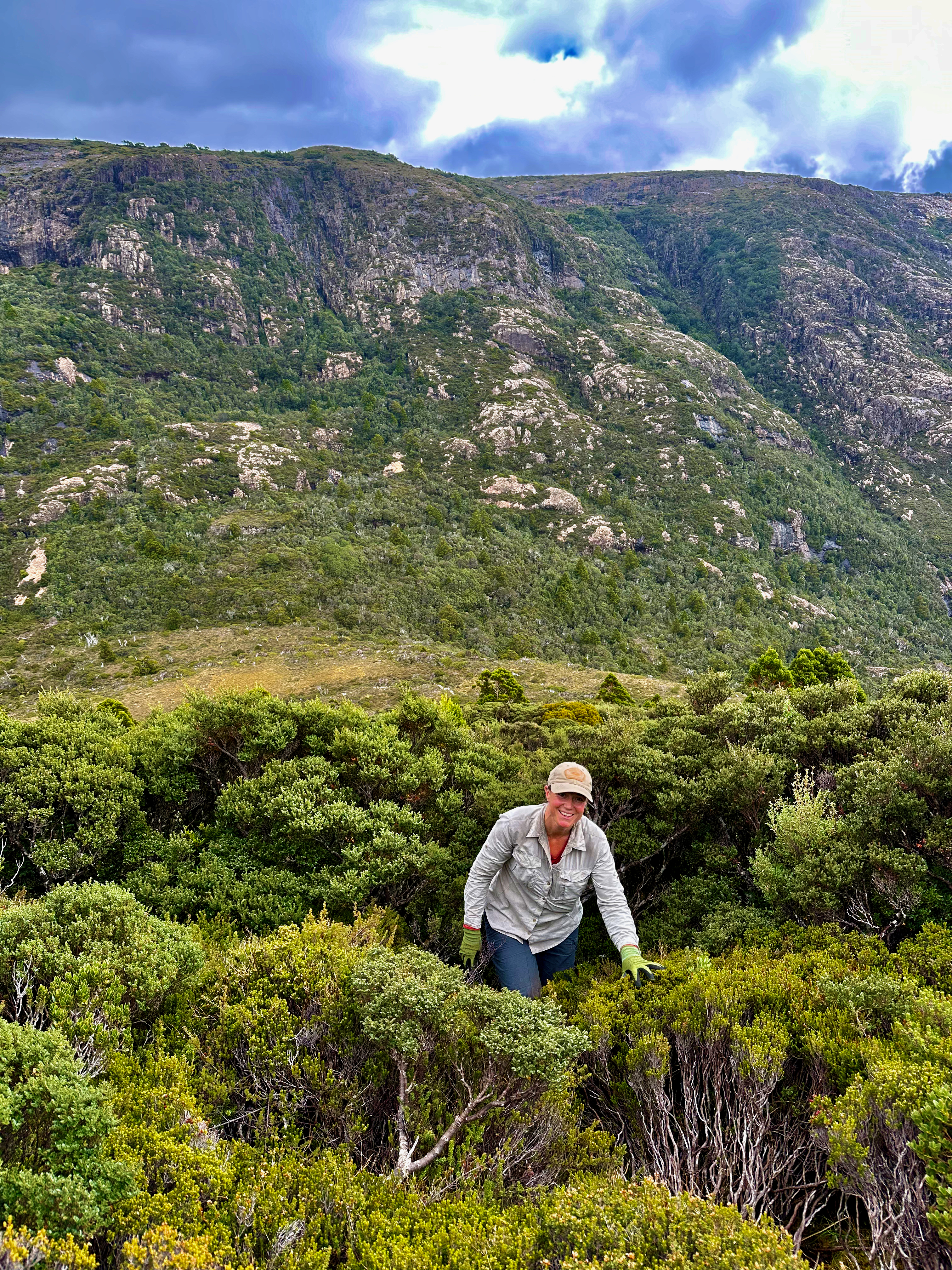
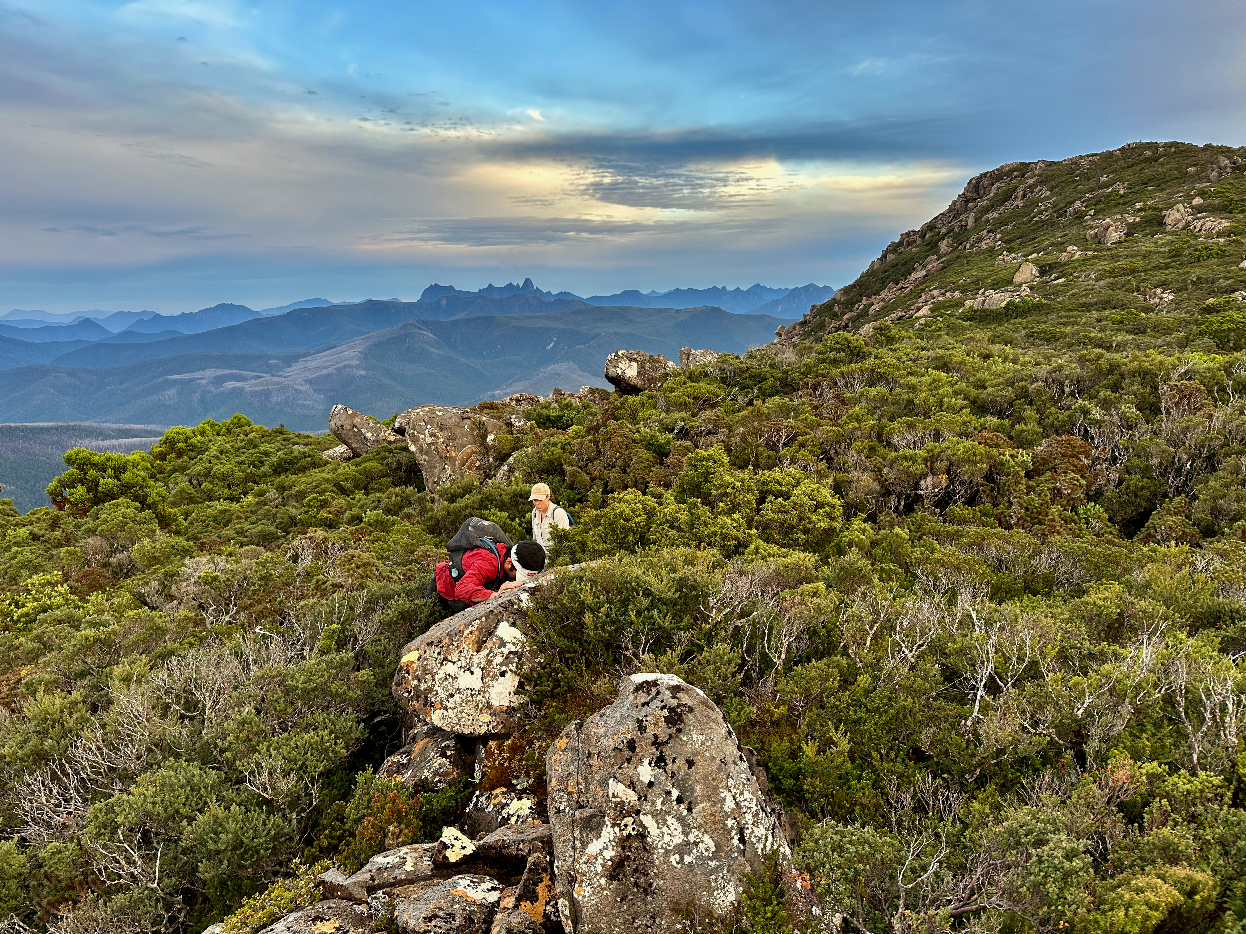
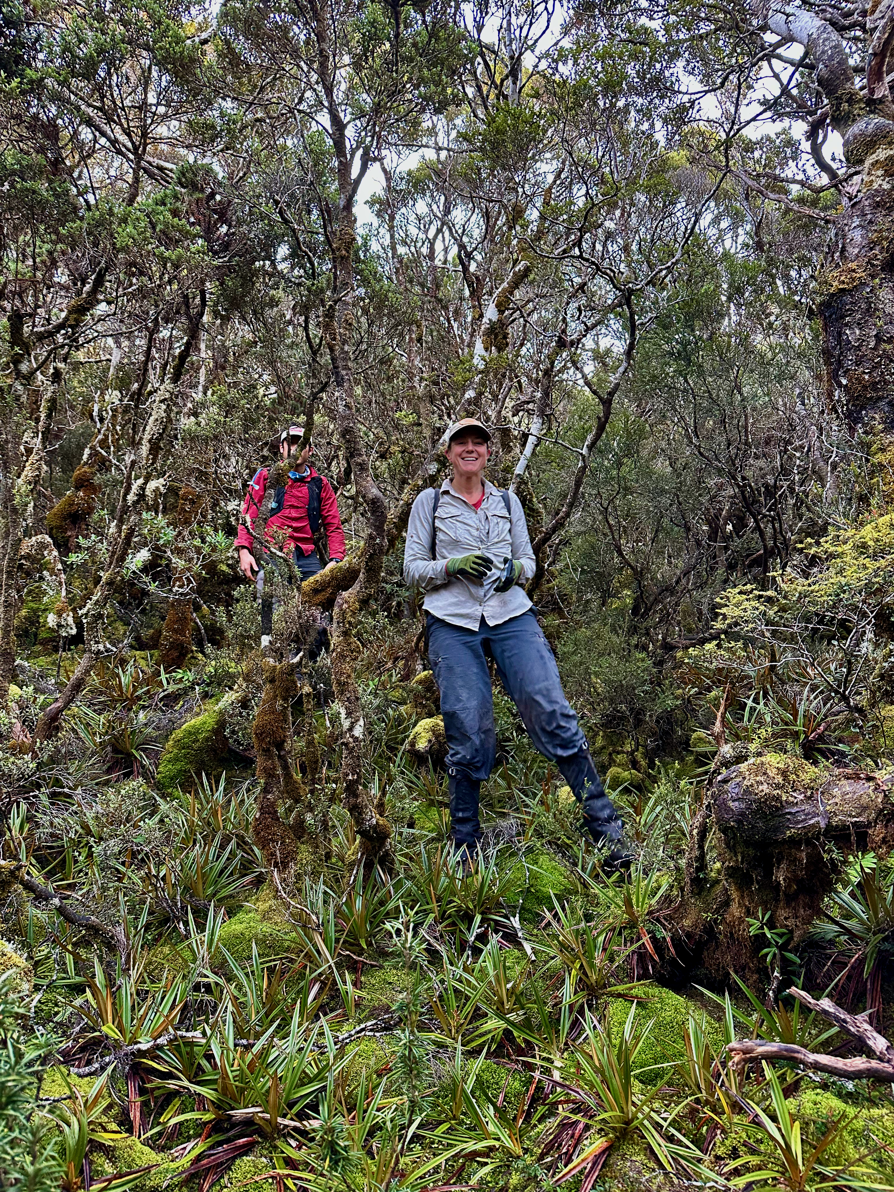
The open forest continued until about the 400m contour line and then the scrub became nasty. A mix of bauera, big button grass and annoying trees. It felt so big I joked that it seemed like we had fallen into Alice in Wonderland and had just shrunk to half our normal size! It wouldn’t be the last time we felt this way. As we made slow twisty progress the scrub became less nasty and easier to move through, and eventually opened up for some views on the top of the first knoll. At one point however, we still managed to walk in a complete circle. Scrub does that to you sometimes!
The scrub in the saddle wasn’t great, but easy enough to push through with force. Think cutting grass, bauera and tightly spaced pandanis. On the way up the other side we actually opted to stay in the relatively open forest instead of popping out onto the flat ridge, which was awfully wadey. In this fashion we made good progress towards the summit, and popped out onto the lower grassy wadey stuff when we felt appropriate. It was a good call.
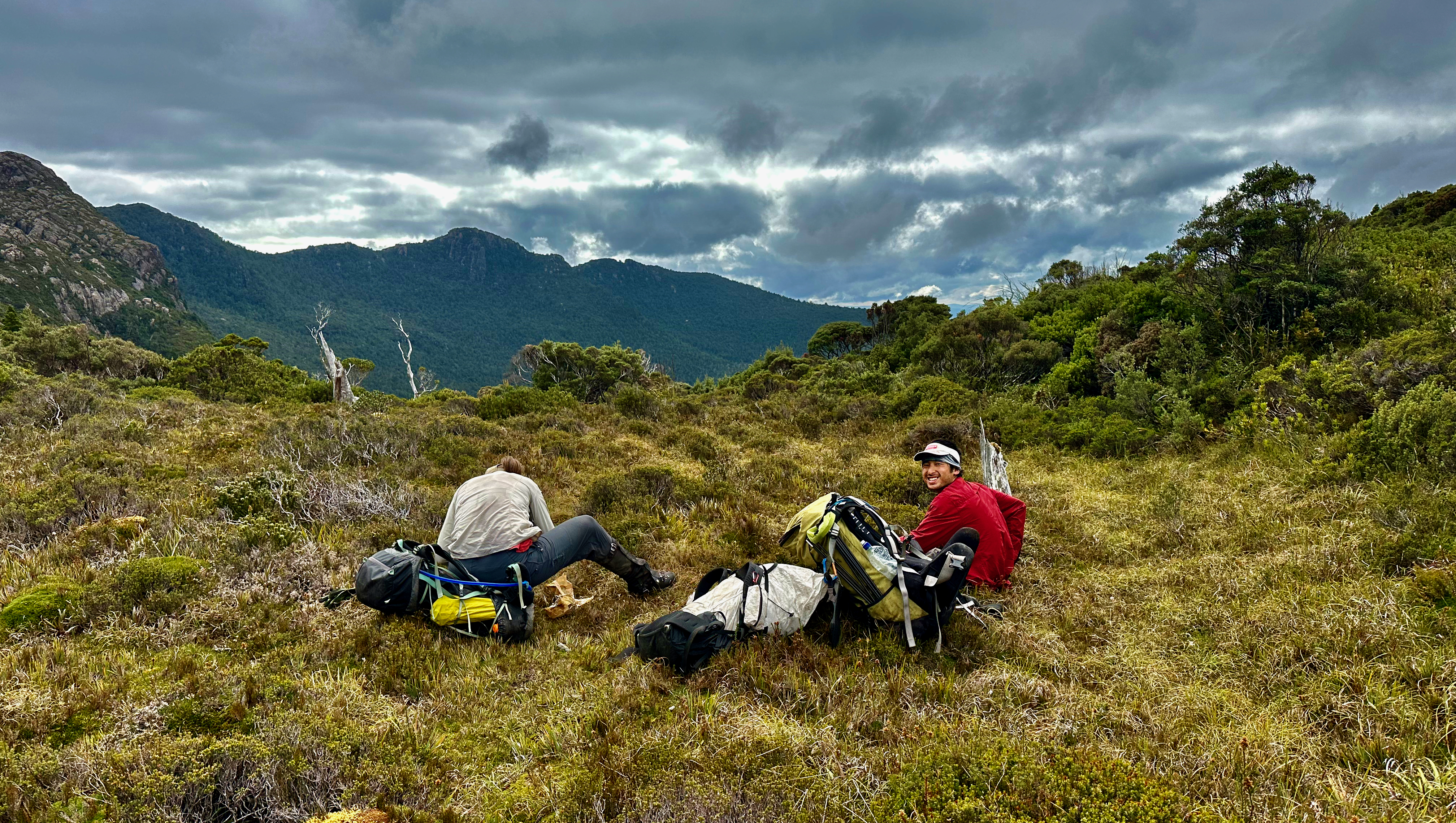
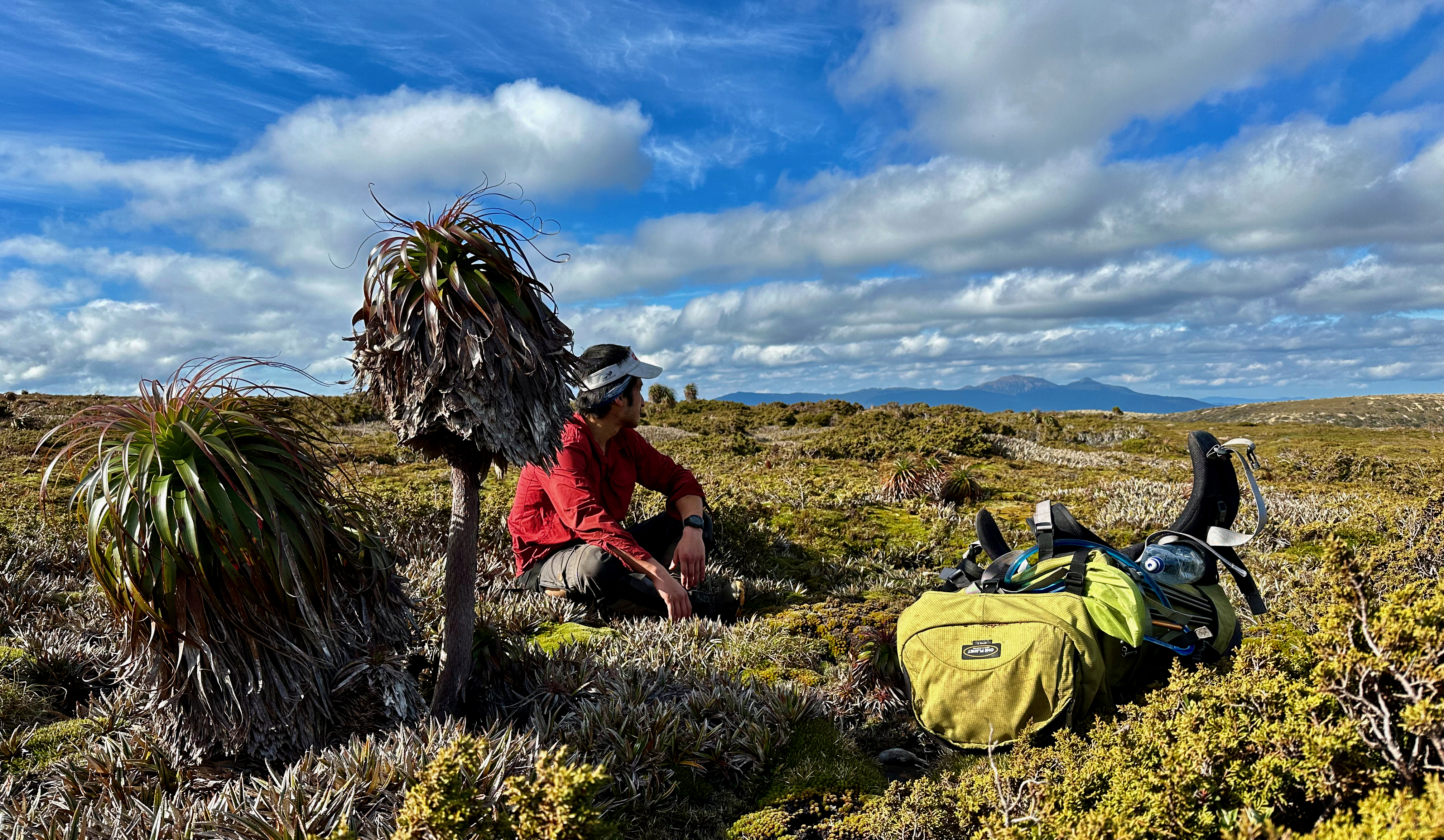
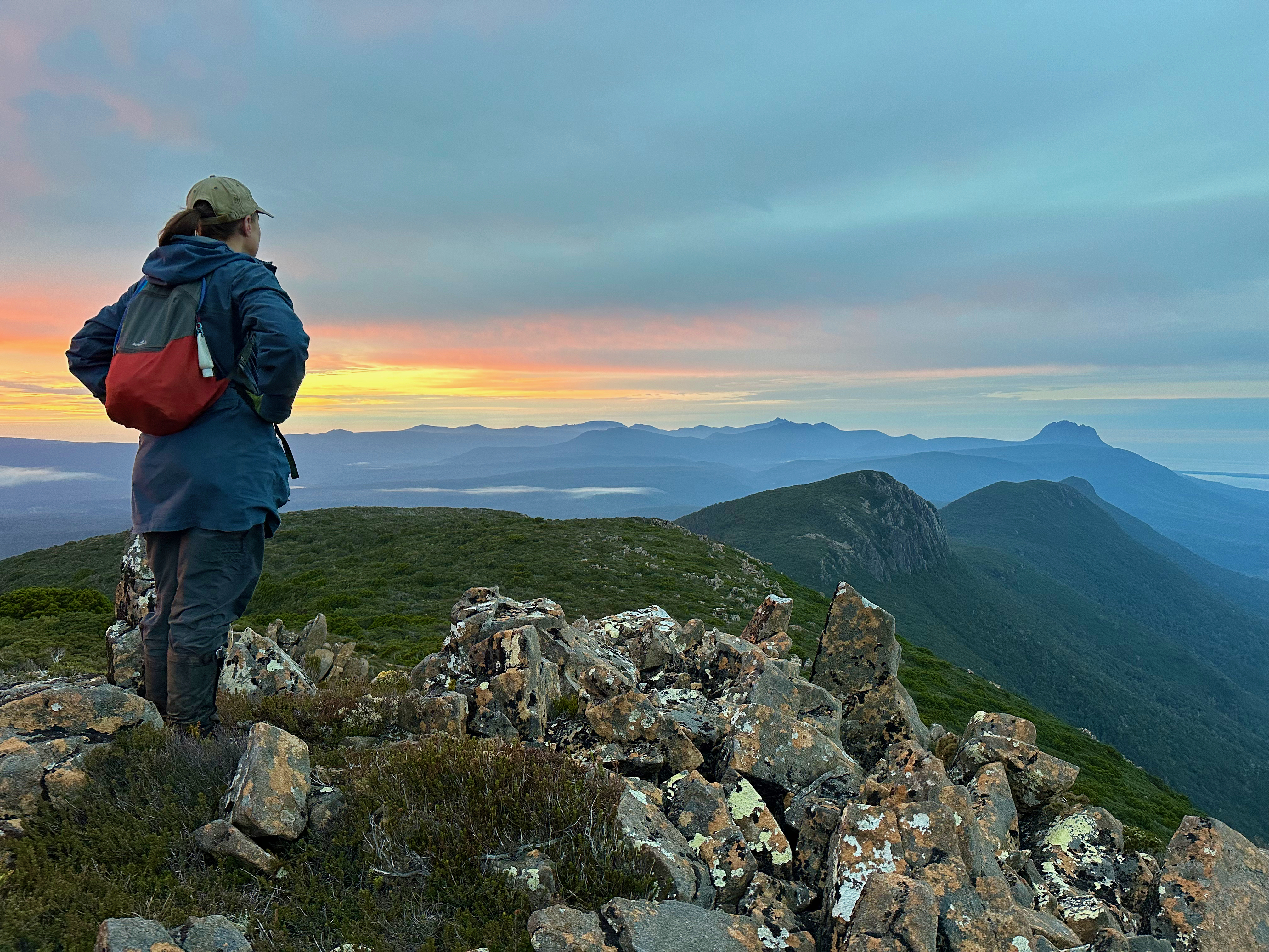
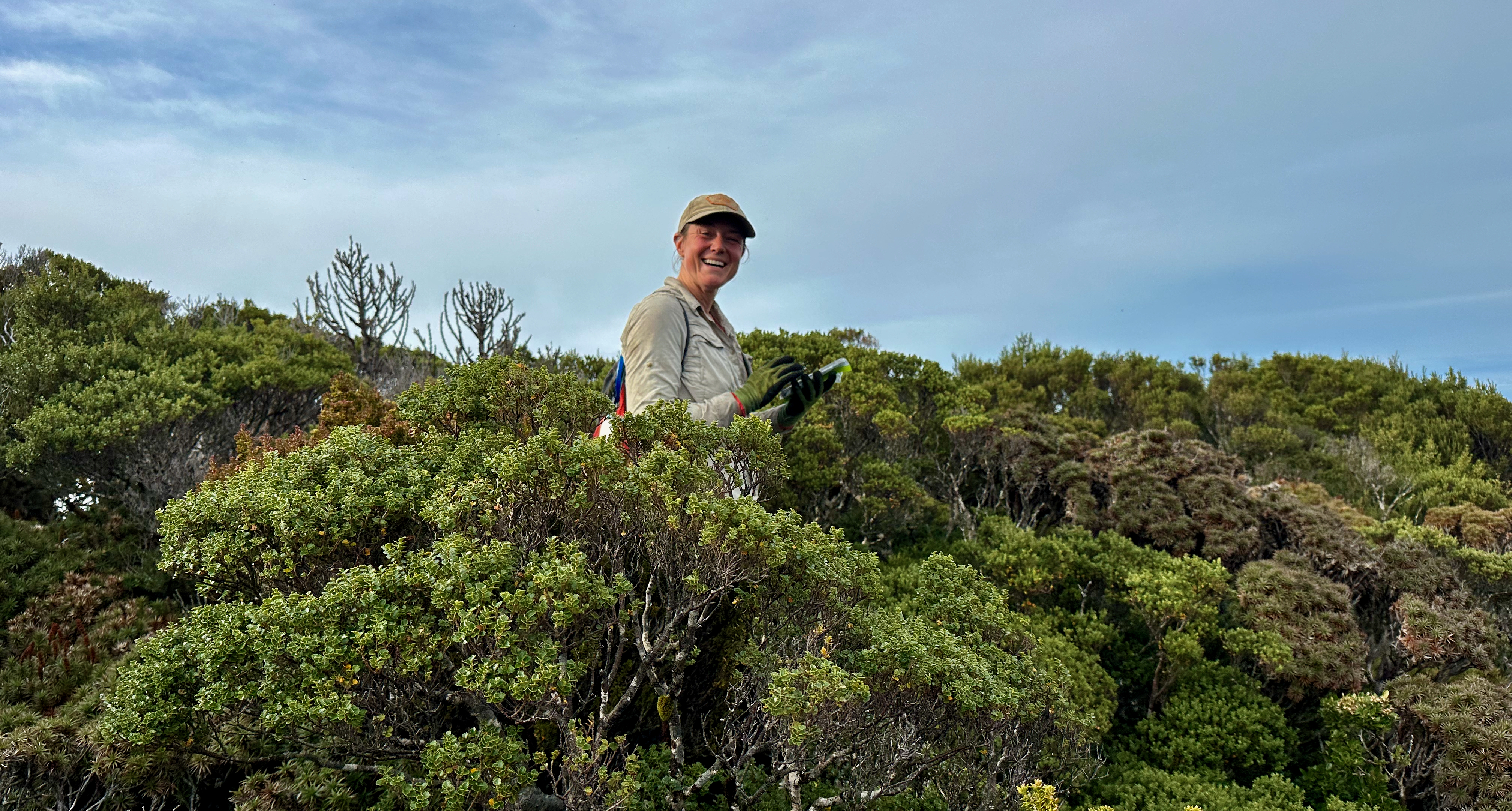
We had been walking in misty, drizzly cloud all morning and finally we got a welcome glimpse of sun, which turned everything instantly a degree or two warmer and raised our spirits enormously. It didn’t last, but we felt it would come back. The final stretch across the rather flat summit looked easier than it was. Some sections were ankle high, but they quickly turned into head high without much warning. We visited a few high points, eventually settling on one for lunch. Shelly shared her delicious treat of caramel popcorn, which was simply perfect for the occasion. We didn’t stay long, it was cold being soaked through and in the cloud.
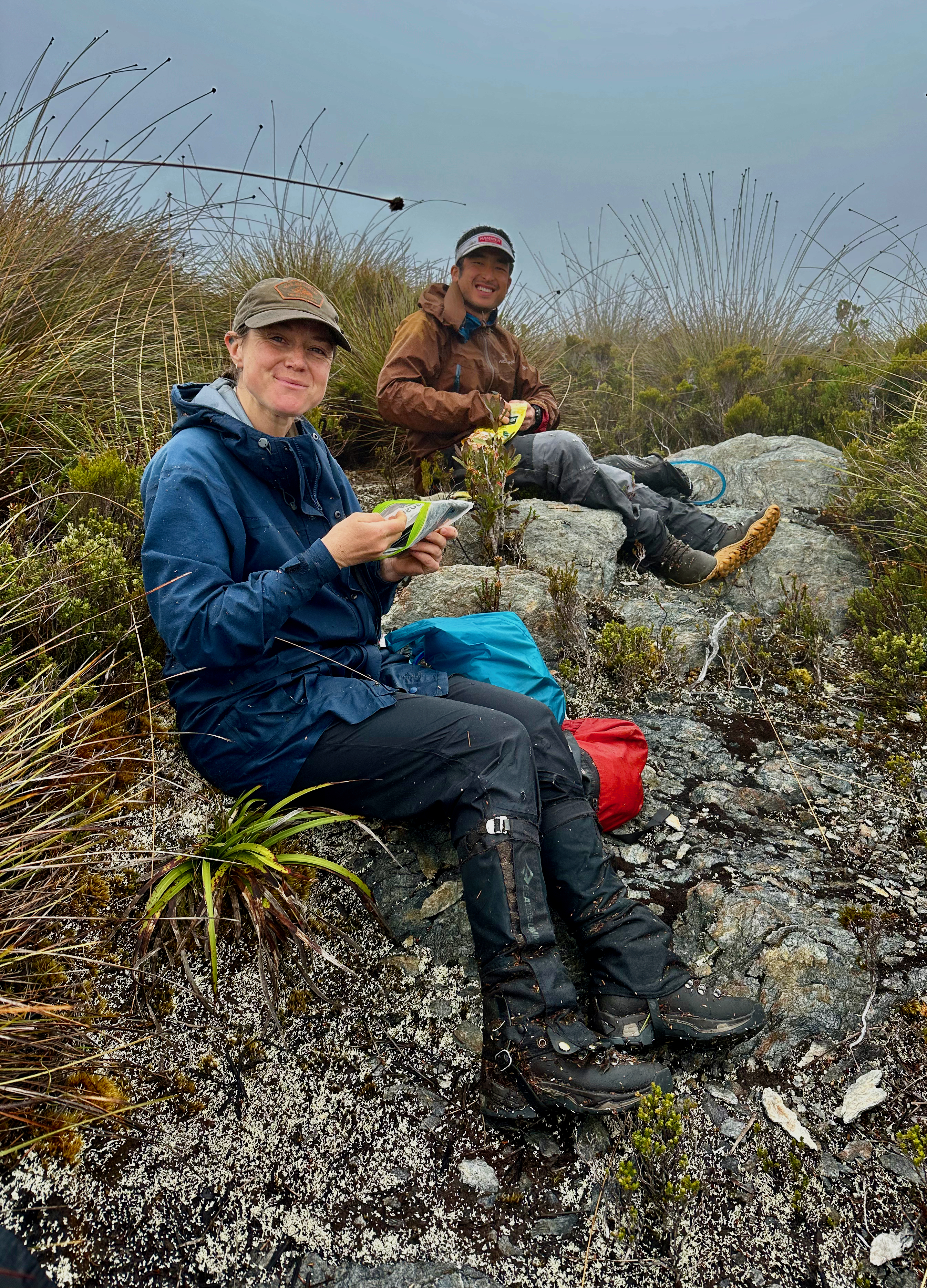
The sun came out on our return to warm things up and we made speedy progress retracing our bash. Funnily enough, the bit that took longest was the open forest section, because it took the same amount of time to clamber through bits of horizontal or up and over and around and under fallen trees. We were still happy to be back in good time to have a few hours of day light left to dry our clothes a bit and enjoy dinner at a leisurely pace. And to celebrate climbing a mountain than none of us really wanted to do alone. It is always much more fun being stuck in scrub with a group of people. Thanks Shelly and Kevin for this one!!


Clearly I wasn’t quite recovered from the cold and I struggled to sleep. At least the boobook owl was vocal again and I enjoyed listening to the noises he or she made, some quite different to the standard call. When dawn eventually broke we were in low misty stillness and despite the forecast being encouraging we were clearly still in for a wet start. We donned our wet weather gear, almost out of habit now, packed tents and set off into the mist, retracing our steps towards the head of the Spring River.
The level had dropped significantly, the trees we’d walked across on under the water were now well out of it and we could see the bottom of the river on either side, though the middle still ran deep and dark. After a bit of an annoying bash out the far side that took more energy than expected and we were climbing up onto open plains, heading north to intersect the Port Davey Track again.

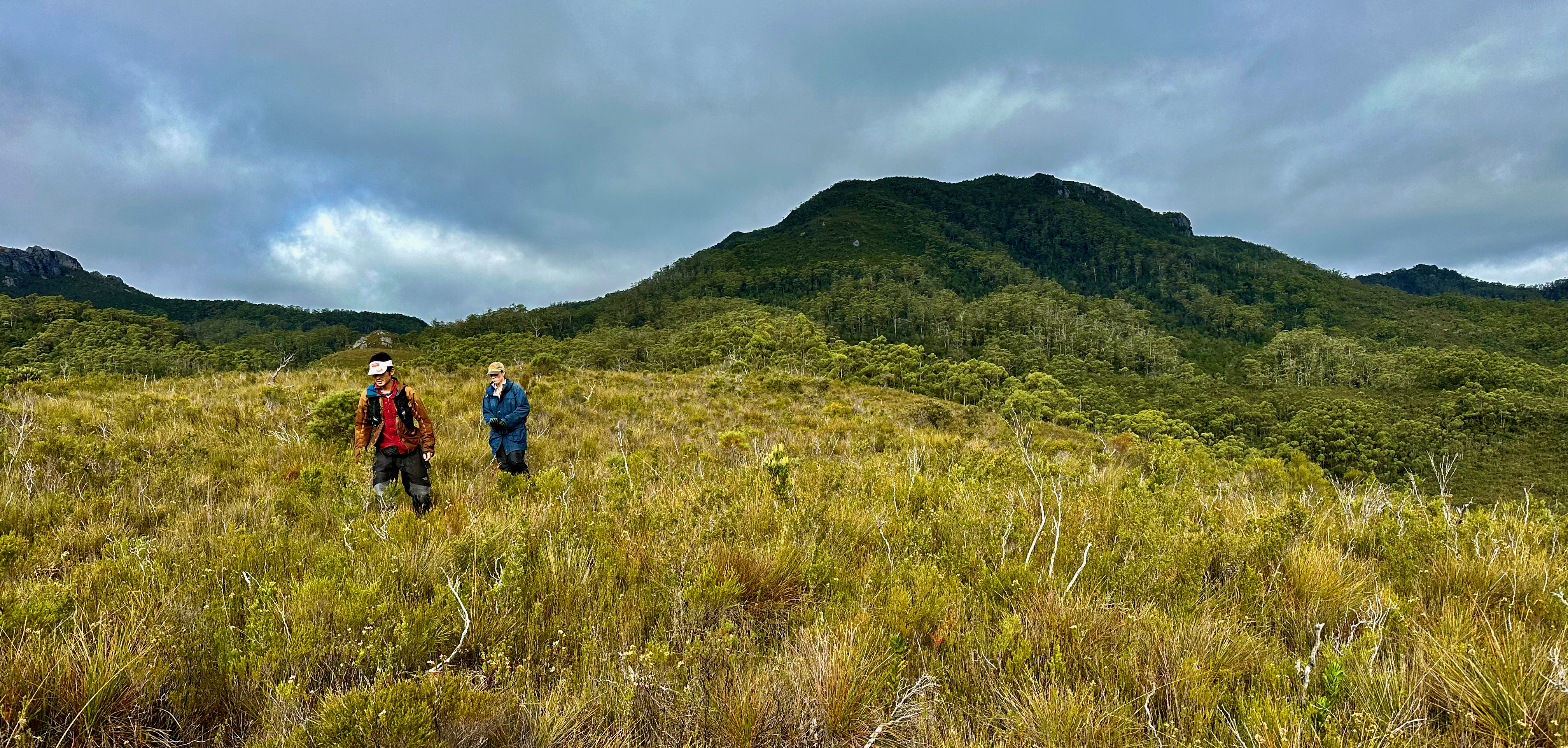
The track was probably harder to walk on than the plains, courtesy of the low sun, trench-like nature of the track and the frequent boggy sections. It made for slow going and it took till about 11:30 to arrive at the point, a few kilometres from the Crossing River, where Shelly and Kevin would climb Mount Robinson. I was half tempted to, but given the lack of sleep and the fact we had new plans for our extra few days I decided to be sensible. Instead, I sat on the side of the track trying to dry shoes and socks while waiting for them to return. Tassie wilderness isn’t a hard place to while the time away and it passed remarkably quickly.
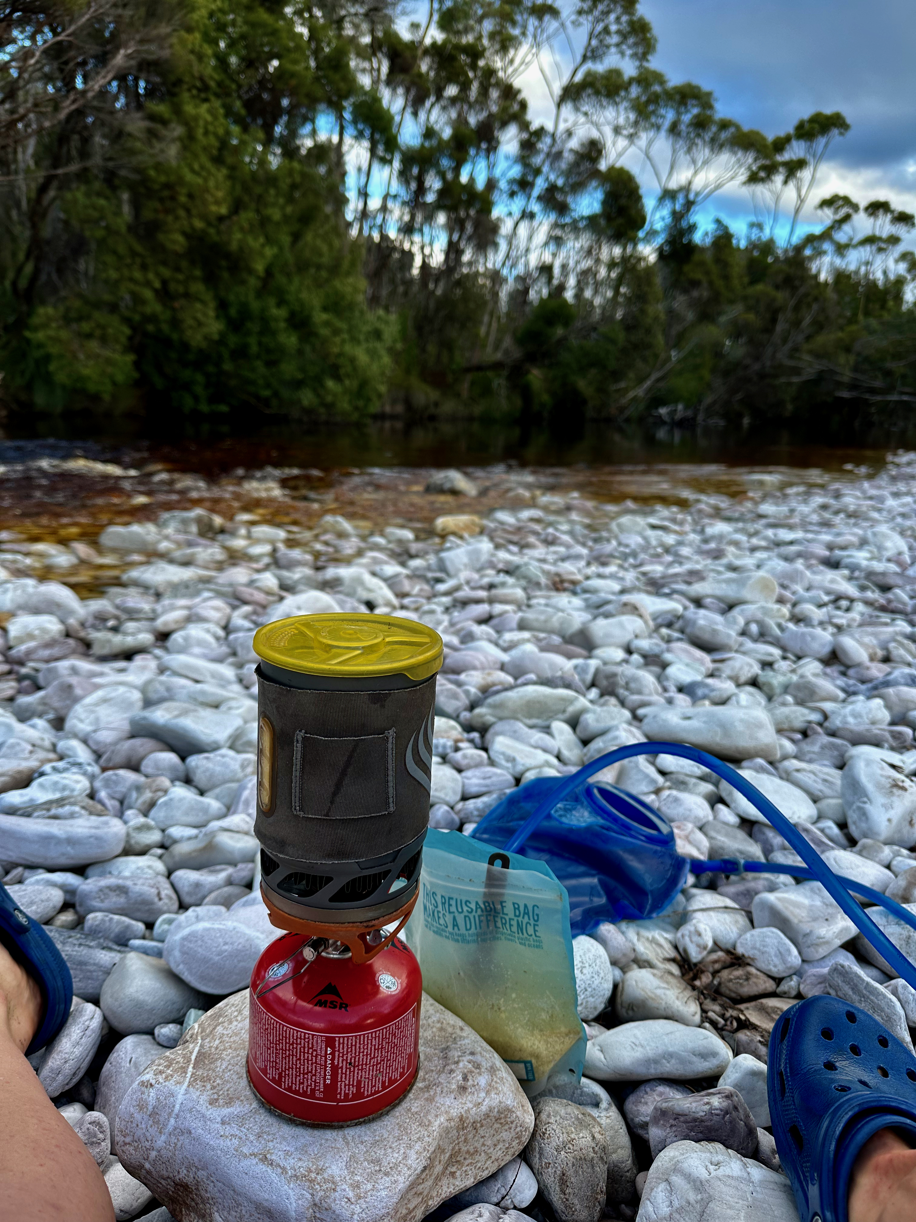
The two returned around 4pm and it didn’t take us long to buzz along the track to the Crossing River. We pitched tents, washed clothes and set about dinner when another walker turned up. He was a young, pleasant apprentice chef who chatted to us while he made some dinner. It was the first evening we’d actually been able to sit around out of our tents and enjoy a collective meal. The white pebbly beach of the Crossing River seemed the perfect place for it.
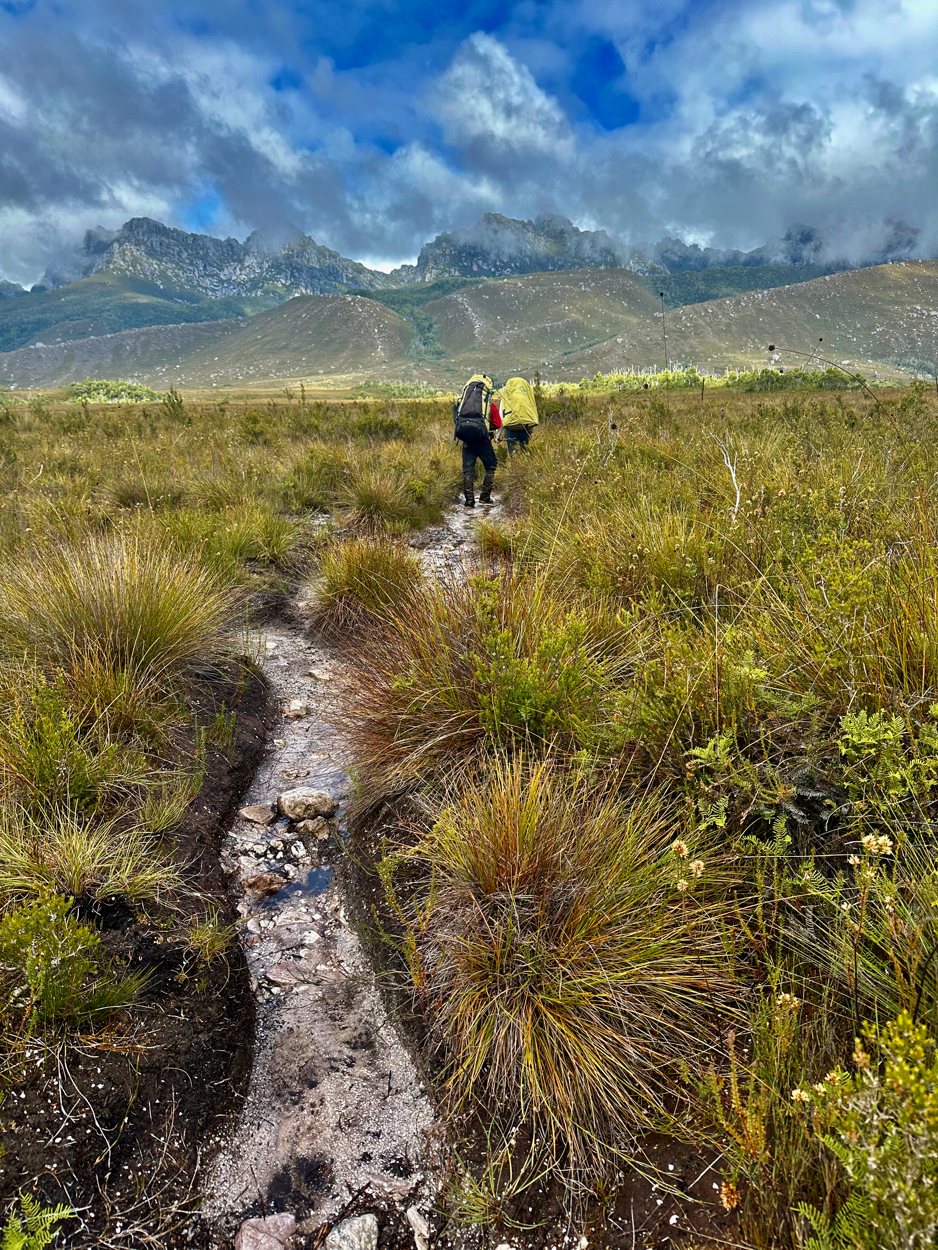
We woke again at our standard time of 6 to have us ready to walk by 7. It proved a muggy overcast morning, but we weren’t complaining. We didn’t really want hot sun for the 20km traipse back to the car. When we approached the Western Arthurs we started seeing a fair few people. We chatted to some and simply said hello to others.
The true mud slog began after Junction Creek. I’m sure there’s an art to picking which boggy looking puddles are safe to stride on through and which will end up with you wallowing in waist deep mud. Poles definitely help the unskilled practitioner. It was with great relief that we finally hit the gravel and boardwalk bit of track a few kilometres from the end and knew the hard work was over. Kevin had a boot that had grown a mouth, and Shelly and I both had one or two aches that could do with some resting.
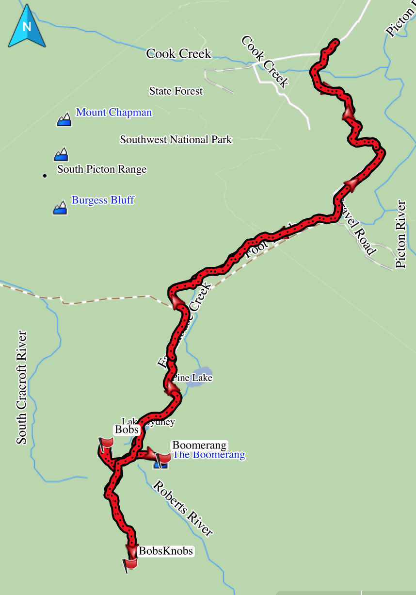
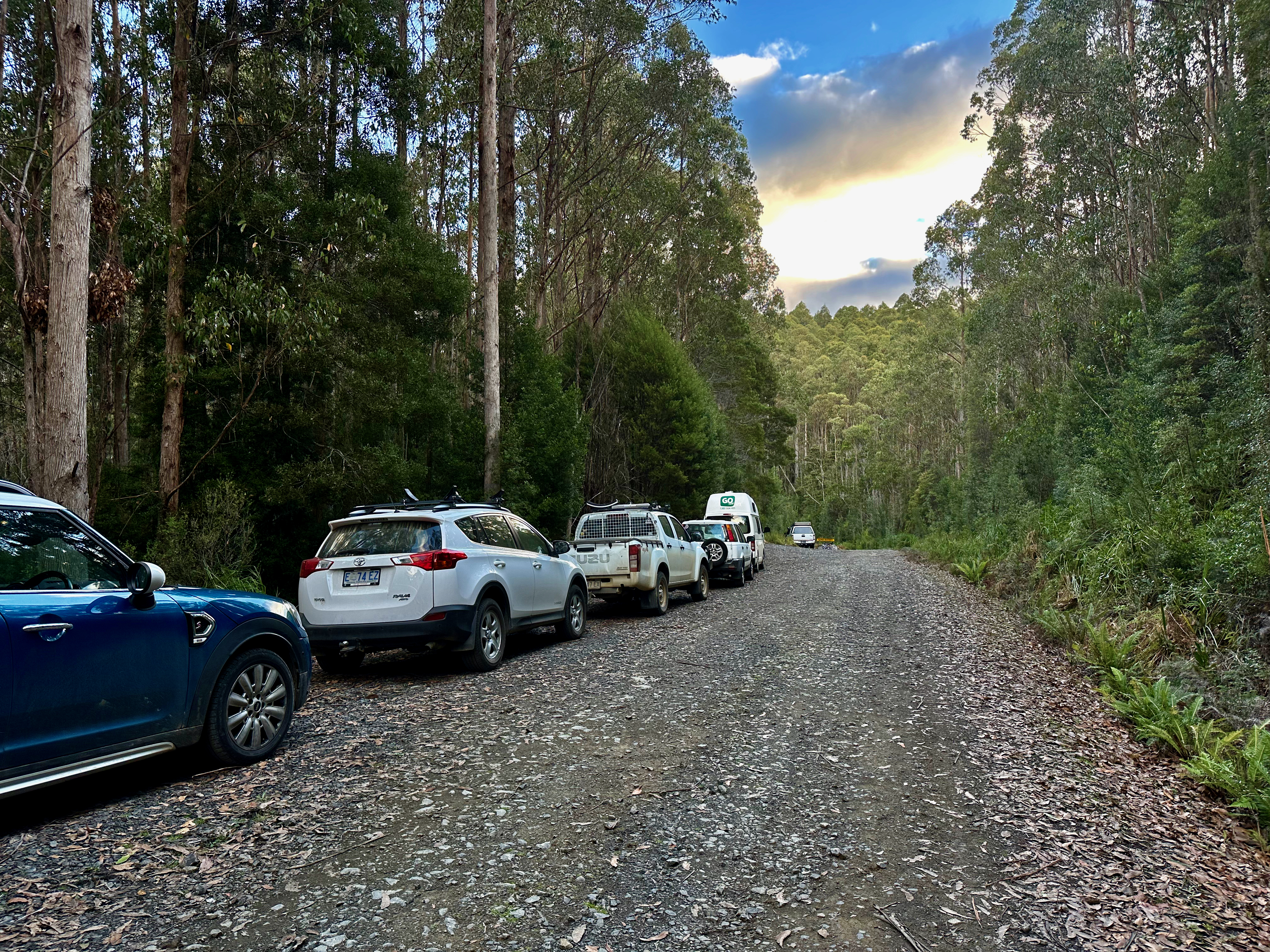
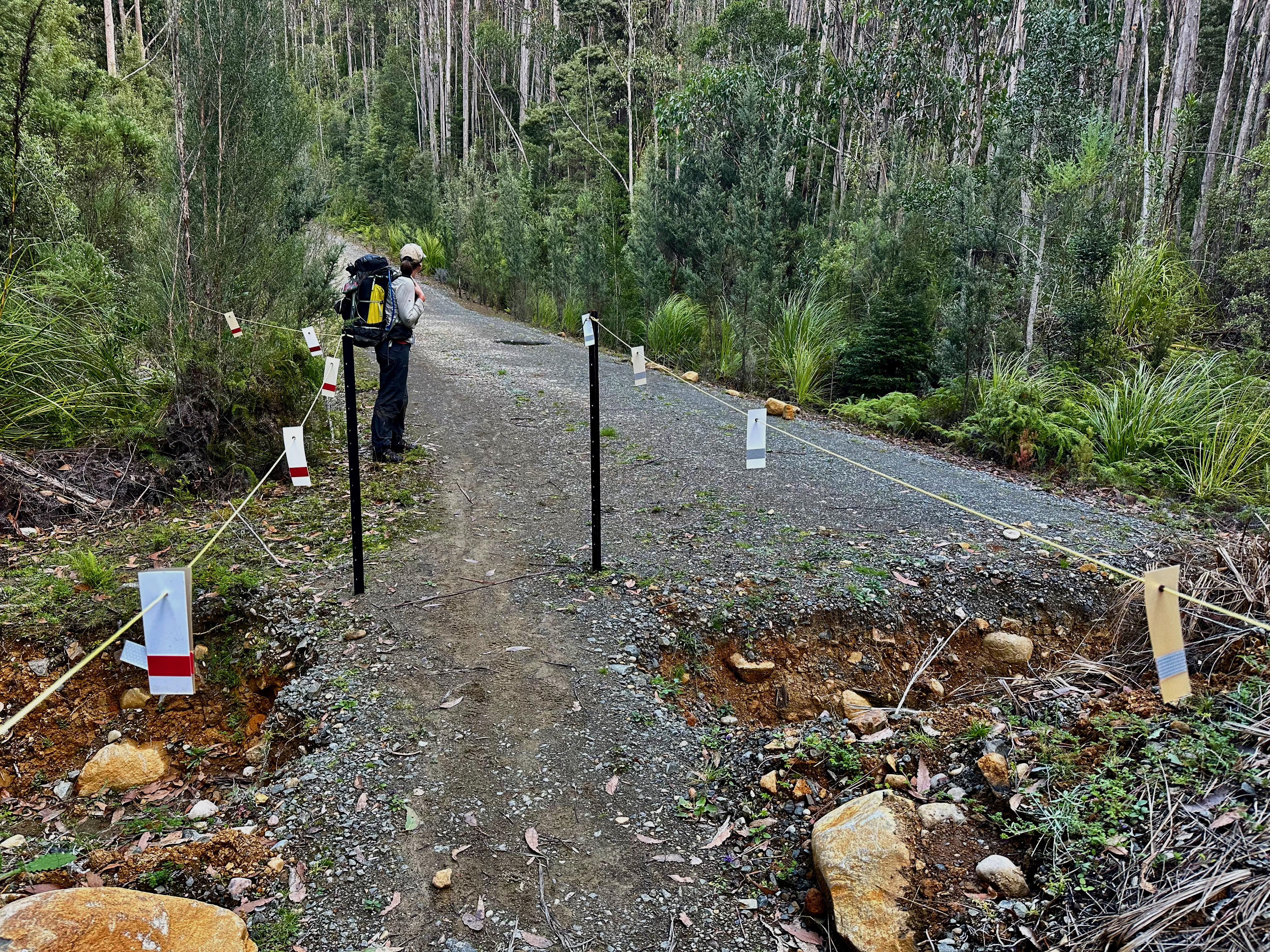
The apple and chips I had stashed in the car went down remarkably well, with plenty of room left for a souvlaki at New Norfolk. A few messages later and we buzzed across the state to the start of the Farmhouse Creek track. It was already late evening and we weren’t going to get very far, but we figured if we could just get the 8km road walk done it would make the walk up to the Bobs plateau a bit easier.
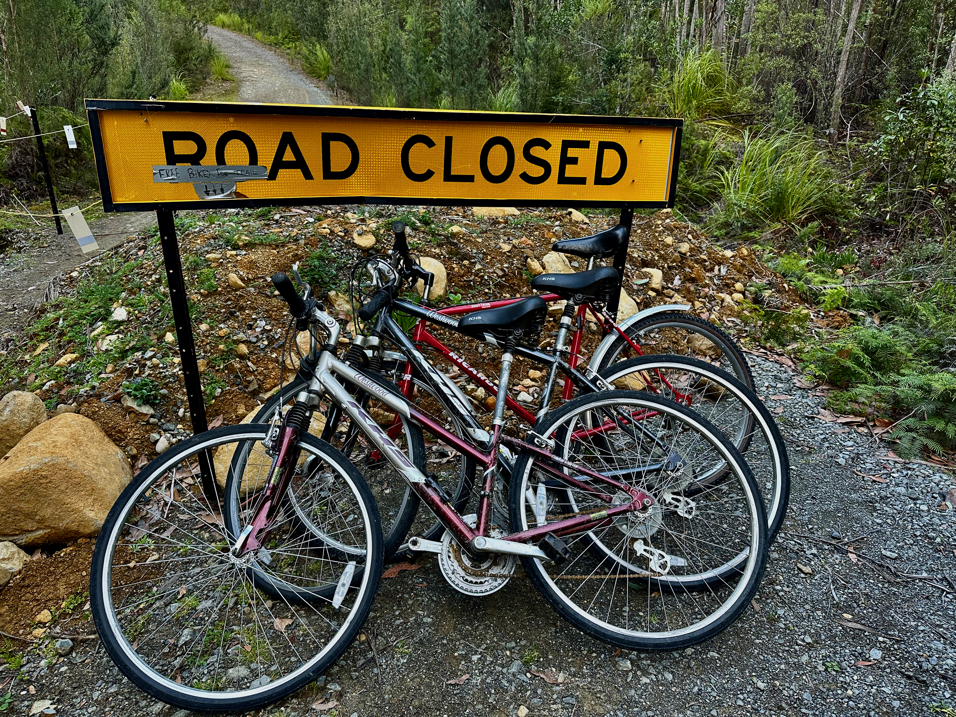
We ditched some food and other bits of gear we didn’t need anymore and ended up with the lightest packs we’d had for the trip. We were most excited to find three bikes at the start of the road walk, with a sign to indicate they were for walkers to use. Sadly they were no longer useable, which quickly deflated our bubble of joy. One had upside down handle-bars and no breaks, another had very loose handlebars, and the third, the best looking, had a flat tyre. Bummer.
Off we set on foot, surprised to meet a few groups walking out. The last of these, and most memorable, were a man and perhaps a teenage girl, I assumed father and daughter. They came across immediately as really decent people. They’d been on a through trip to Federation Peak and the Eastern Arthurs, but illness had turned them around at Bechervaise Plateau. I felt for the girl, who has climbed a whopping 137 Abels, and this was clearly going to be a trip to visit a few more of those slightly harder remaining ones. I remembered how much anticipation I’d felt in the lead up to climbing Feder for the first time and how gutted I’d have been to have to come back another time. I knew she’d make it (so did her dad) because you don’t climb that many Abels without a decent amount of resilience, but I still felt for them in their misfortune this trip. I also realised that our own failures had been solidly put into perspective!
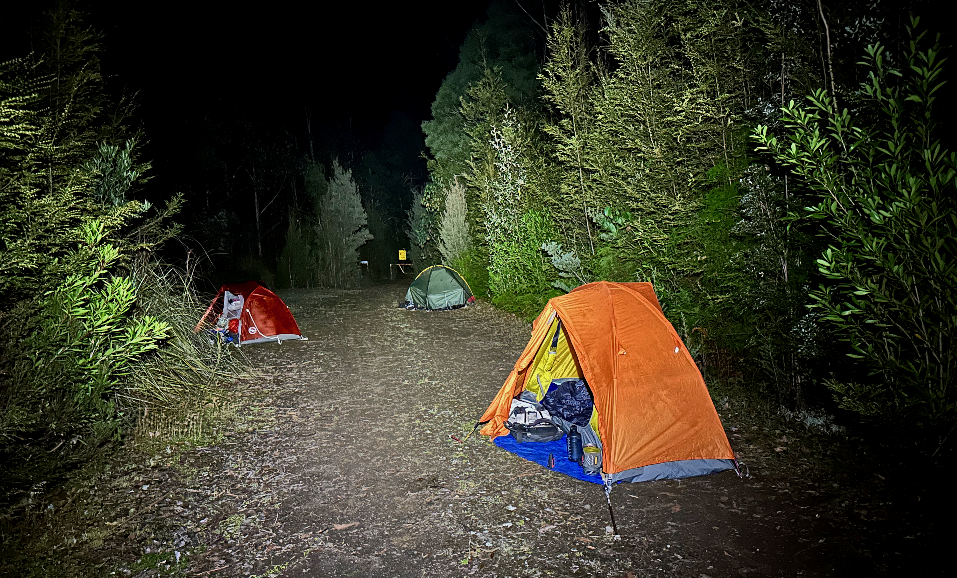
With that to mull over in my head, the 8km road walk went relatively quickly and we finished the final several hundred metres by head torch. We popped down to the river for water, had dinner and didn’t take long to get to bed. We were all excited for a high camp the next two nights and some good weather! What we think was an owlet nightjar sung us to sleep.
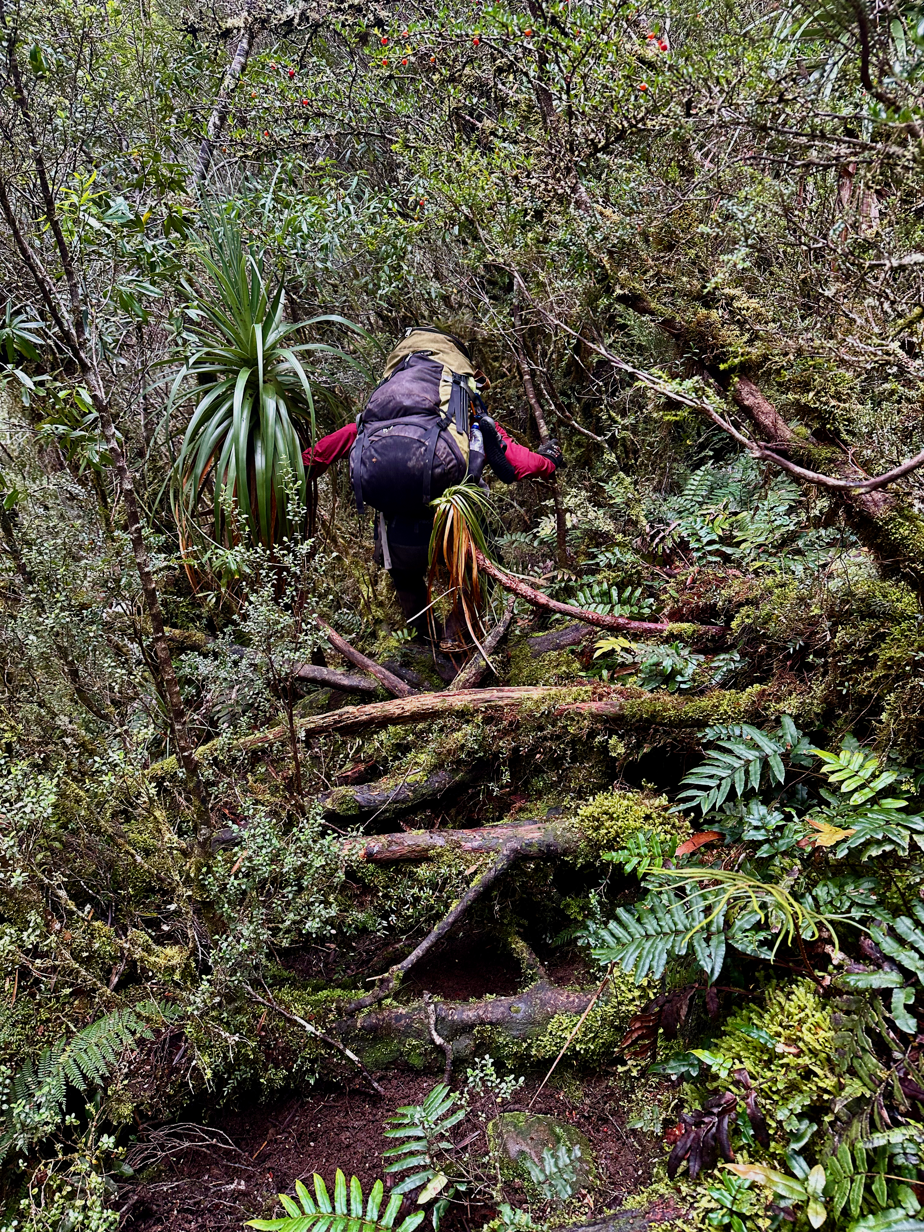
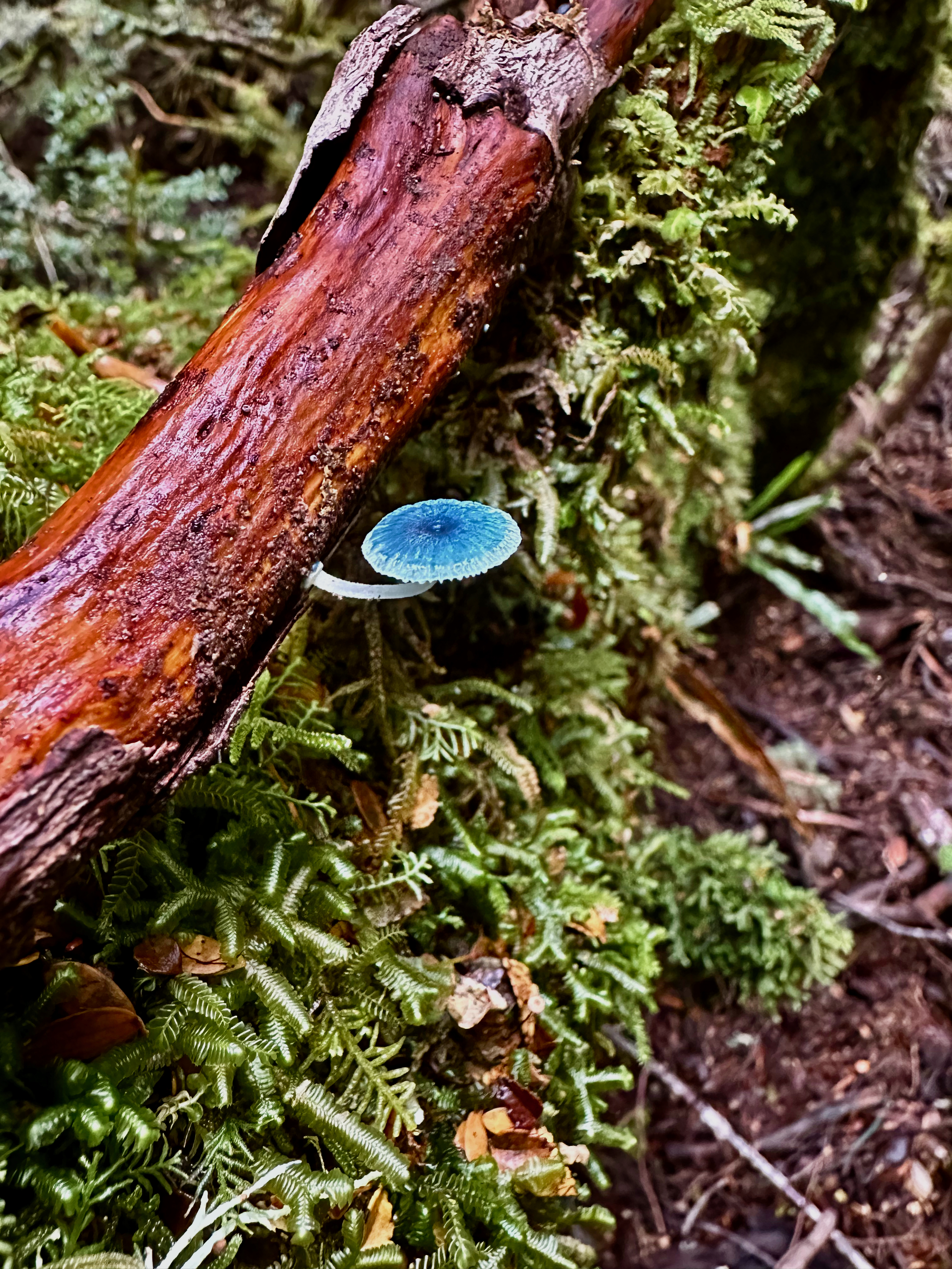
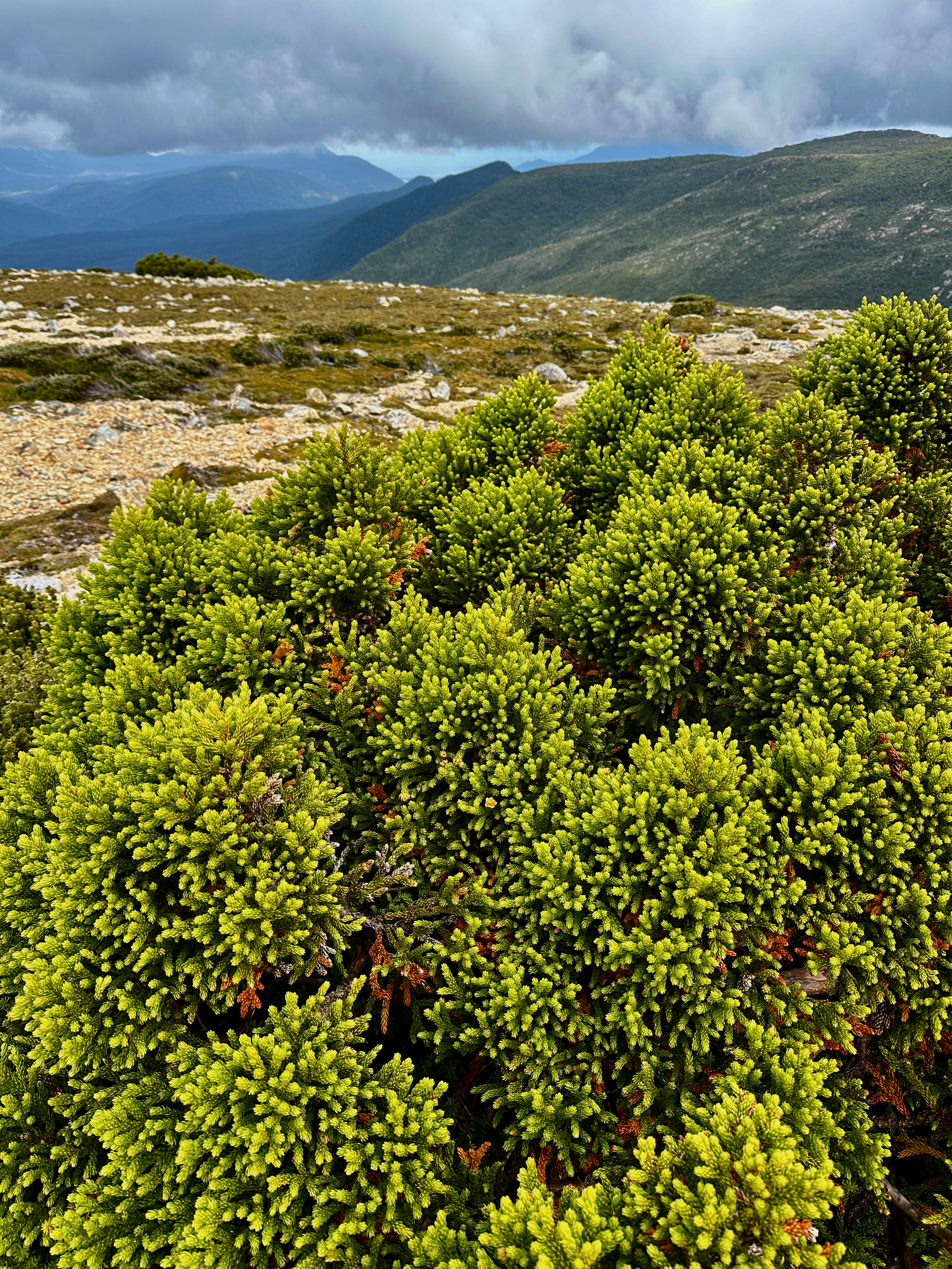
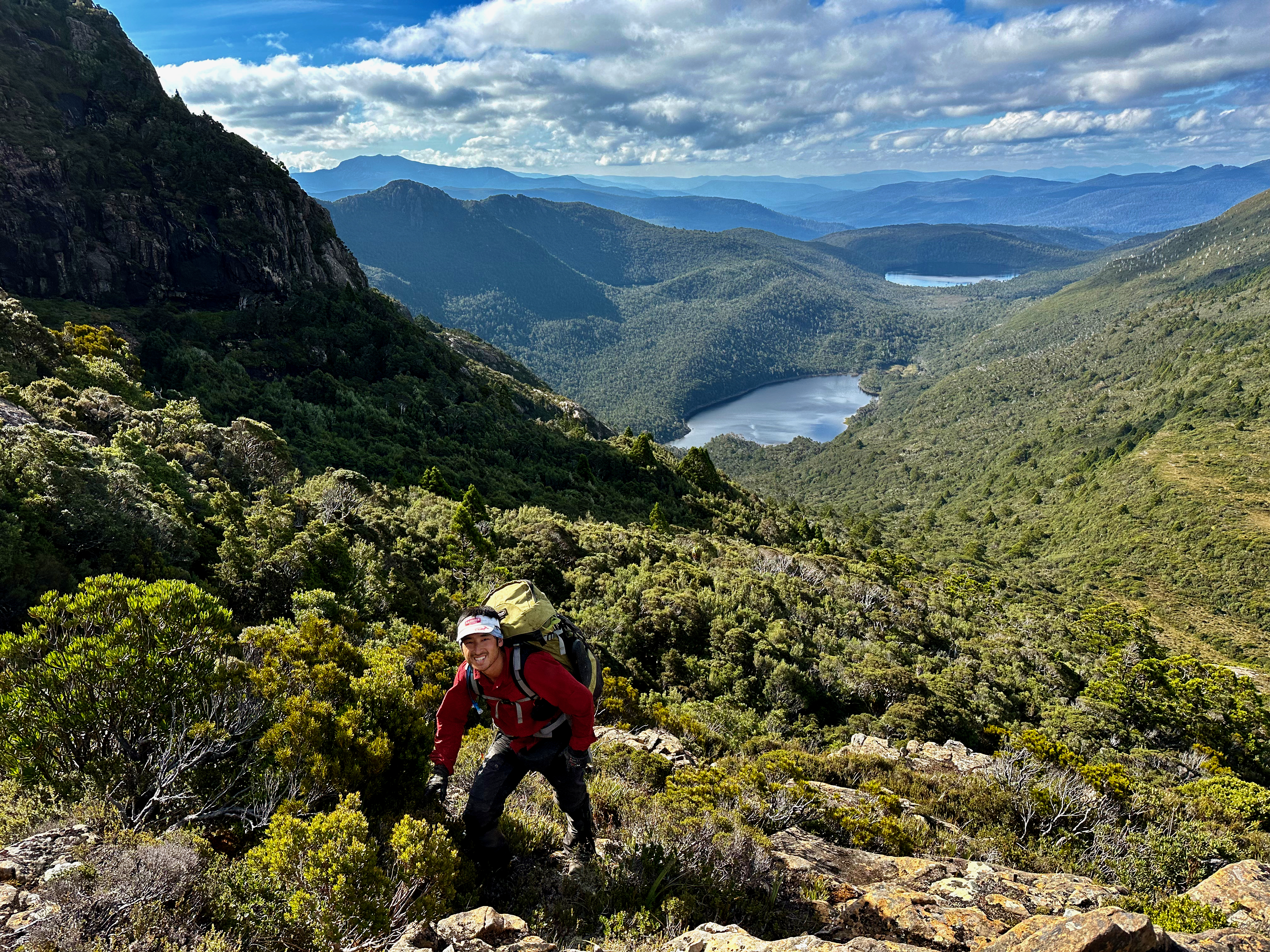
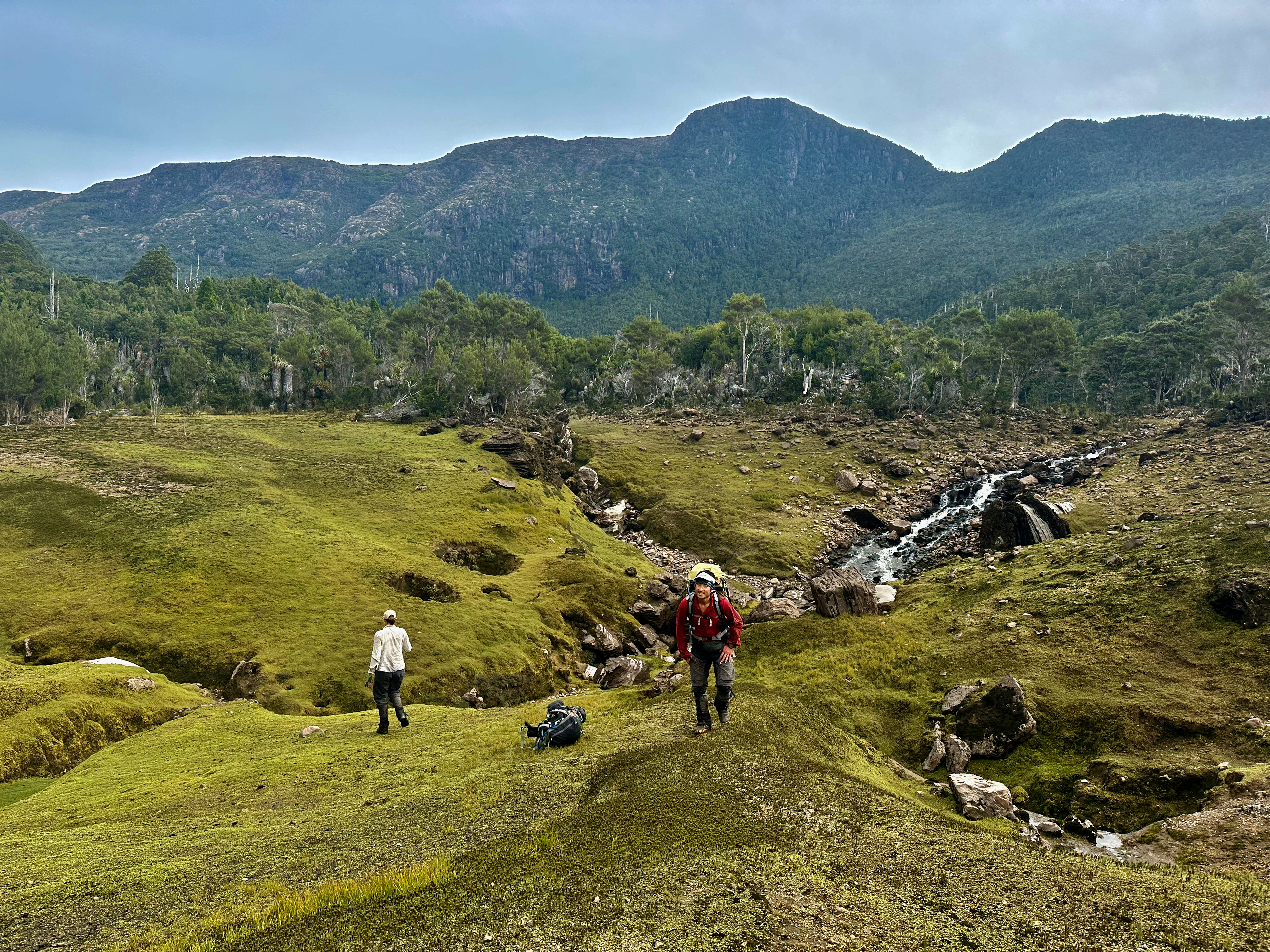
We set out again at the crack of dawn, finding the river low and the track not too muddy. We were at the junction to Lake Sydney in well under two hours and began pushing through overgrown bauera and cutting grass until we reached the alpine forest and start of the climb. We expected easier progress but the lower part wasn’t much faster, thanks to a number of large fallen down trees. It did improve as we ascended though and we made steady progress. It was exciting to see fagus, scoparia, pineapple grass and King Billies again, and I realised with a start that it had been a while since I’d done any true alpine walks.
Back down the other side the track along the flat to Lake Sydney was very boggy, the kind you could lose yourself in. We took more care than usual and were grateful to pop out at the sink hole, which were well and truly hidden under an average amount of water. It was the most water I’d seen in the area, but not as much as Shelly had had when she’d last visited. The lake was still providing a solid flow of water into the area, but it was draining out at a faster rate. We marvelled and ate treats from Banjos and home before rock hopping our way around the lake.
At the far end we followed evidence of a route that other people had taken but kept losing it. The pink climbing heath didn’t help, it was so easy to mistake it for tape! We made a bit of a mess of it at times, and it made me feel much better about my first visit, a solo trip when I was still relatively new to bushwalking. I’d found the taped route difficult to follow then, and given it was no easier this time round I figured it probably wasn’t due to incompetence!!
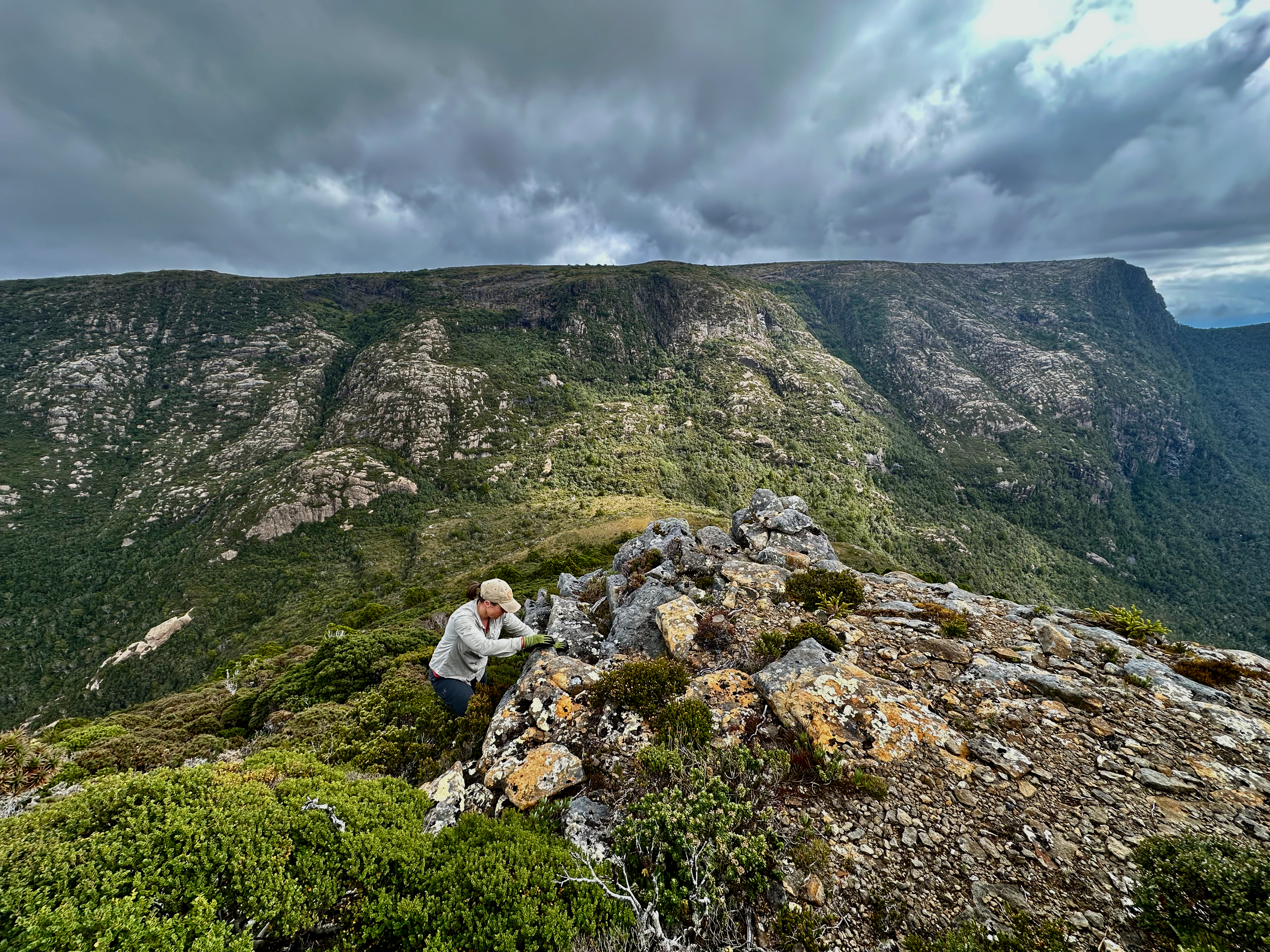
We eventually got to the saddle, dropped our packs and walked, waded and even crawled to the summit of the Boomerang. Yes, crawled. There is one section of tall scoparia where it bodes well to pretend to either be a wombat or to jump back into Alice in Wonderland as half-sized humans. But the summit itself is a vast open expanse and we’d timed it so well with all our wallowing in the scrub that the cloud had burnt off many of the surrounding peaks. Neither Shelly or Kevin had been up before, but I lapped up the views just as much.
Back at the saddle we grabbed packs and made our way up to Mount Bobs. We also managed to get stuck in the green, despite being on worn pads from time to time and took our time pushing through. Neither Shelly or I could remember it being so annoying, but then we’d both done it as a day trip from the lake, and quite some time ago. Regardless, we made it into the open and onto the plateau where we dropped our packs again. This time we went in search of the summit of Mount Bobs for Kevin, the only one of us who hadn’t climbed it yet.
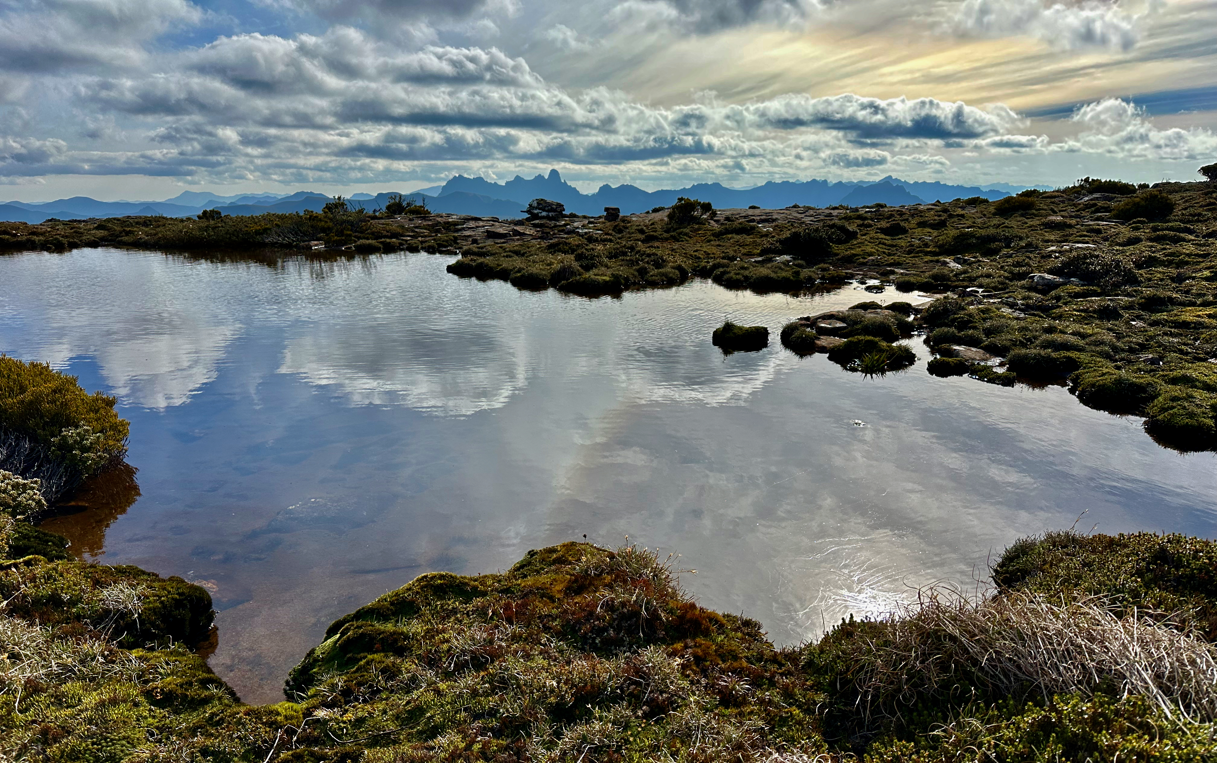
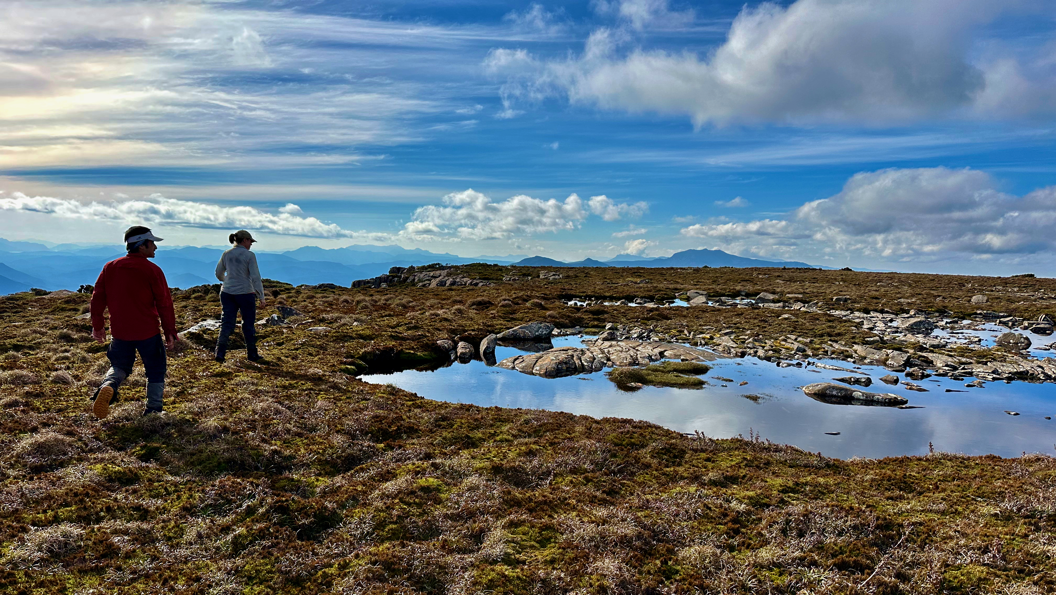
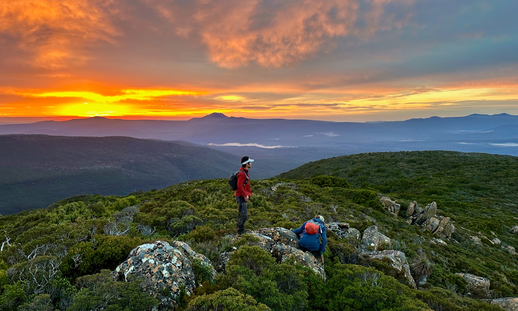
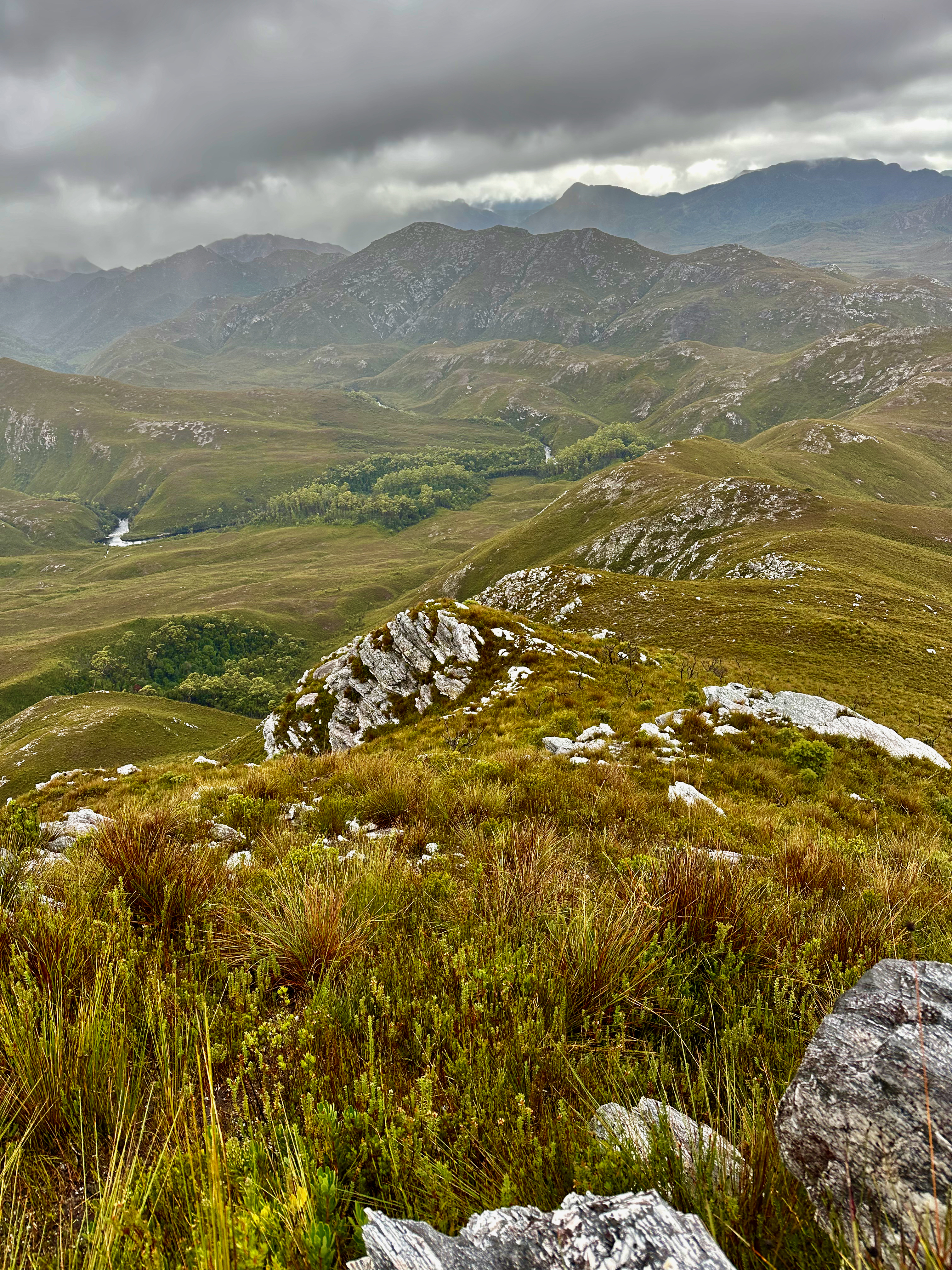
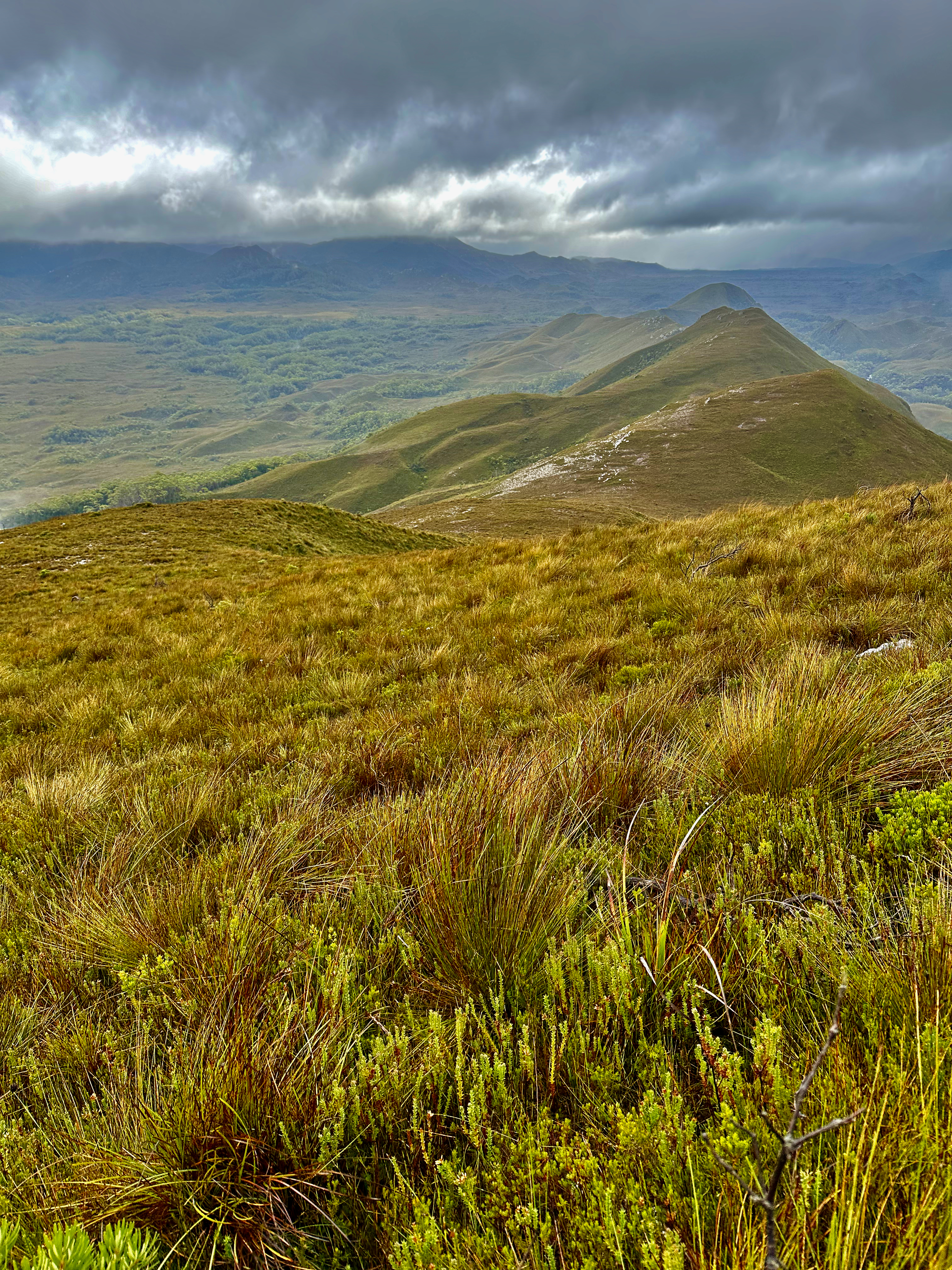
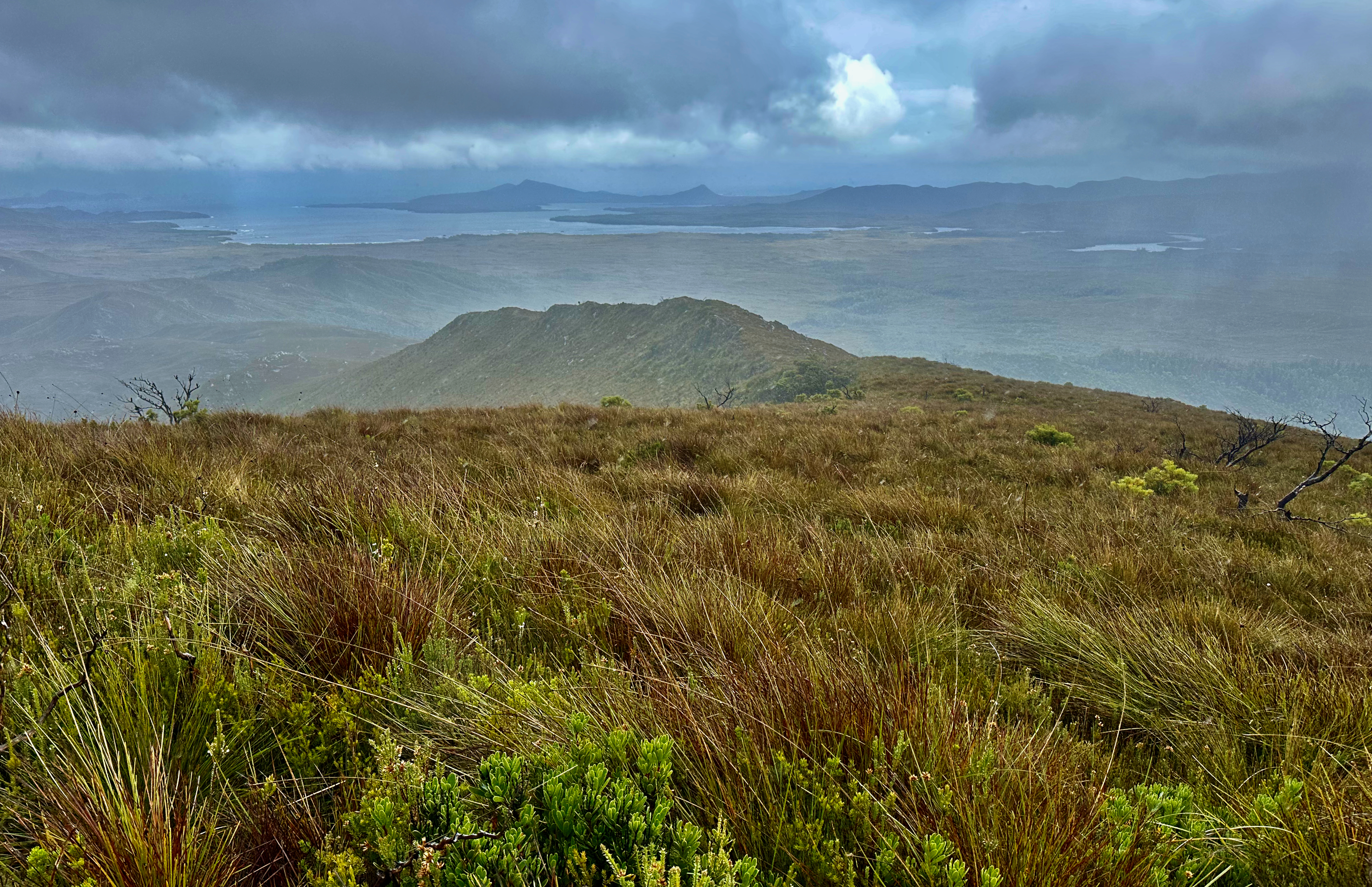
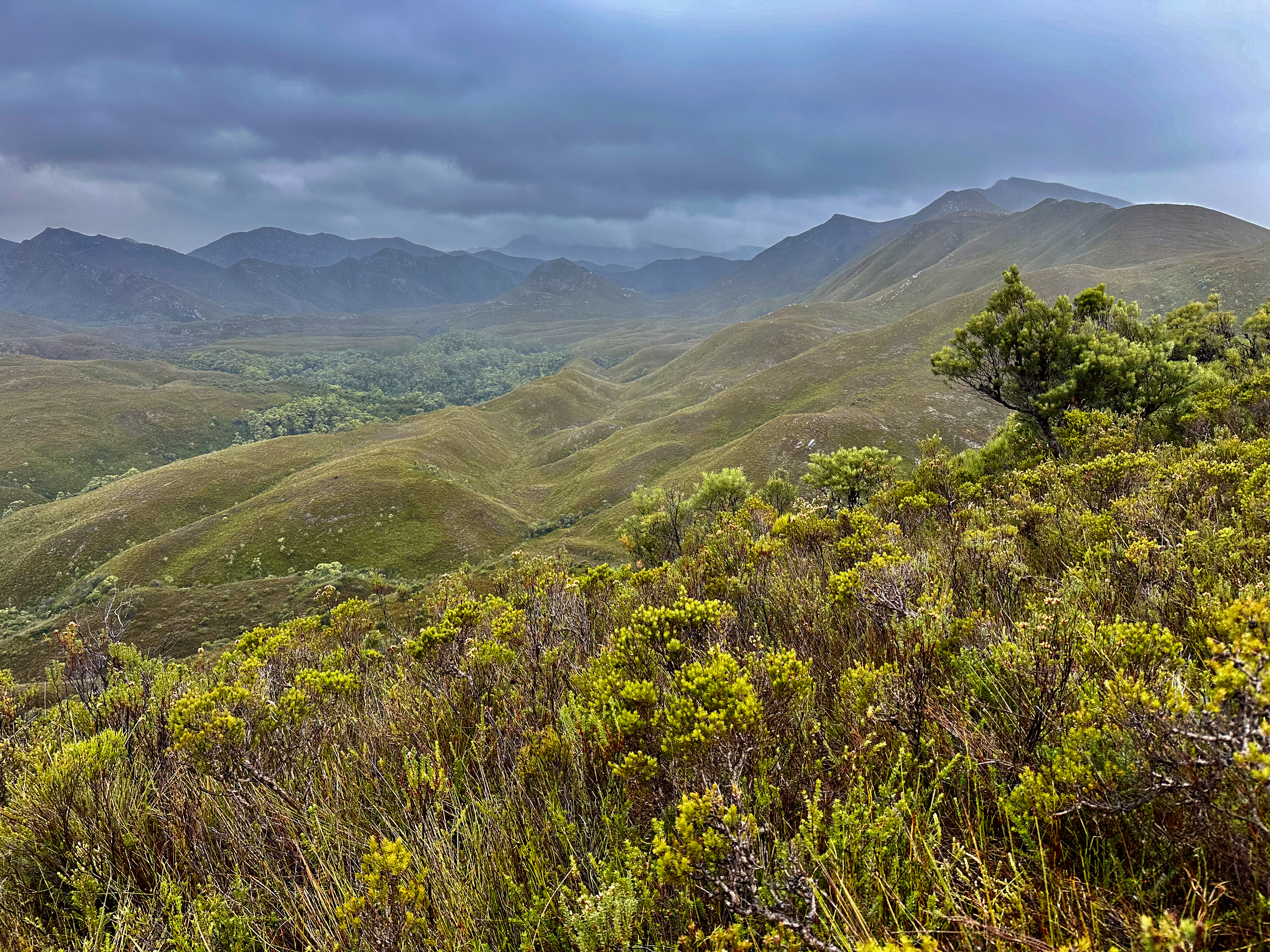
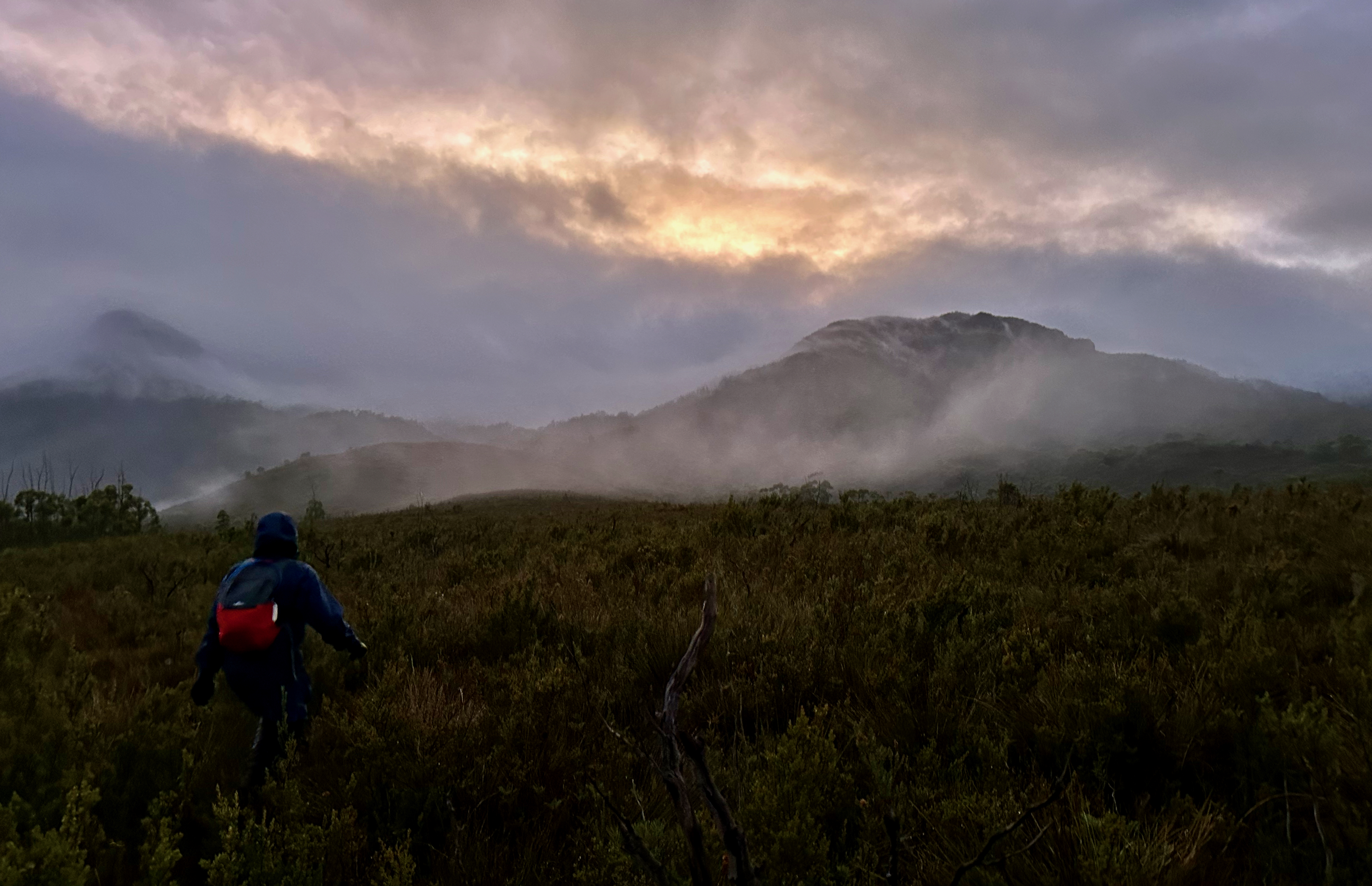
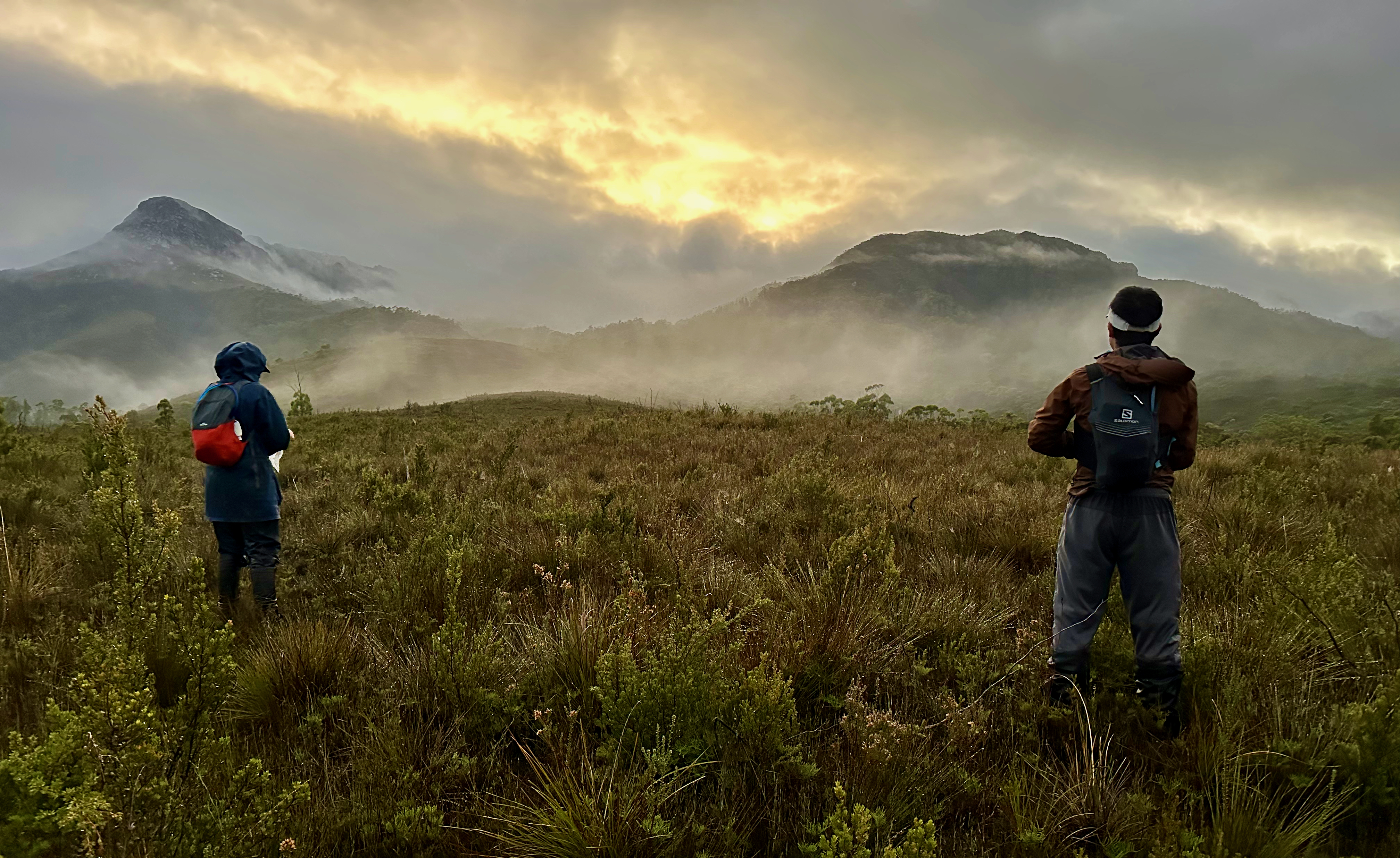
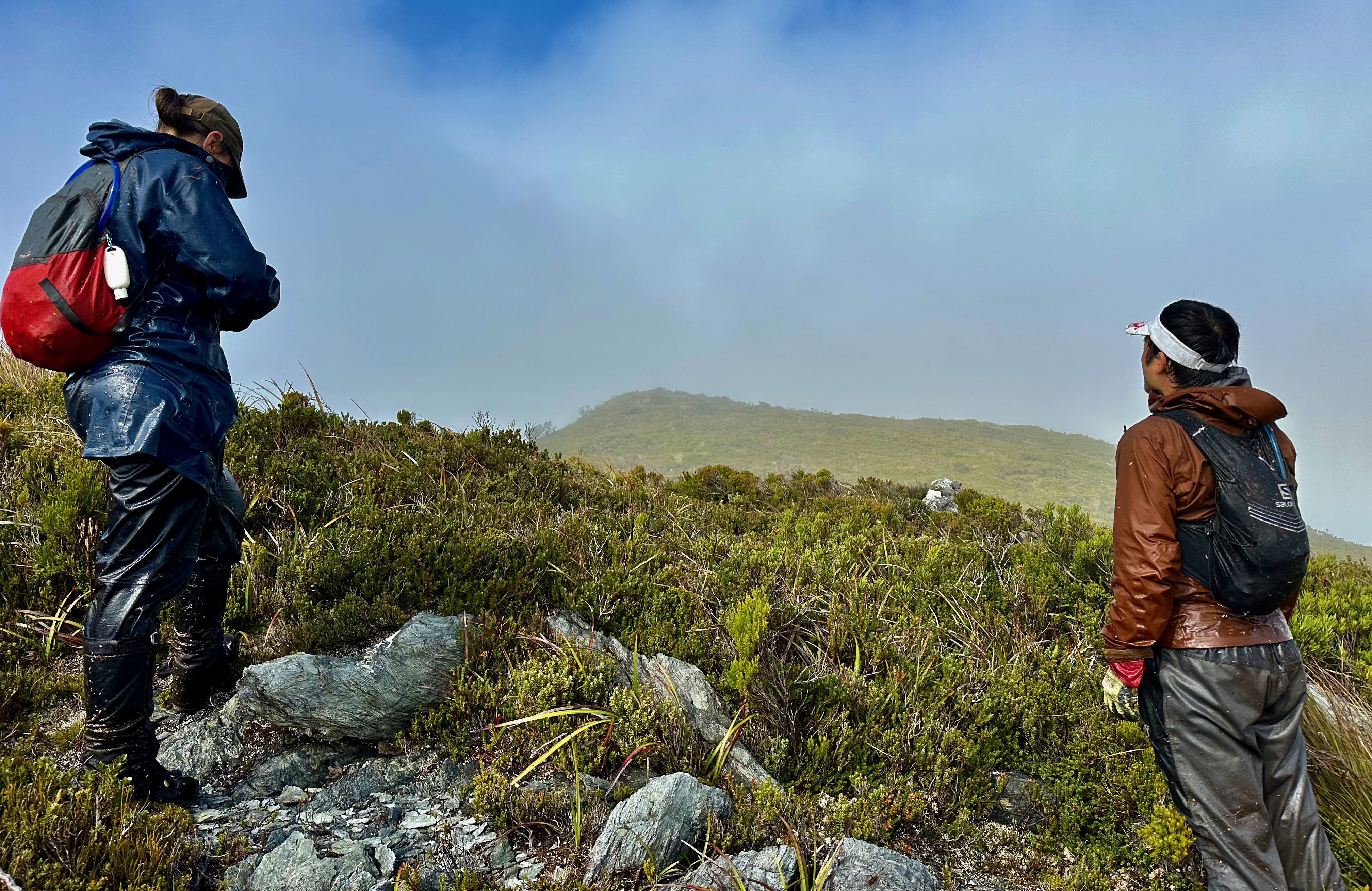
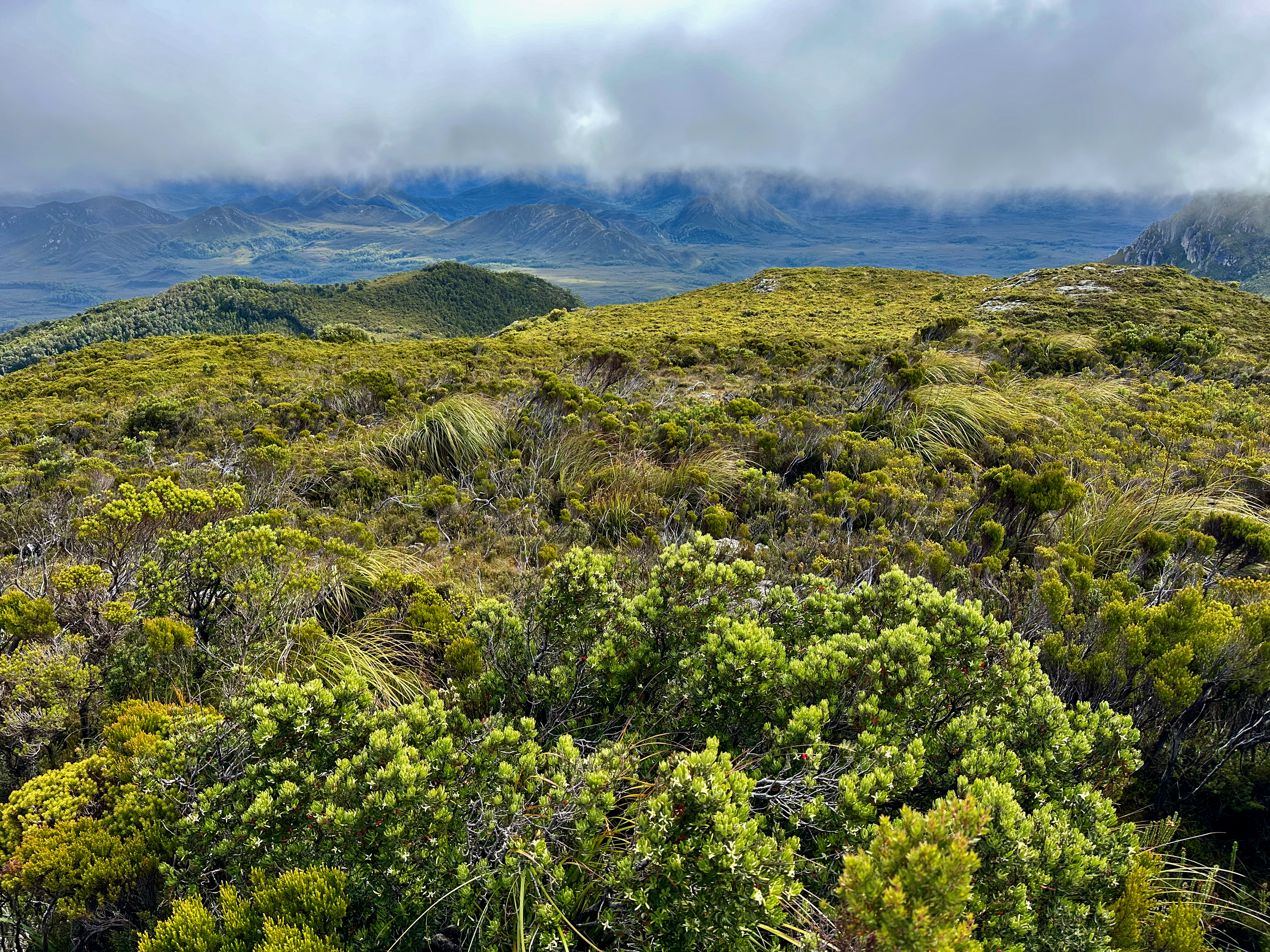
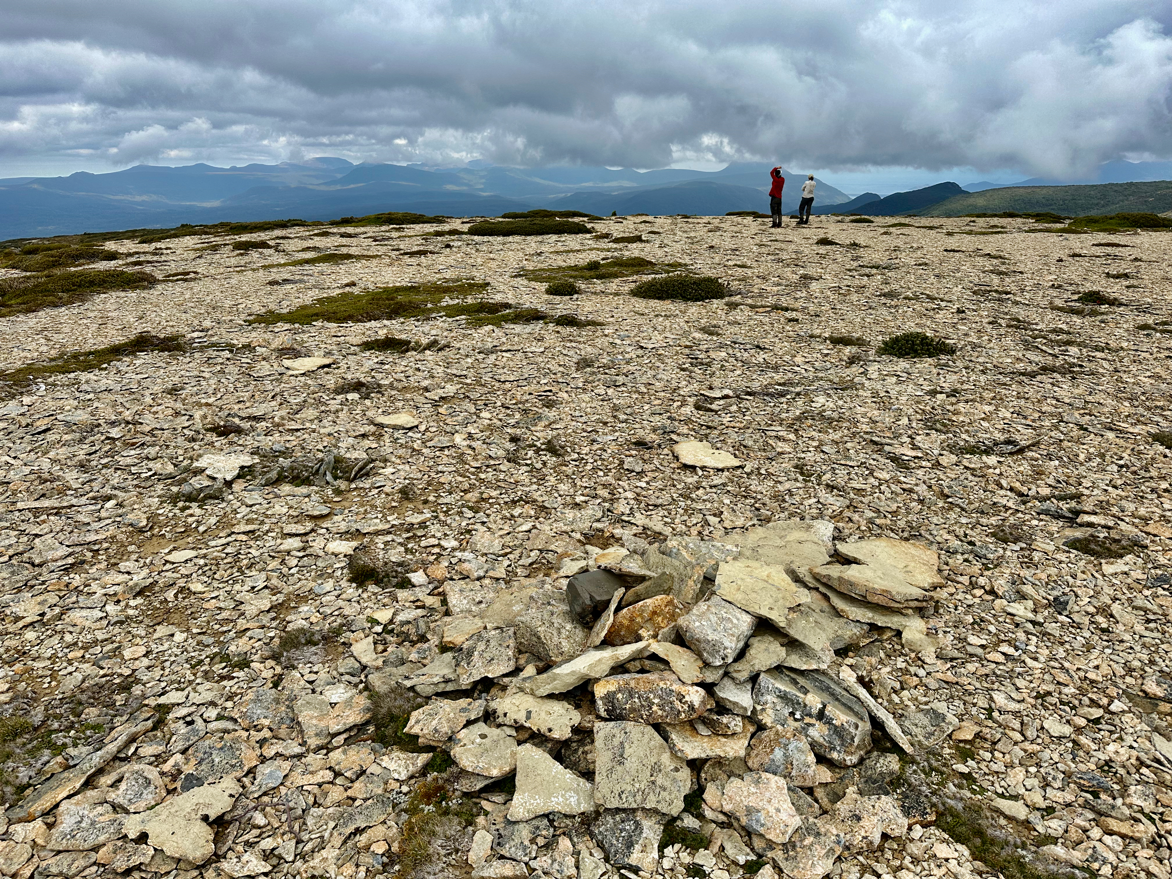
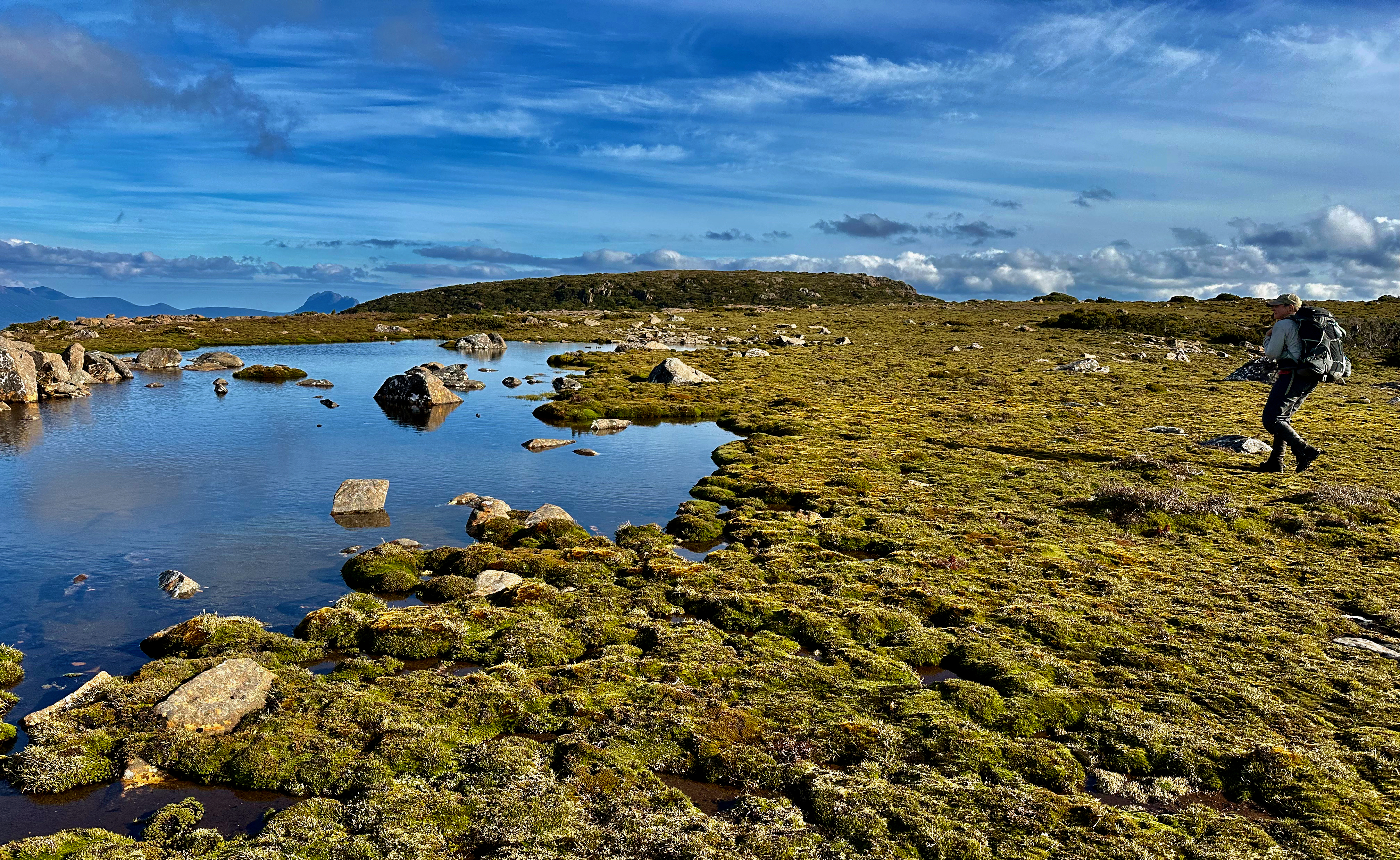
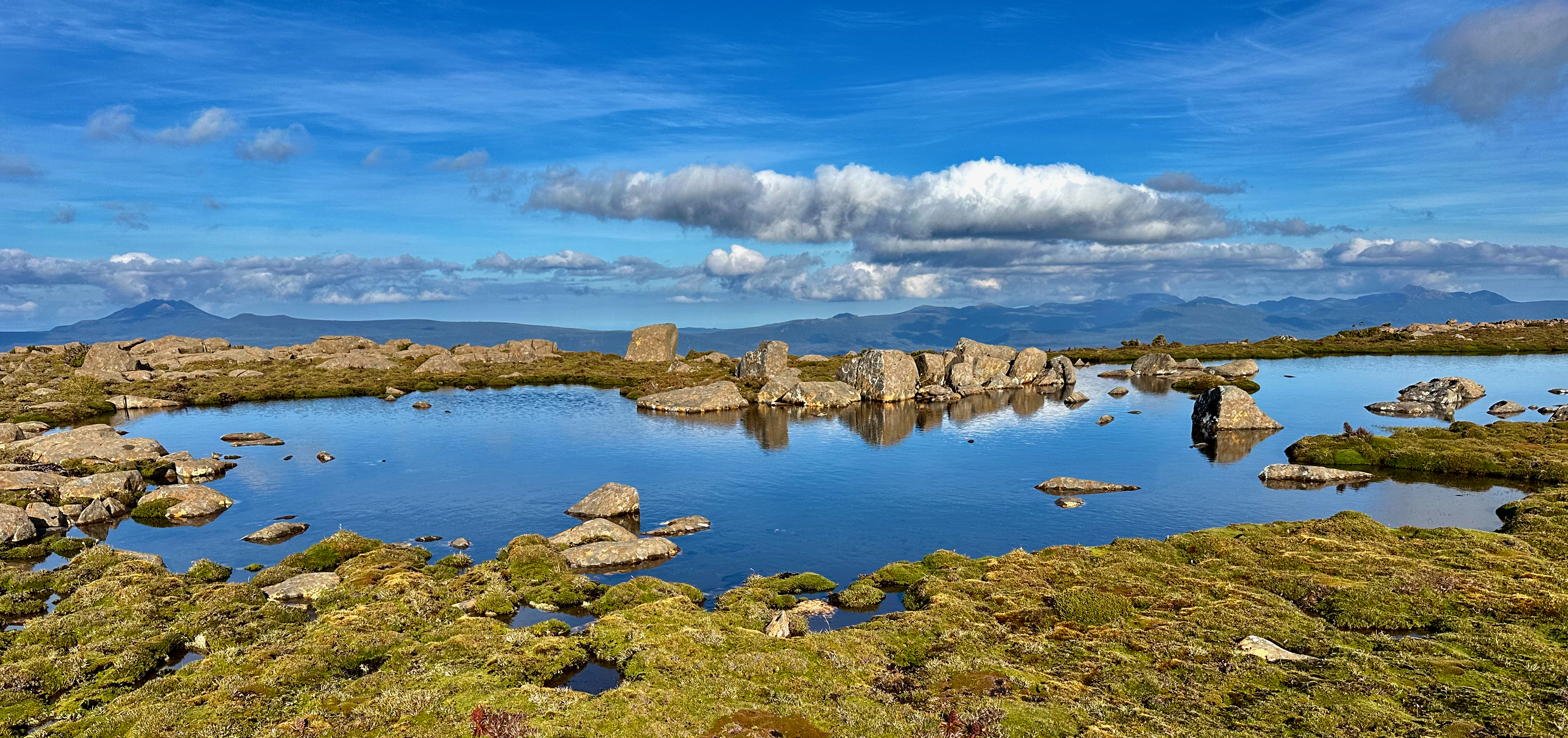
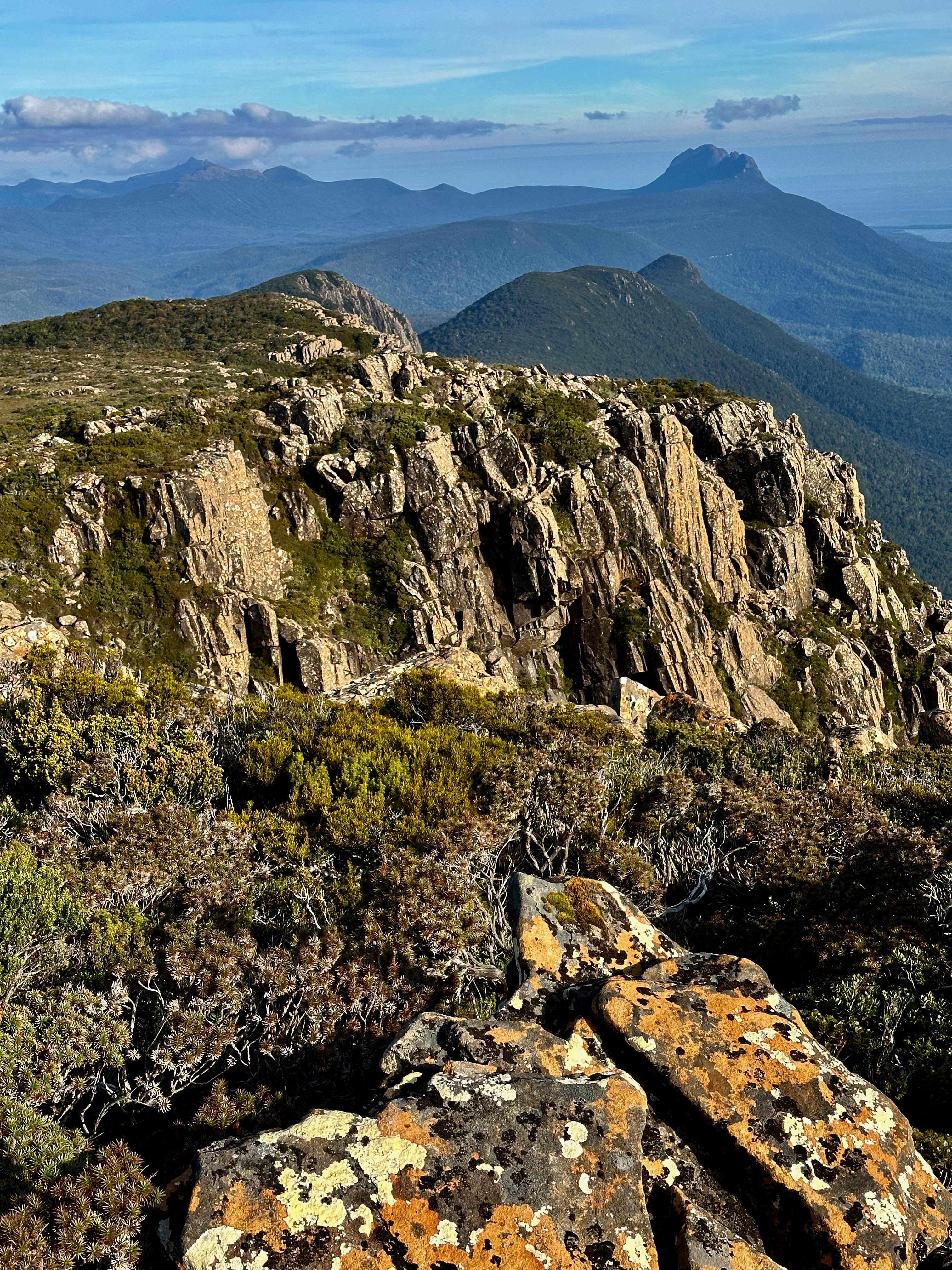
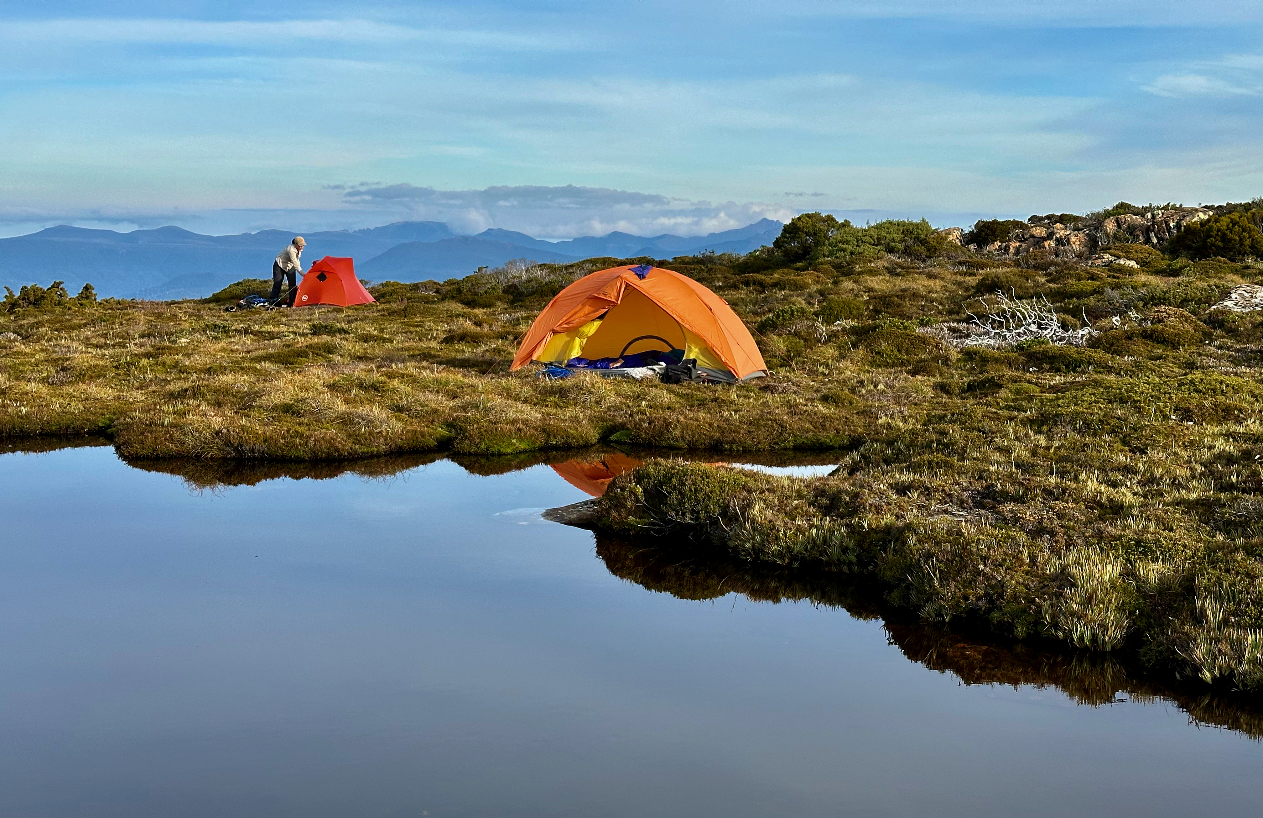
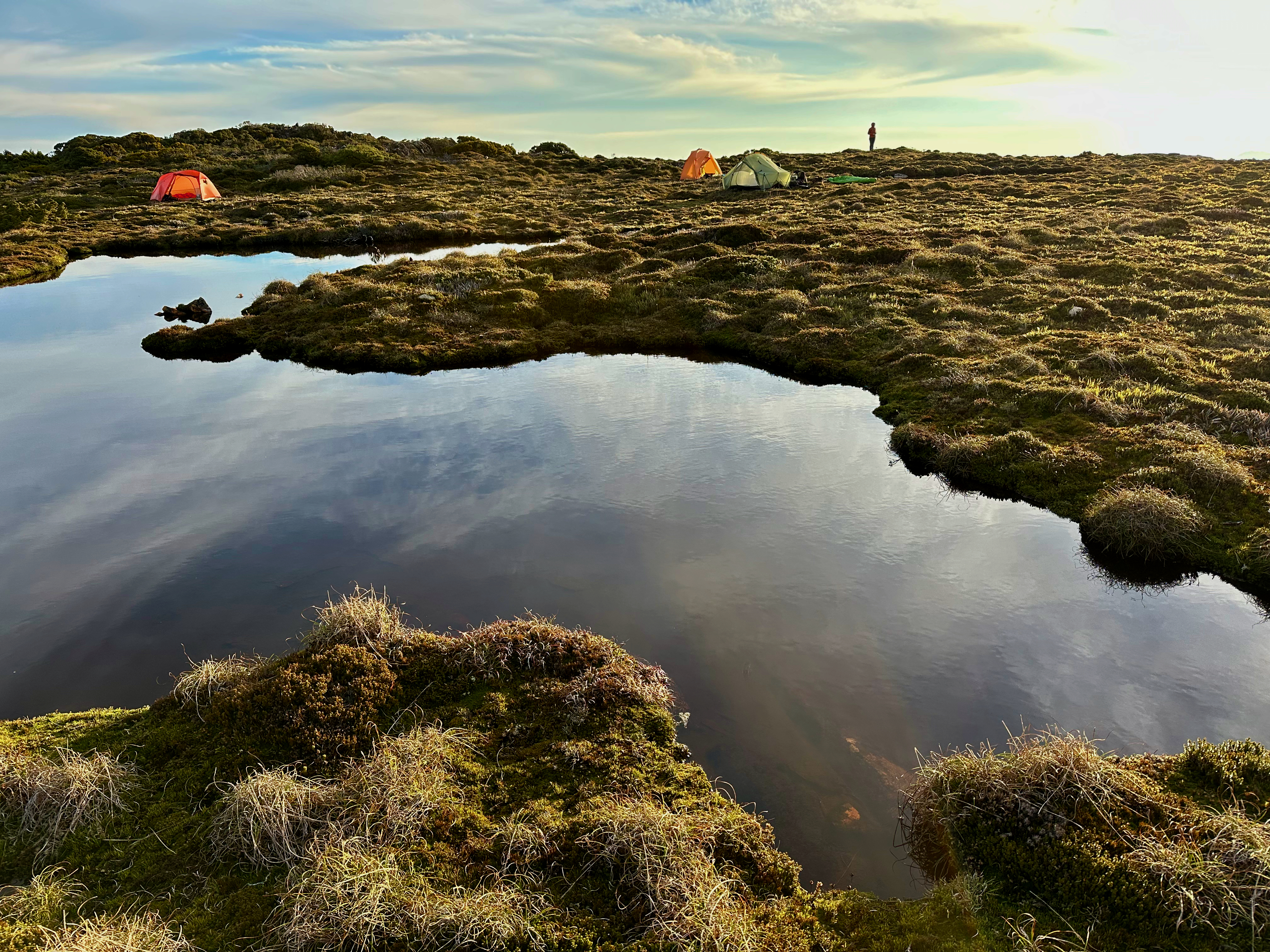
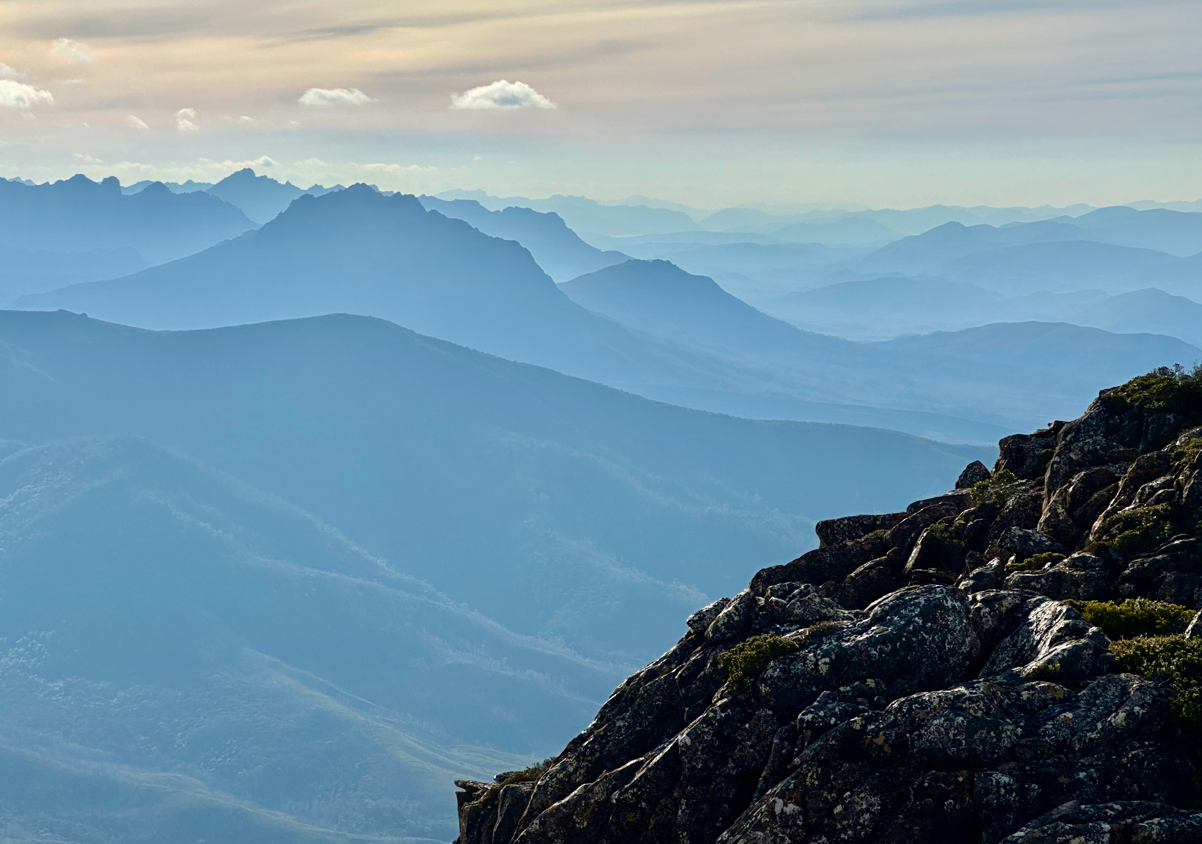
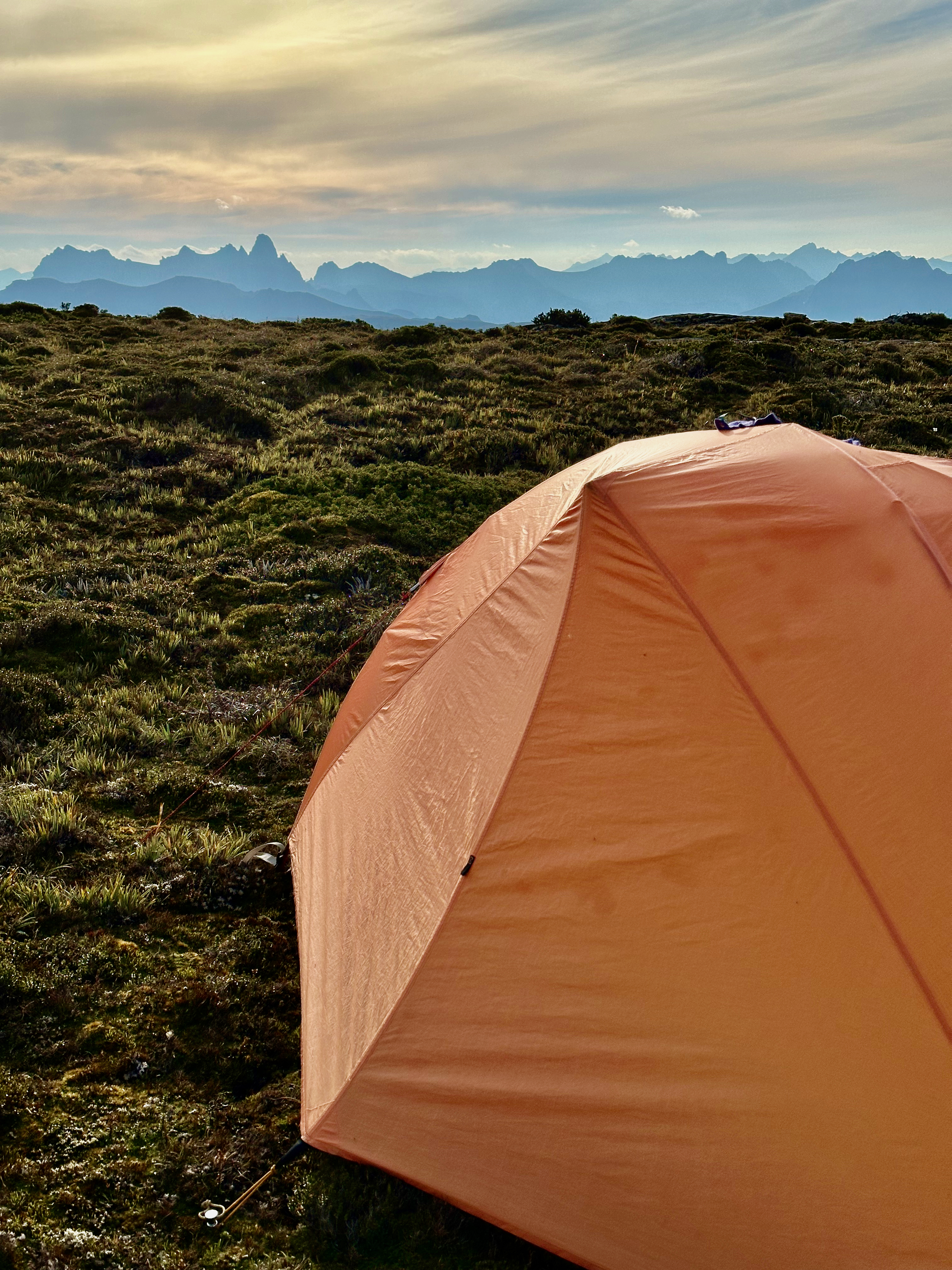
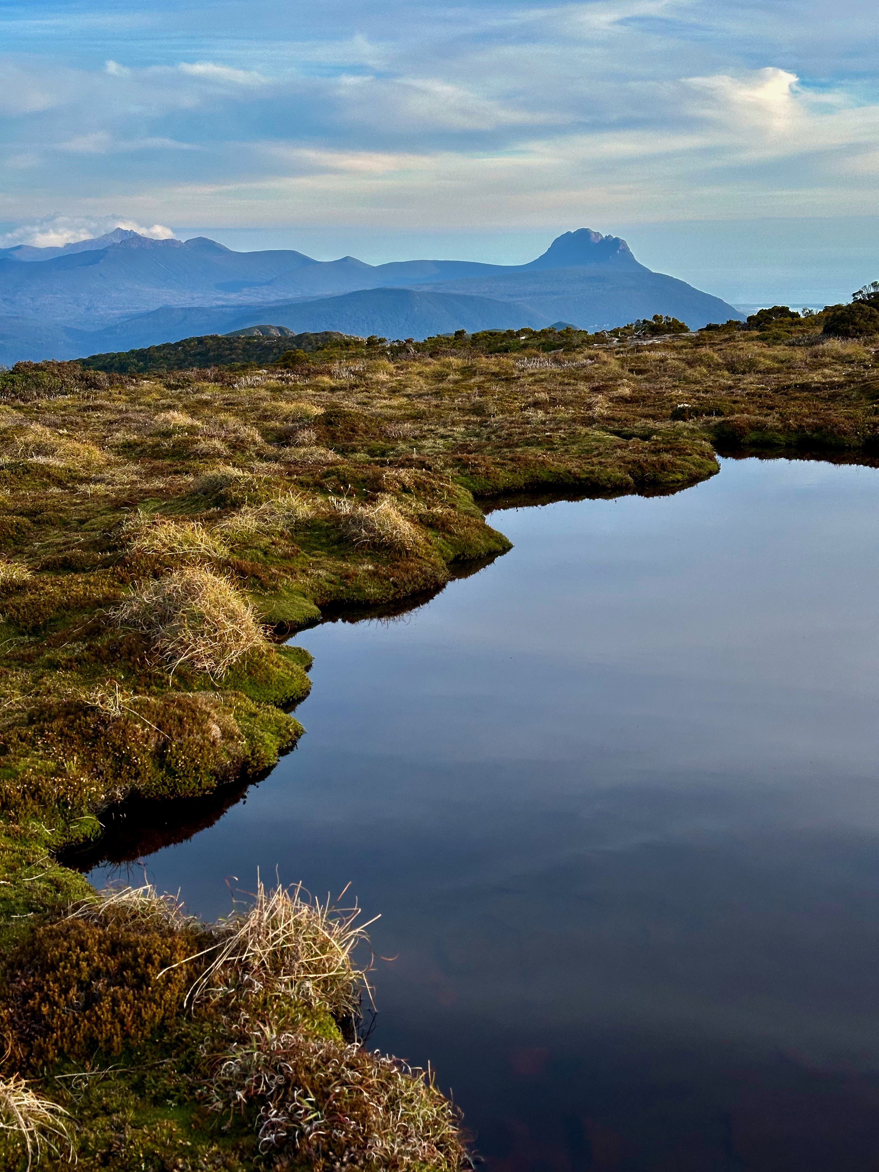
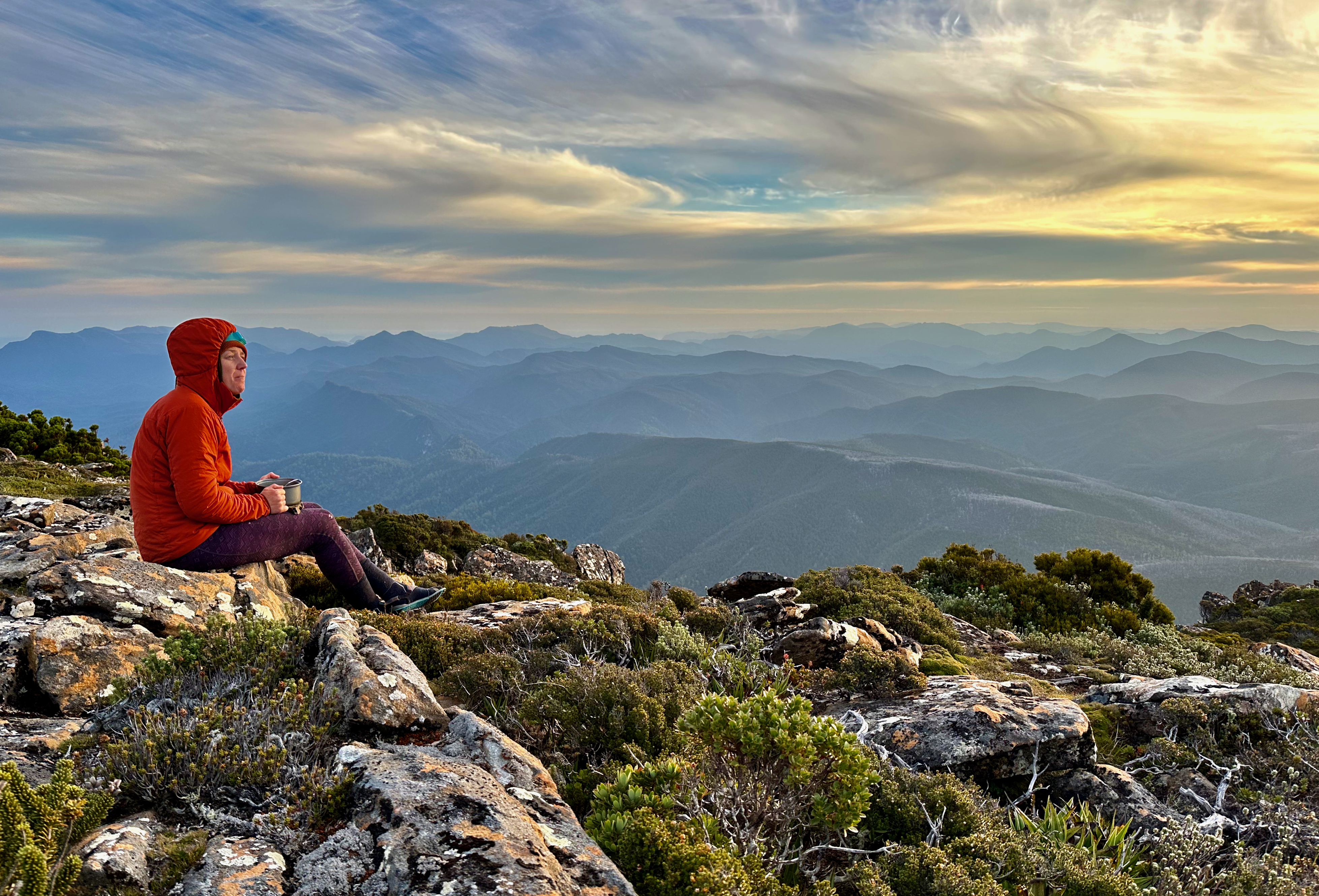
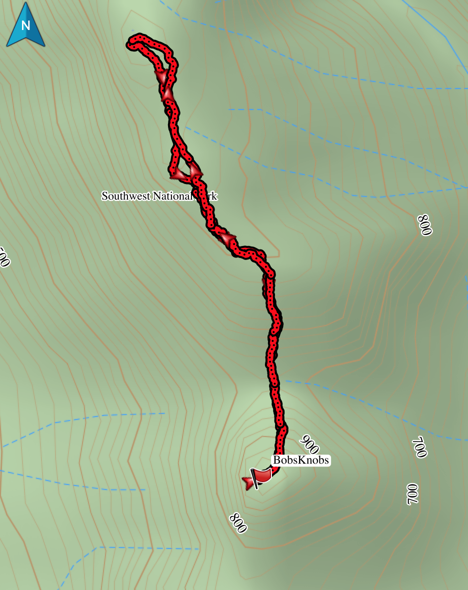
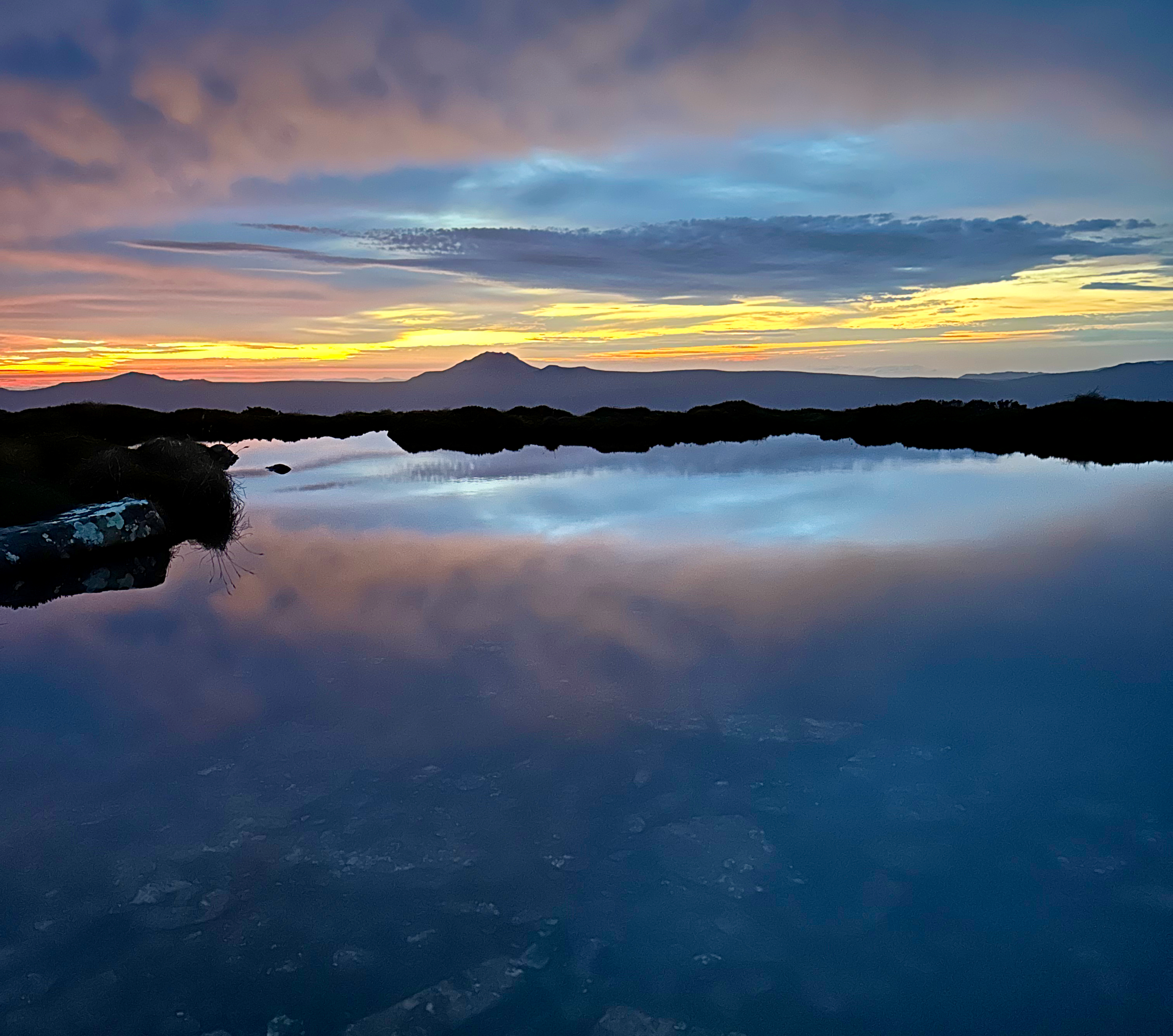
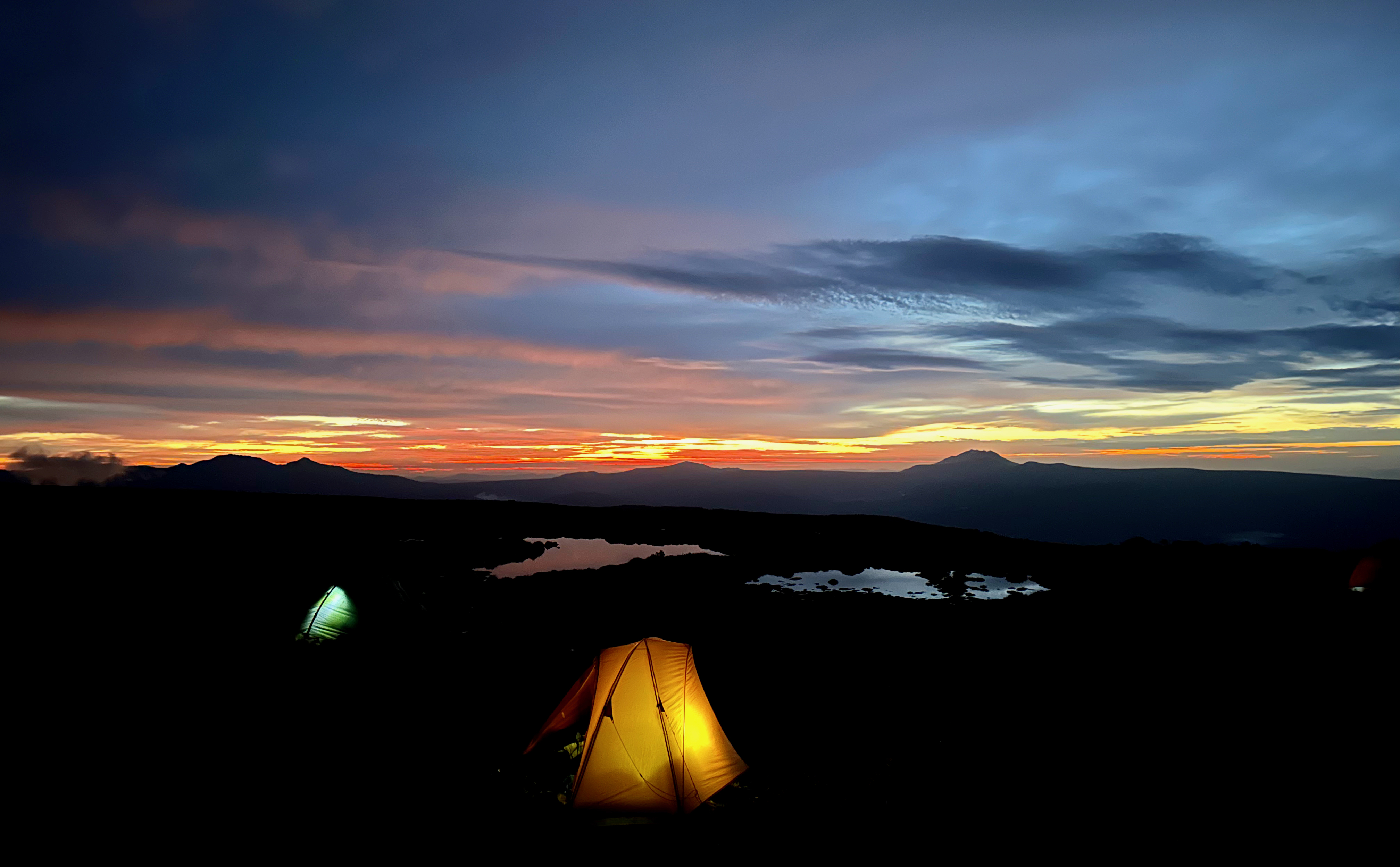
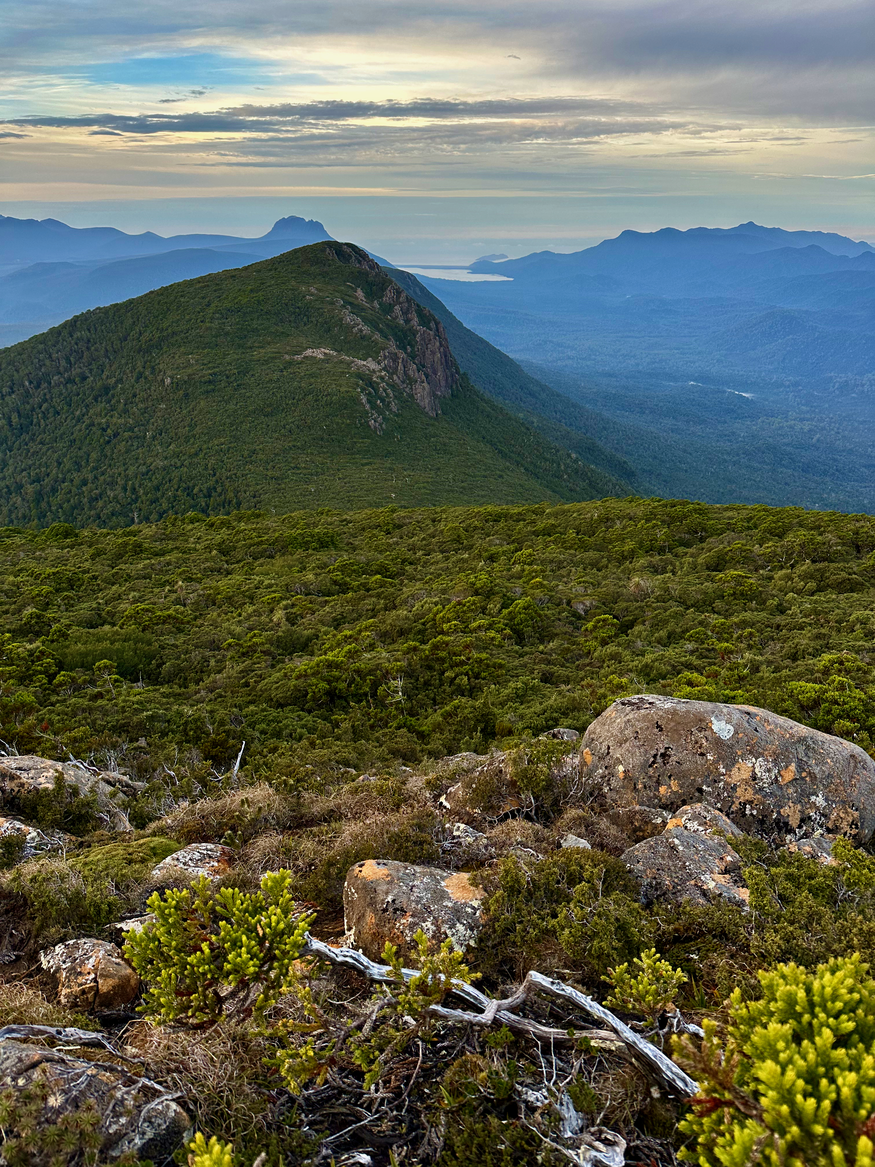
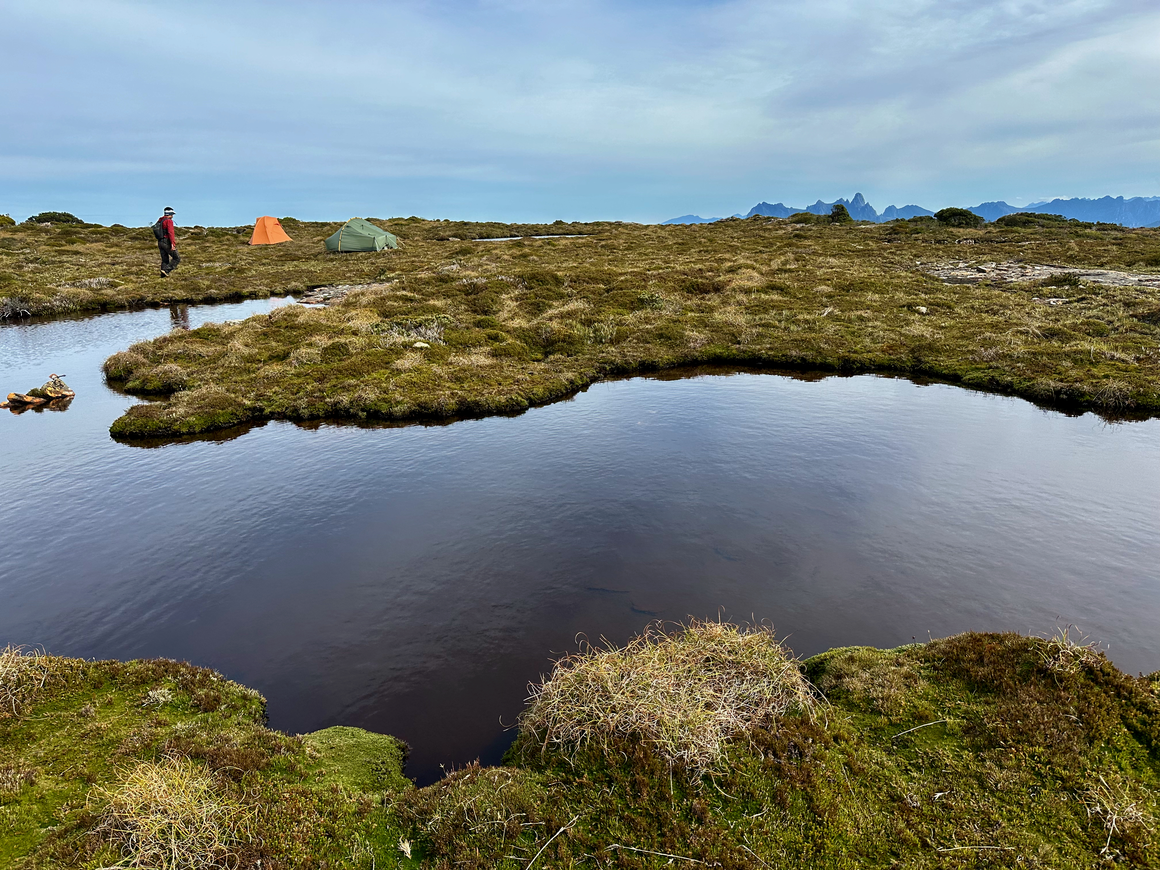
We went via the western edge, which has lovely views towards the Arthurs and Federation Peak. We took the more direct route back and continued south, towards a slight rise on the southern end of the Bobs plateau. It had water and flat open spaces and placed us nice and close to Bobs Knobs, the main destination for this trip and the only peak none of us had climbed. We arrived around 5pm and had a perfect evening setting up high camp, eating a leisurely dinner and watching the sun set over Federation Peak. The weather could not have more starkly contrasted to the wind and rain we’d had at the beginning of our trip!
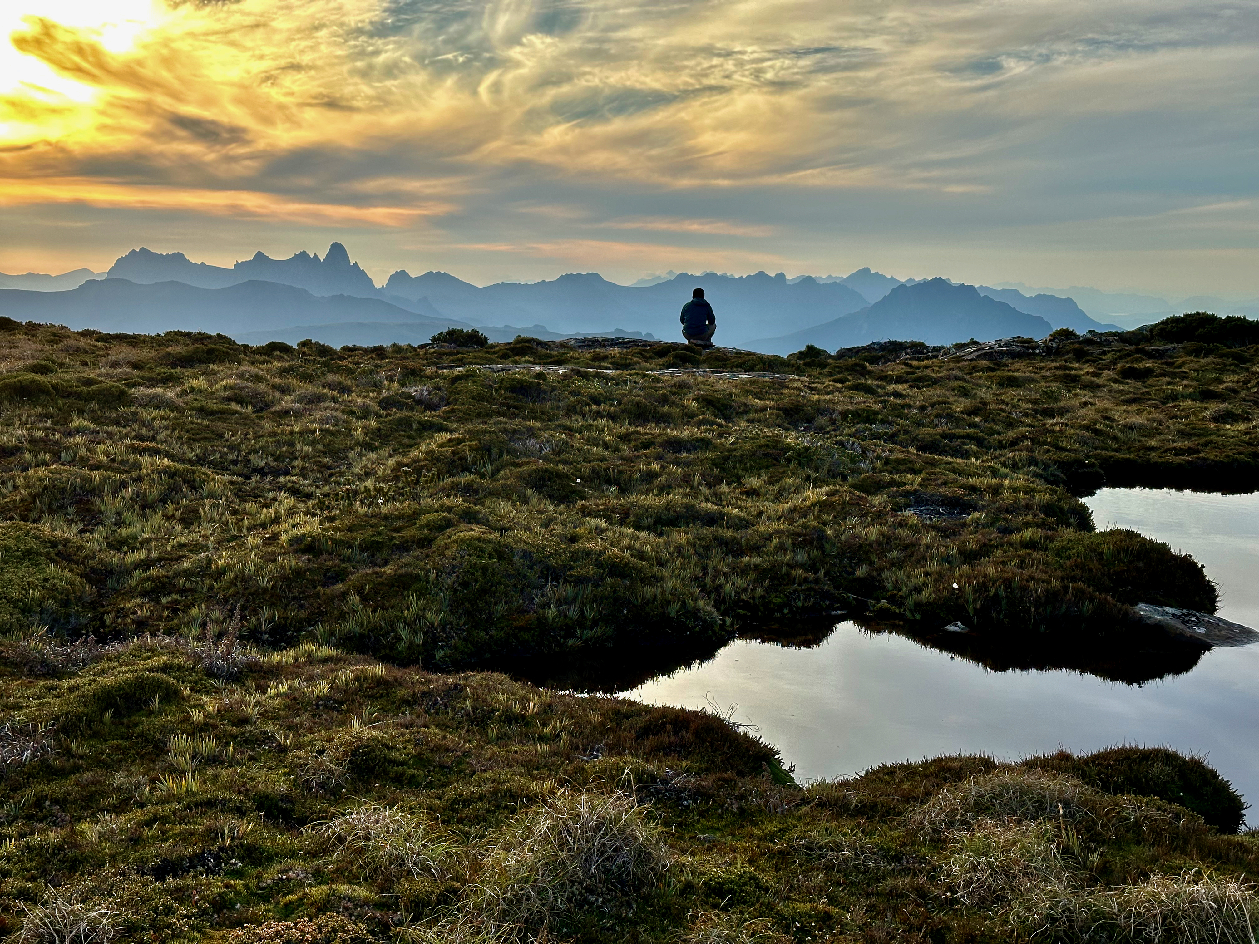
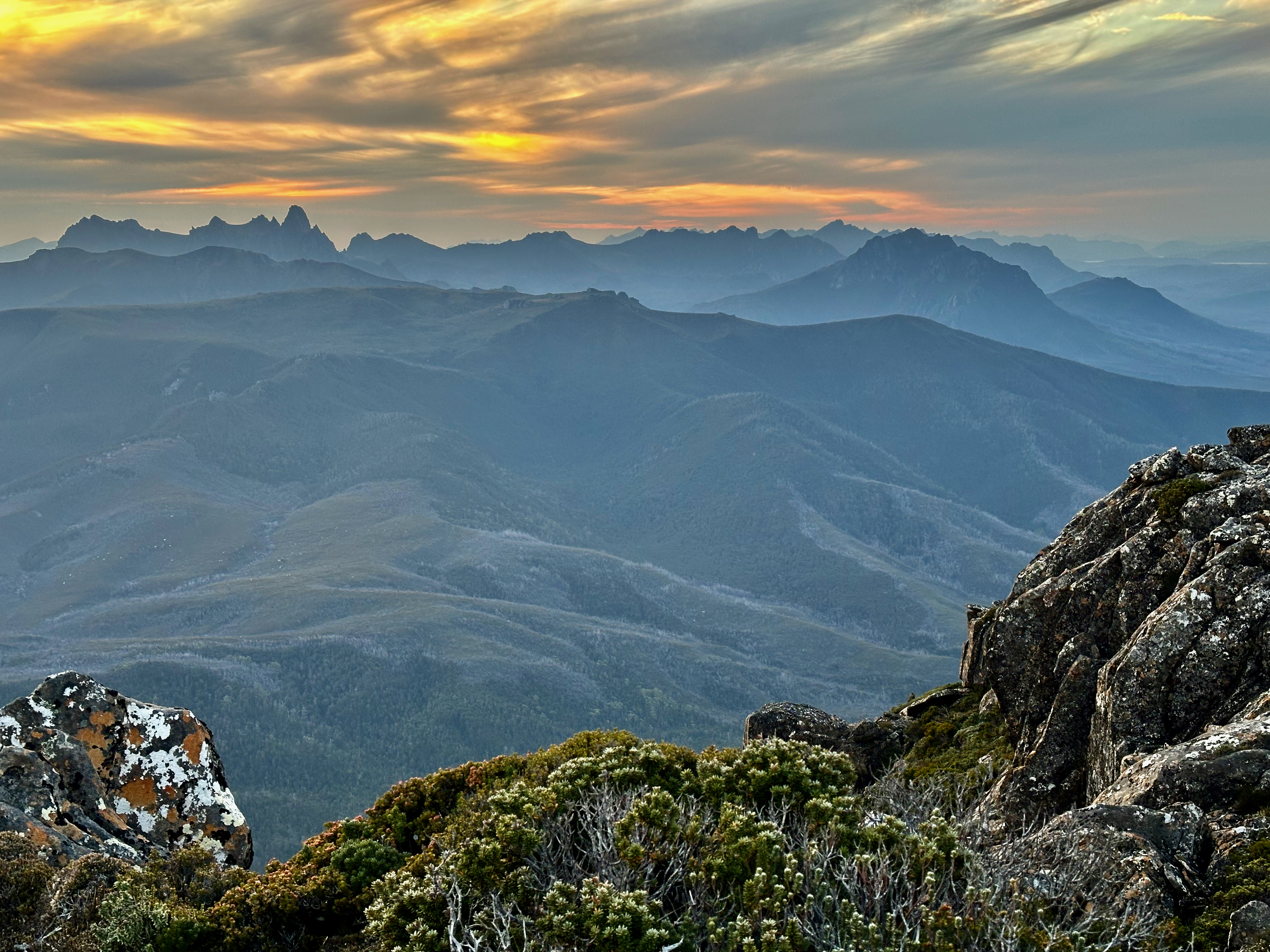
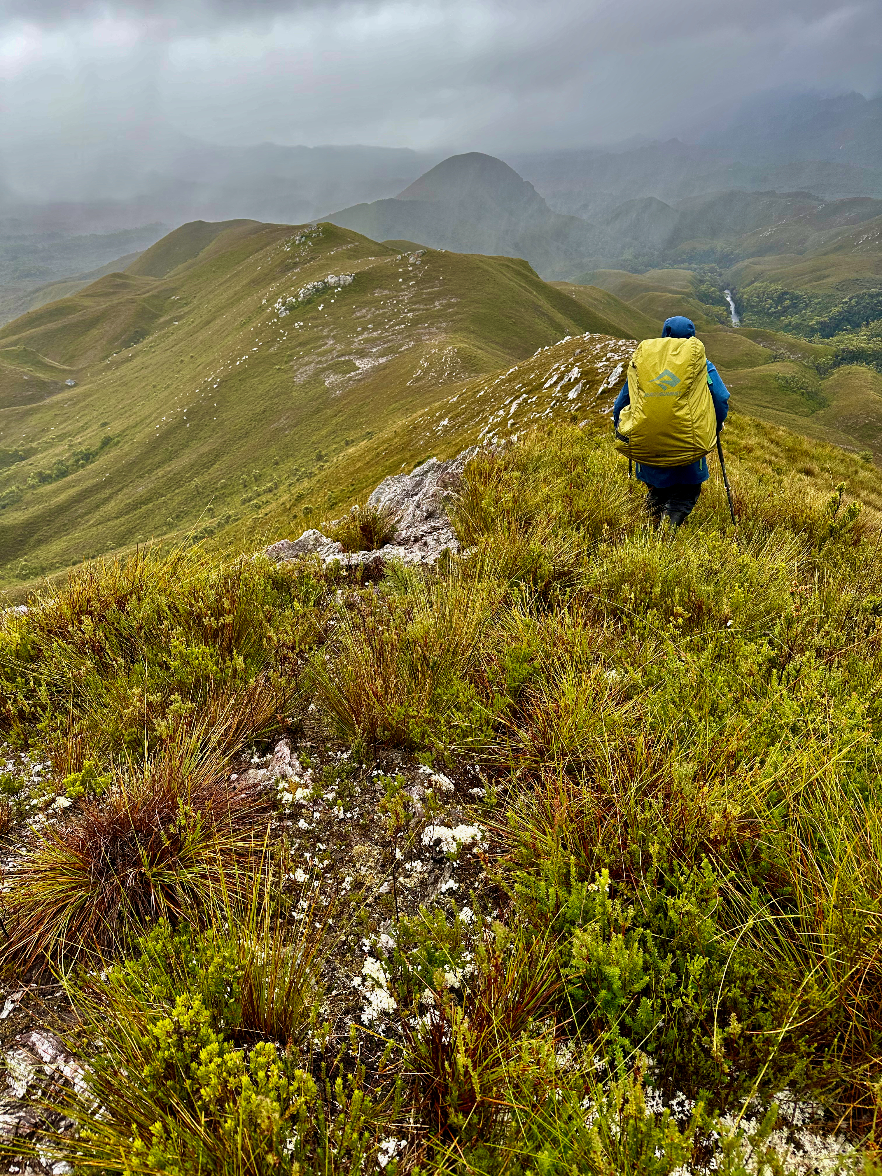
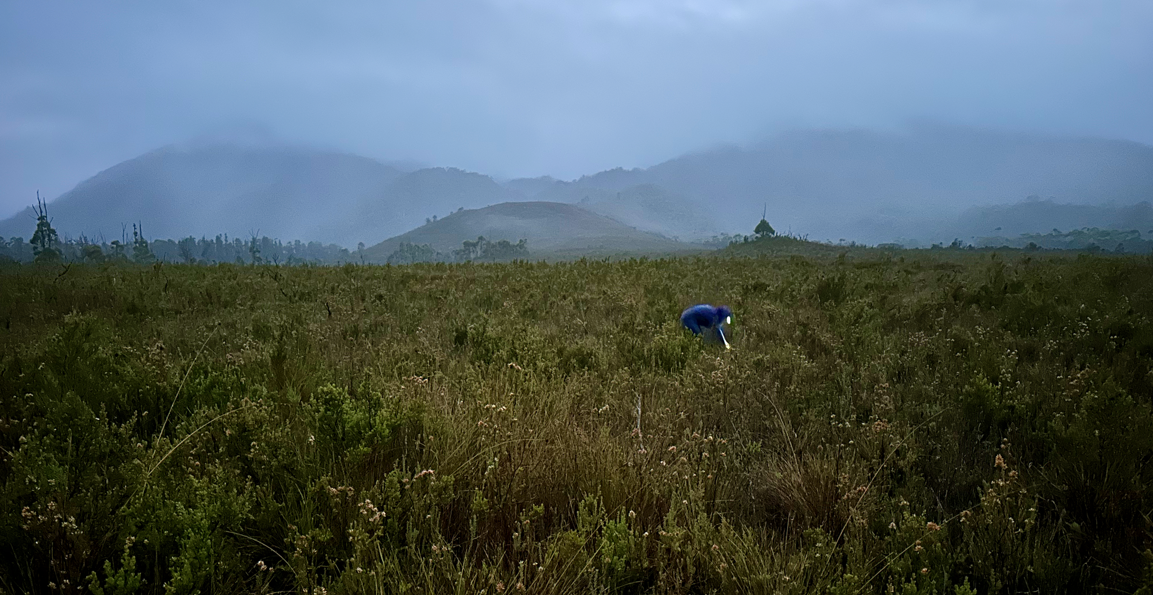
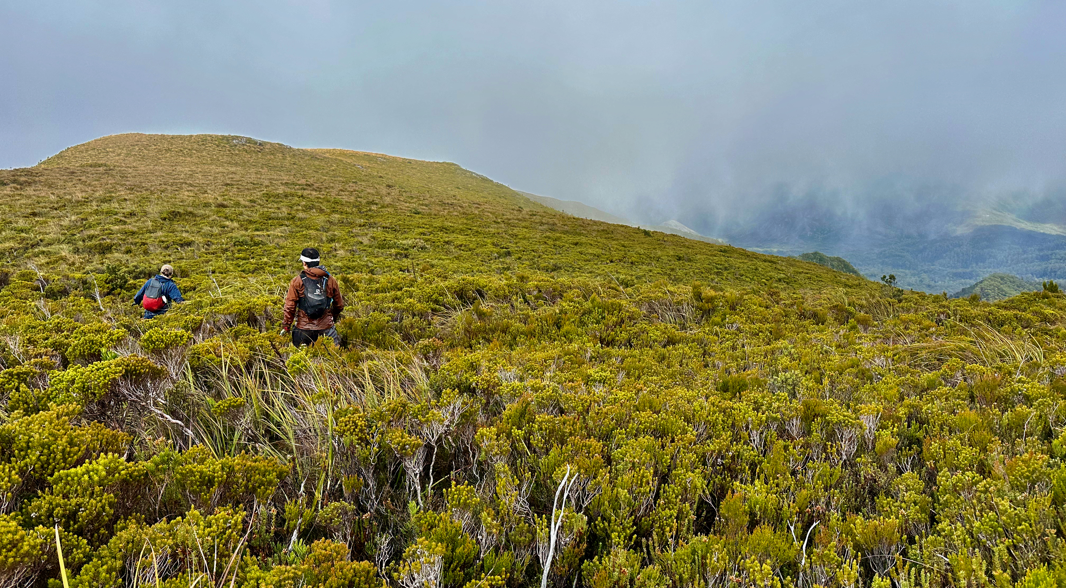
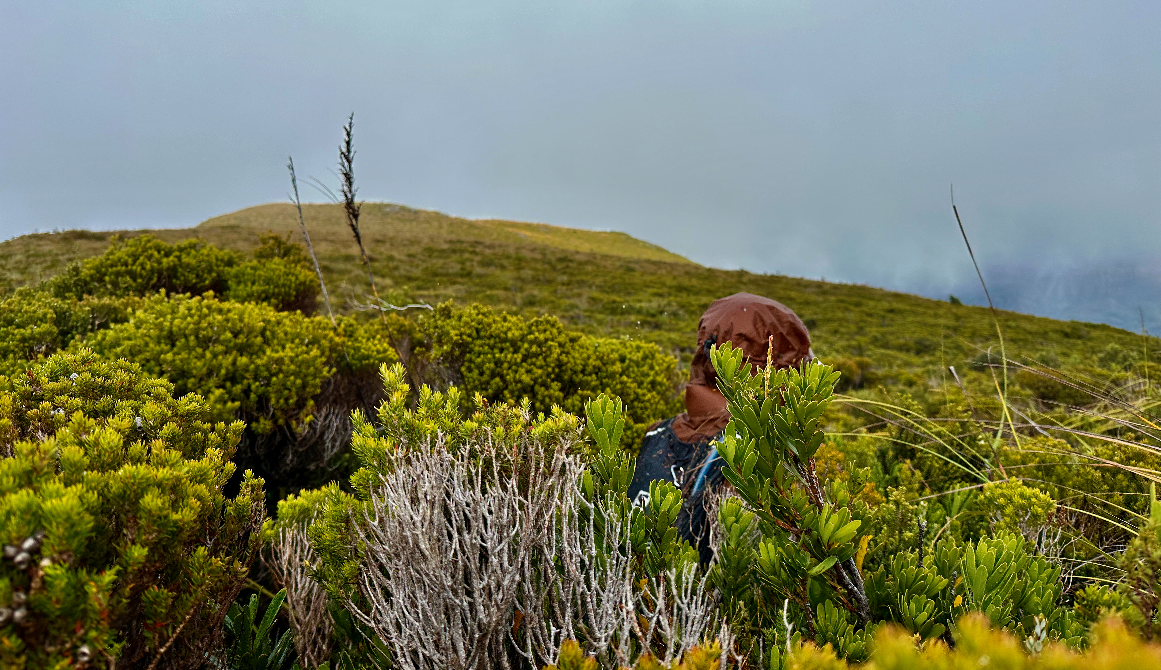
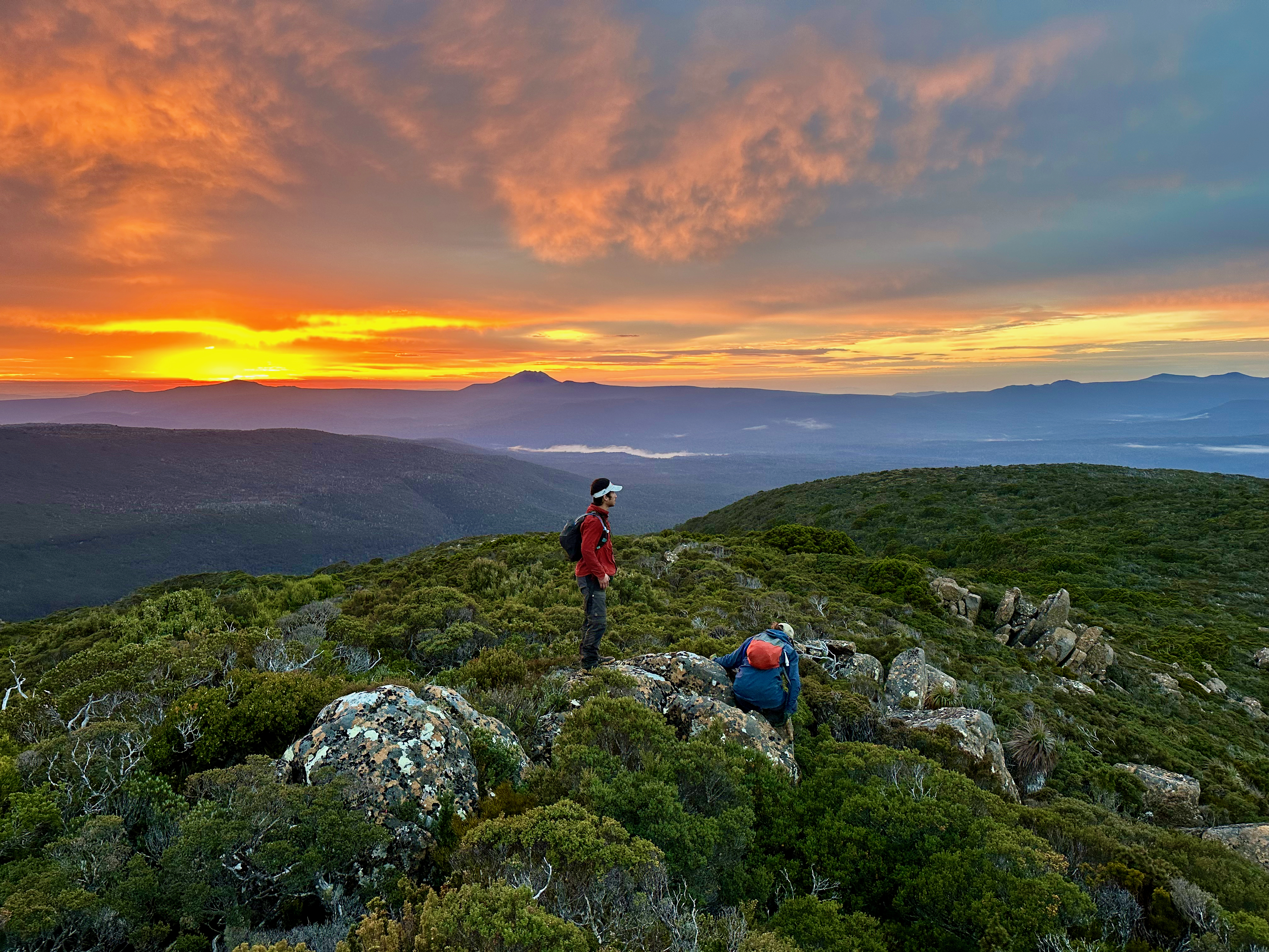
The moon had a halo in the morning, as we prepared for what we expected to be a scrubby day walk. The rising sun glowed orange on the eastern horizon as we worked our way south along the relatively open plateau. We mired in some thicker scrub that grew between dolerite rocks part way along as the sun peaked over the horizon and moved quickly into cloud. In an hour we were standing on the last open point of the ridge, looking down at the green saddle that stood between us and Bob’s Knobs. It was just under one green kilometre away.


We’d heard stories of groups being benighted out here, of horror scrub, but also of others not finding it too bad. In general, the region between Bobs and Vanishing falls is known to be difficult to move fast through. We were prepared for the worst, but still hopeful. We were more than pleasantly surprised. We quickly dropped down into open forest, that went on and on. We kept expecting and waiting for it to close in and for the bash to begin, but it was largely a duck and weave affair. Full packs would have been a slightly different story, but we couldn’t believe our luck.
2.5 hours after leaving our tents we were celebrating on the top of Bob’s Knobs, which is fortunately the first of the three knobs. We were grateful for that too! There was even a small spot to stick our heads out and look at the view into the valley below. Buoyed by our success, we retraced our steps, pretty confident that we’d be able to pack up our camp and move down off the mountain. The weather forecasts we’d got suggested heavy rain (and severe weather warnings for most of the state) the next day and we really wanted to avoid that.
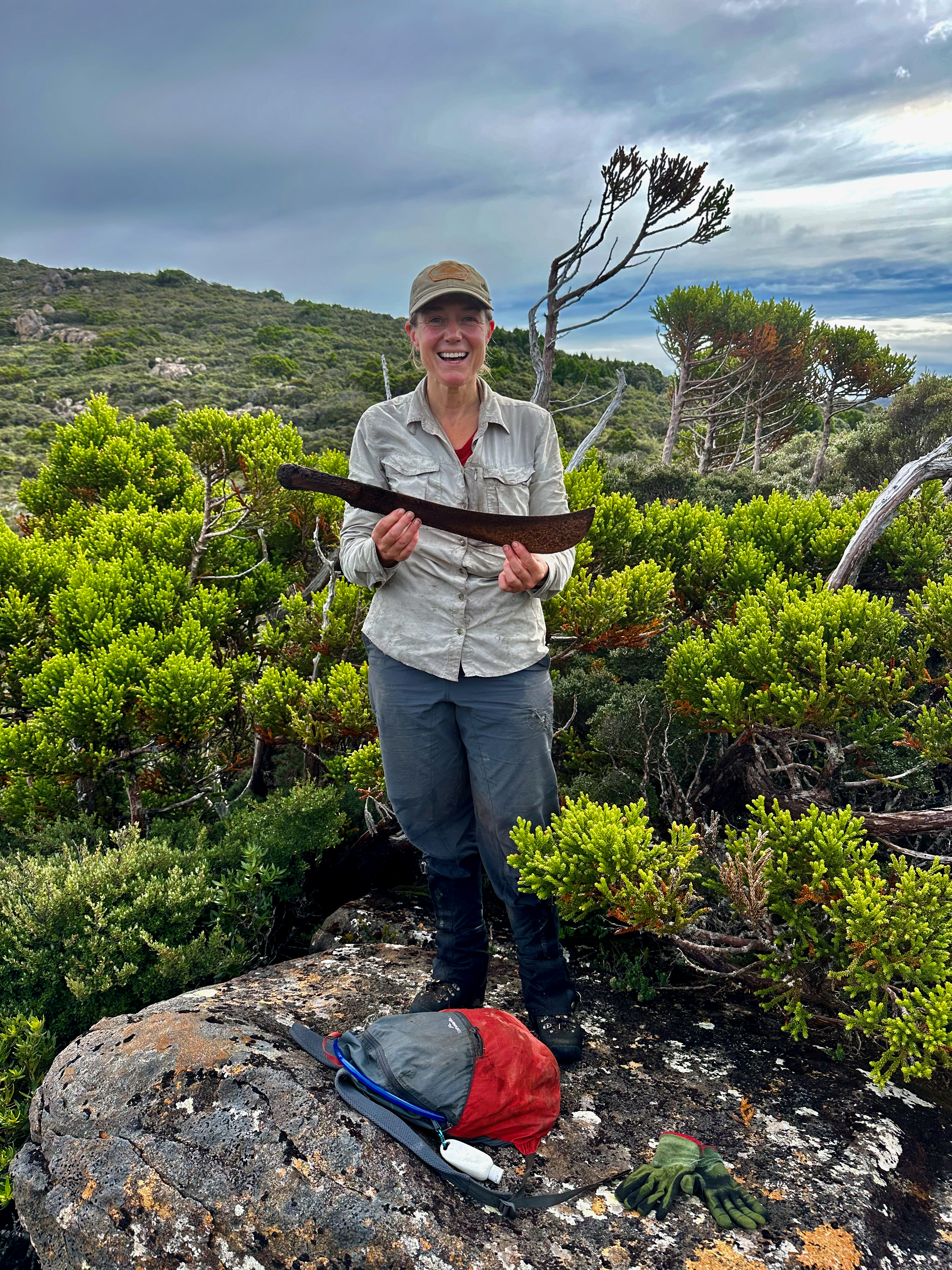
We stopped on the ridge to apply sunscreen at one point and as we were doing so I noticed a blade partly hidden by scrub on the rock Shelly was standing on. She pulled it out and we discovered it was a machete. We wondered who had been through with it, when, whether they’d used it on the scrub or to cut tent poles, and how annoyed they’d been when they found it missing. Further along a wedge-tailed eagle came to check us out. This was definitely an underrated little peak, one of those rare one that exceeds expectations.
We were back at our tents shortly after midday and we ate, packed and set off at least to Lake Sydney, but perhaps all the way back to the car. The thought of our own beds and getting clean and dry, and NOT having to pack up in heavy rain the following morning was increasingly tempting. We popped out at the saddle between Bobs and the Boomerang, having found a much better way down than we’d taken up. There we came across Michael, a solo walker who had been waiting for us. He’d also picked a pretty average way up to the saddle from the lake and asked if he could tag along with us.
And so the four of us worked our way down, trying to stay on the taped route but not finding it all that easy. We did a better job, each of us playing a role in finding tapes, until we decided it was time to beeline across to where we’d left the lake edge. The going stayed open, somehow, and we were down quite quickly. We rock-hopped back around the edge, trying to keep up with a platypus who kept popping up just ahead of us. At the northern end Michael stopped and bid us farewell, as we admired how fast the now visible sink hole had drained, before continuing our flight back to the car. We had all agreed on trying to get the whole way out at this point.
Shelly set a cracking pace and we slopped through the mud, caring much less for wet boots now than ever before. We were hot and sweaty as we climbed up the small hill before the long descent down to the Farmhouse Creek track. We chatted intermittently, but otherwise just concentrated on navigating the obstacles and staying on the track, which occasionally became vague. The section along the Farmhouse Creek was determined, despite the protests our bodies gave us. When we needed to pee we had to catch back up, which was difficult to do without breaking into a slow jog. But that in itself was kind of fun.
We made it back to the road just as light was fading and we grabbed out our head torches so we didn’t have to go searching for them when it was properly dark. Then we had the very long road walk back to the car. My goodness, someone needs to fix that road. Feet and necks ached, although I seemed to have avoided blisters, unlike Shelly and Kevin. We still set a cracking pace for walking with packs, averaging 11 minute kilometres. We expected the rain to start up at any moment, but managed to get back and changed without getting wet. It was a slow drive home with all the wildlife on the roads, wombats and quolls included, but we avoided hitting anything and made it home before the heavens opened. The following morning we were all grateful to wake in our own beds to the sound of heavy rain falling outside.
All up:
Day 1 – Scotts Peak to Watershed camp: 31.3km, 9.5hrs, 708m ascent
Day 2 – Watershed camp to confluence of Davey and Crossing rivers: 18.9km, 8.5 hrs, 1126m ascent
Day 3 – Davey River to Spring River camp: 22.3km, 9 hrs, 897m ascent
Day 4: rest day for me while the others climbed Berry
Day 5 – Spring River to foot of Mt Braddon: 20.8km, 8.5 hrs, 579m ascent
Day 6 – Mt Braddon return: 11.1km, 10:10 hrs, 928m ascent
Day 7 – Mt Braddon to Crossing River: 11.7km (the others climbed Robinson too), 9.5hrs elapsed (including their side trip), 314m ascent
Day 8 – Crossing River to Scotts Peak: 20km, 6 hrs, 541m ascent
Day 8 – Road closure to start of Farmhouse Creek Track: 8.3km, 1:50 hrs, 182m ascent
Day 9 – Farmhouse Creek Track to Bob’s Plateau via Boomerang and Bobs: 22km, 10 hrs, 1438m ascent
Day 10 – Bob’s Knobs return and out to car: 32.6km, 13.5hrs, 927m ascent

Brilliant – I’ve always wondered about Davey SL – it looks great from surrounds. Braddon high on my to-do list after an aborted attempt via east ridge from the North River in December. May trace your delicate footfalls through the scrub soon
LikeLike
There’s a good bash there now! Can’t miss it, including one full circle in the scrub at one point 🤣
LikeLiked by 1 person
Another couple of challenging journeys, well done Shelly, Kevin and Becca. River crossings looked a little tricky. Great photos from Mt Bobs in evening and morning light.
LikeLike